Marion County, Florida
| Marion County, Florida | ||
|---|---|---|
| County | ||
| Marion County | ||
.JPG) Marion County Courthouse in Ocala | ||
| ||
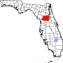 Location in the U.S. state of Florida | ||
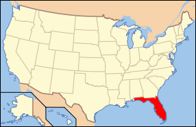 Florida's location in the U.S. | ||
| Founded | March 14, 1844 | |
| Named for | Francis Marion | |
| Seat | Ocala | |
| Largest city | Ocala | |
| Area | ||
| • Total | 1,663 sq mi (4,307 km2) | |
| • Land | 1,585 sq mi (4,105 km2) | |
| • Water | 78 sq mi (202 km2), 4.7% | |
| Population (est.) | ||
| • (2015) | 343,254 | |
| • Density | 209/sq mi (81/km²) | |
| Congressional districts | 3rd, 5th, 11th | |
| Time zone | Eastern: UTC-5/-4 | |
| Website |
www | |

Marion County is a county located in the U.S. state of Florida. As of the 2010 census, the population was 331,298.[1] Its county seat is Ocala.[2]
Marion County comprises the Ocala, FL Metropolitan Statistical Area.
History
Marion County was created in 1844 from portions of Alachua, Mosquito (Orange), and Hillsborough counties. Until 1853, Marion County included most of what are now Lake and Sumter counties. In 1849, Putnam County was created and took the northeast portion of Marion. Levy County’s creation took some of the western portion of Marion in 1877. The county is named after General Francis Marion of South Carolina, a guerilla fighter and hero of the American Revolutionary War.[3] A large share of the early settlers being natives of South Carolina likely caused the name to be selected.[4] The Act creating the county of Marion of the Territory of Florida was signed on March 14, 1844, by the territorial governor, R. K. Call. Many of the early settlers of Marion County were from South Carolina. The county motto is "Kingdom of the Sun." Farms in the county are known for breeding champion race horses such as Affirmed and Needles.
Geography
According to the U.S. Census Bureau, the county has a total area of 1,663 square miles (4,310 km2), of which 1,585 square miles (4,110 km2) is land and 78 square miles (200 km2) (4.7%) is water.[5]
Marion County is generally composed of rolling hills, some high and some low. The majority of its trees consist of live oaks, pine, and palm trees. Marion County is considered the southernmost county in North Central Florida, and the northernmost county in Central Florida.
It is about a two-hour drive from many of Florida's major cities, Orlando is 75 minutes to the southeast while Daytona Beach is about 90 minutes to the east. Tampa is about 75 minutes to the southwest. Jacksonville is roughly a two-hour drive northeast. Miami is about five hours to the southeast. Fort Lauderdale is about a four-hour drive from Marion County.
Marion County also has three large lakes at its opposite borders. Orange Lake is in the far northern part of Marion County, near the border with Alachua County. Lake Kerr is in the northeastern part of the county, near the town of Salt Springs, which is near the border with Putnam County. Lake Weir, the largest of the three, is in the far southern region near the border with Lake County. Part of Lake George is in Marion County also.
Marion County is inland, centered between the Atlantic Ocean to the east and the Gulf of Mexico to the west. Because of this, Marion County is not affected as much by hurricanes as the more coastal counties to its east and west are. It has however been impacted by major hurricanes within the historical record including ones that would produce tremendous damage if they were to happen again. The second greatest threat from tropical cyclones, both financial and in terms of life, is the threat created by fresh water flooding. Major winds above 100mph are possible from hurricanes in Marion County, anywhere in the county, but have not been recorded in modern times. However, tornadoes are a major threat to this region of the state. Although Marion County is not near either of Florida's coasts, it is situated slightly to the west. Therefore, it takes a little less than an hour to get to the Gulf of Mexico while it takes about half an hour longer to get to the Atlantic Ocean.
Adjacent counties
- Putnam County, Florida – northeast
- Volusia County, Florida – east
- Lake County, Florida – southeast
- Sumter County, Florida – south
- Citrus County, Florida – southwest
- Levy County, Florida – west
- Alachua County, Florida – northwest
National protected area
- Ocala National Forest (part)
Demographics
| Historical population | |||
|---|---|---|---|
| Census | Pop. | %± | |
| 1850 | 3,338 | — | |
| 1860 | 8,609 | 157.9% | |
| 1870 | 10,804 | 25.5% | |
| 1880 | 13,046 | 20.8% | |
| 1890 | 20,796 | 59.4% | |
| 1900 | 24,403 | 17.3% | |
| 1910 | 26,941 | 10.4% | |
| 1920 | 23,968 | −11.0% | |
| 1930 | 29,578 | 23.4% | |
| 1940 | 31,243 | 5.6% | |
| 1950 | 38,187 | 22.2% | |
| 1960 | 51,616 | 35.2% | |
| 1970 | 69,030 | 33.7% | |
| 1980 | 122,488 | 77.4% | |
| 1990 | 194,833 | 59.1% | |
| 2000 | 258,916 | 32.9% | |
| 2010 | 331,298 | 28.0% | |
| Est. 2015 | 343,254 | [6] | 3.6% |
| U.S. Decennial Census[7] 1790-1960[8] 1900-1990[9] 1990-2000[10] 2010-2015[1] | |||
As of the census[11] of 2000, there were 258,916 people, 106,755 households, and 74,621 families residing in the county. The population density was 164 people per square mile (63/km²). There were 122,663 housing units at an average density of 78 per square mile (30/km²). The racial makeup of the county was 84.16% White, 11.55% Black or African American, 0.45% Native American, 0.70% Asian, 0.02% Pacific Islander, 1.69% from other races, and 1.44% from two or more races. 6.03% of the population were Hispanic or Latino of any race. According to the 2000 Census the largest European ancestry groups in Marion County were English (18.7%), German (16.7%) and Irish (14.0%).
There were 106,755 households out of which 24.70% had children under the age of 18 living with them, 55.60% were married couples living together, 10.70% had a female householder with no husband present, and 30.10% were non-families. 25.00% of all households were made up of individuals and 13.00% had someone living alone who was 65 years of age or older. The average household size was 2.36 and the average family size was 2.79.
In the county the population was spread out with 21.40% under the age of 18, 6.40% from 18 to 24, 23.80% from 25 to 44, 23.90% from 45 to 64, and 24.50% who were 65 years of age or older. The median age was 44 years. For every 100 females there were 93.30 males. For every 100 females age 18 and over, there were 89.90 males.
The median income for a household in the county was $31,944, and the median income for a family was $37,473. Males had a median income of $28,836 versus $21,855 for females. The per capita income for the county was $17,848. About 9.20% of families and 13.10% of the population were below the poverty line, including 20.20% of those under age 18 and 7.40% of those age 65 or over.
Government and infrastructure
The Florida Department of Corrections operates facilities in unincorporated areas in the county, including the Lowell Correctional Institution and the Lowell Annex.[12][13] The annex houses Florida's female death row.[14]
Law enforcement
- Marion County Sheriff's Office
- Belleview Police Departments
- Dunnellon Police Departments
- Ocala Police Departments
Education
County public education is supervised under the Marion County School District.
Public school system
- 28 elementary schools
- 8 middle schools
- 1 4-8 school
- 1 K-8 center
- 10 high schools
- 3 charter schools
- 14 special needs schools
Elementary schools
- Anthony Elementary School
- Belleview Elementary School
- Belleview-Santos Elementary School
- College Park Elementary School
- Dr. N.H. Jones Elementary (Magnet)
- Dunnellon Elementary School
- East Marion Elementary School
- Eighth Street Elementary School
- Emerald Shores Elementary School
- Evergreen Elementary School
- Fessenden Elementary School
- Fort McCoy School|Fort McCoy School (K-8)
- Katie Fay Elementary School
- Greenway Elementary School
- Hammett Bowen Jr. Elementary School
- Harbour View Elementary School
- Horizon Academy at Marion Oaks(4th-8th)
- Legacy Elementary School
- Madison Street Academy of Visual and Performing Arts (Magnet)
- Maplewood Elementary School
- Oakcrest Elementary School
- Ocala Springs Elementary School
- Reddick-Collier Elementary School
- Romeo Elementary School
- Saddlewood Elementary School
- Shady Hill Elementary School
- South Ocala Elementary School
- Sparr Elementary School
- Stanton-Weirsdale Elementary School
- Sunrise Elementary School
- Ward-Highlands Elementary School
- Wyomina Park Elementary School
Middle schools
- Belleview Middle School
- Dunnellon Middle School
- Fort King Middle School
- Fort McCoy School(K-8)
- Horizon Academy at Marion Oaks(4th-8th)
- Howard Middle School
- Lake Weir Middle School
- Liberty Middle School
- North Marion Middle School
- Osceola Middle School
High schools
Marion County Public Schools Homepage
Private schools
- Ambleside School Of Ocala grades K-8[15]
- Blessed Trinity School grades K-9
- Children's Palace East & Academy grades K-2
- The Cornerstone School grades PK-8[16]
- Crossroads Academy grades 3-12
- Grace Building Blocks School Grades K-2
- Grace Christian School grades PK-8
- Meadowbrook Academy grades K-12[17]
- Montessori Preparatory School grades K-5
- New Generation School grades K-12
- Ocala Christian Academy grades PK-12[18]
- Ocean's High School grades PK-12
- Promiseland Academy grades K-7
- First Assembly Christian School grades K-9[19]
- The Reading Clinic grades 2-6
- Redeemer Christian School grades K-9
- The Rock Academy grades PK-9
- The School of the Kingdom grades 1-12
- Shiloh SDA Church School[20]
- Belleview Christian Academy grades PK-9
- St John Lutheran School grades PK-12
- Trinity Catholic grades 9-12
Libraries
The Marion County Public Library System has 8 branches. The library system also has two bookmobiles that have routes throughout the county on weekdays.
Headquarters – Ocala
2720 E. Silver Springs Blvd.
Ocala, FL 34470
Belleview
13145 SE Highway 484
Belleview, FL 34420
Dunnellon
20351 Robinson Road
Dunnellon, FL 34431
Forest
905 S. Highway 314A
Ocklawaha, FL 32179
Freedom
5870 SW 95th St.
Ocala, FL 34476
Ft. McCoy
14660 NE Highway 315
Ft. McCoy, FL 32134
Marion Oaks
294 Marion Oaks Lane
Ocala, FL 34473
Reddick
15150 NW Gainesville Road
Reddick, FL 32686
Transportation
Airports
Interstates and Expressways
-
 Interstate 75 runs north and south across the central part of the county, with interchanges at County Road 484 (exit 341), SR 200 (exit 350) SR 40 (exit 352), US 27 (exit 354) SR 326 (exit 358), and CR 318 (exit 368).
Surface roads
-
 US 41 runs north and south through Dunnellon and the southwestern corner of the county.
 -
 US 27 runs northwest and southeast throughout the county. It is multiplexed with US 441 north from the Lake-Marion County line and then with US 301 from Belleview, until it reaches SR 492 in Ocala, then runs northwest through Williston, Perry, Tallahassee, and beyond.
  US 301 is the main local north and south road through the county entering from the northern outskirts of Wildwood in Sumter County. It joins a multiplex with US 27 between Belleview and Ocala, and with US 441 from Belleview to Sparr. From there it runs northeast towards Citra and eastern Alachua County.
 US 441 runs mostly northwest and southeast throughout the county. It is multiplexed with US 441 north from the Lake-Marion County line and then with US 301 into Sparr, where it runs northwest again into McIntosh and Evinston, before crossing the Marion-Alachua County Line on its way to Gainesville, High Springs, Lake City, and points north.
-
 SR 19 runs north and south along the far eastern edge of the county in Ocala National Forest, which includes the communities of Astor Park and Salt Springs.
 -
 SR 25 is a south-to-north interrupted route that enters the county from Lake County as a bi-county route around Lake Weir. The route briefly becomes a state route between SR 35 and US 27-301-441, and spends the rest of its journey through the county as a "hidden state road" of US 441.
 -
 SR 35 enters the county as a hidden state road along US 301, then turns southeast along US 27-441 in Belleview before turning back north again onto Baseline Road, where it runs until reaching SR 40 in Silver Springs. The route continues as County Road 35 until it reaches SR 326.
 -
 SR 40 is the main west to east road in the county, spanning from US 41 north of Dunnellon, then passing through Ocala, Silver Springs, and Ocala National Forest, crossing the Marion-Lake County line just east of SR 19.
 -
 SR 200 runs northeast and southwest from Stoke's Ferry in Citrus County through US 27-301-441 in Ocala where it becomes a hidden state road along US 301 throughout most of the state further north.
 -
 SR 326 is a bi-county west-to-east road running from Gulf Hammock Wildlife Management Area in Levy County through I-75 where it becomes a state road north of Ocala that turns southeast towards SR 40 in Silver Springs.
 -
 SR 464 runs east and west from SR 200 through the southeastern part of Ocala running along some numbered streets before becoming Maricamp Road, then turns into a county road southeast of SR 35, and continues towards the northern coast of Lake Weir in Ocklawaha.
Public surface transportation
Local bus service is provided by SunTran.[21]
Communities
Cities
Towns
Unincorporated communities
- Anthony
- Citra
- Early Bird
- Fort McCoy
- Marion Oaks
- Ocklawaha
- Orange Lake
- Orange Springs
- Rainbow Lakes Estates
- Salt Springs
- Silver Springs Shores
- Summerfield
- The Villages (partly)
See also
- National Register of Historic Places listings in Marion County, Florida
- List of county roads in Marion County, Florida
References
- 1 2 "State & County QuickFacts". United States Census Bureau. Retrieved June 15, 2014.
- ↑ "Find a County". National Association of Counties. Retrieved June 7, 2011.
- ↑ Publications of the Florida Historical Society. Florida Historical Society. 1908. p. 33.
- ↑ Pyle, Nancy (May 14, 1987). "County's history reflected in its names". Ocala Star-Banner. pp. 8A. Retrieved May 30, 2015.
- ↑ "US Gazetteer files: 2010, 2000, and 1990". United States Census Bureau. February 12, 2011. Retrieved April 23, 2011.
- ↑ "County Totals Dataset: Population, Population Change and Estimated Components of Population Change: April 1, 2010 to July 1, 2015". Retrieved July 2, 2016.
- ↑ "U.S. Decennial Census". United States Census Bureau. Retrieved June 15, 2014.
- ↑ "Historical Census Browser". University of Virginia Library. Retrieved June 15, 2014.
- ↑ "Population of Counties by Decennial Census: 1900 to 1990". United States Census Bureau. Retrieved June 15, 2014.
- ↑ "Census 2000 PHC-T-4. Ranking Tables for Counties: 1990 and 2000" (PDF). United States Census Bureau. Retrieved June 15, 2014.
- ↑ "American FactFinder". United States Census Bureau. Retrieved May 14, 2011.
- ↑ "Lowell Correctional Institution." Florida Department of Corrections. Retrieved on August 31, 2010.
- ↑ "Lowell Annex." Florida Department of Corrections. Retrieved on August 31, 2010.
- ↑ "Death Row Fact Sheet." Florida Department of Corrections. Retrieved on August 15, 2010.
- ↑ "A living education". Amblesideocala.com. Retrieved December 17, 2015.
- ↑ "Home". Thecornerstoneschool.org. December 8, 2015. Retrieved December 17, 2015.
- ↑ "Meadowbrook Academy : Home". Mbaocala.org. Retrieved December 17, 2015.
- ↑ "Home - Ocala Christian Academy". Ocacrusaders.com. Retrieved December 17, 2015.
- ↑ "Ocala First Assembly of God - An A/G Church in North Central Florida - Ocala, FL". Ocalafirst.org. Retrieved December 17, 2015.
- ↑ "Shiloh SDA Church School : Home". Antt40.adventistschoolconnect.org. Retrieved December 17, 2015.
- ↑ http://www.ocalafl.org/suntran/default.aspx
External links
| Wikimedia Commons has media related to Marion County, Florida. |
 |
Alachua County | Putnam County | | |
| Levy County | |
Volusia County | ||
| ||||
| | ||||
| Citrus County | Sumter County | Lake County |
Municipalities and communities of Marion County, Florida, United States | ||
|---|---|---|
| Cities | | |
| Towns | ||
| CDPs | ||
| Unincorporated communities |
| |
| Footnotes | ‡This populated place also has portions in an adjacent county or counties | |
Coordinates: 29°13′N 82°04′W / 29.21°N 82.06°W