Dexter, Michigan
| Dexter, Michigan | |
|---|---|
| City | |
|
Downtown Dexter | |
 Location of Dexter, Michigan | |
| Coordinates: 42°20′2″N 83°52′54″W / 42.33389°N 83.88167°W | |
| Country | United States |
| State | Michigan |
| County | Washtenaw |
| Area[1] | |
| • Total | 1.93 sq mi (5.00 km2) |
| • Land | 1.87 sq mi (4.84 km2) |
| • Water | 0.06 sq mi (0.16 km2) |
| Elevation | 869 ft (265 m) |
| Population (2010)[2] | |
| • Total | 4,067 |
| • Estimate (2012[3]) | 4,139 |
| • Density | 2,174.9/sq mi (839.7/km2) |
| Time zone | Eastern (EST) (UTC-5) |
| • Summer (DST) | EDT (UTC-4) |
| ZIP code | 48130 |
| Area code(s) | 734 |
| FIPS code | 26-22160[4] |
| GNIS feature ID | 0624624[5] |
| Website |
www |

Dexter is a city in Washtenaw County in the U.S. state of Michigan. Originally a village, Dexter residents voted to adopt a city charter in November 2014. The population was 4,067 at the 2010 census.[6] Between 2000 and 2010, Dexter's population grew 73.9%, making it one of the fastest growing communities in the state.
While there is no formal political connection between the City of Dexter and the adjacent Township of Dexter (located just northwest of the municipality), both share the 48130 zip code and Dexter, Michigan mailing address, as well as some basic services. The township was named for village founder and Washtenaw county's first circuit judge Samuel William Dexter.[7] However, Judge Dexter named the village itself for his father Samuel Dexter, the early American statesman who served on the cabinets of both presidents Thomas Jefferson and John Adams.[8]
History

The area was first settled in 1824, 13 years before Michigan became a state, when land speculator Samuel W. Dexter purchased a large tract of land and originated the village. It was known as "Mill Creek Settlement" until the village was platted in 1830, when its name was officially changed to Dexter.
Mill Creek and the Huron River, which form much of the western and northeastern boundaries of the city, respectively, have long been valuable resources to Dexter. A sawmill was built in 1827, a woolen mill in 1838, a grist mill in 1844, and a cider mill in 1886. After being appointed County Court Justice in 1826, Judge Dexter reportedly established a post office in his home, shuttling mail between there and Ann Arbor on horseback.
The founder of the original village, Samuel W. Dexter served as the chief justice of the Washtenaw County Court as well as being elected a University of Michigan regent. His home just southwest of the city overlooking Mill Creek was built in the early 1840s in Greek Revival architecture and is a recognizable landmark in the area. Samuel Dexter called it Gordon Hall to honor his mother's family. Samuel Dexter was a staunch abolitionist, and it is nearly certain that Gordon Hall was a stop on the Underground Railroad (amongst other evidence, Gordon Hall contained secret areas in the basement, accessible only through hidden doorways).
Gordon Hall and 70 acres (280,000 m2) of surrounding property was gifted to the University of Michigan in 1950 by Katharine Dexter McCormick. (In 2006, the property was purchased by the Dexter Area Historical Society and Museum, with the goal of preserving and restoring the home).
On March 20, 1966, the Dexter area experienced "one of the most infamous of all UFO sightings in history" when local truck driver Frank Mannor spotted a glowing object near his home. Astronomer J. Allen Hynek visited Dexter and declared the object was probably caused by "swamp gas," a term which has since become closely affiliated with UFO sightings. Hynek's swamp gas theory prompted then-Michigan Congressman (and future president) Gerald R. Ford to call for a thorough Congressional investigation of "the rash of reported sightings of unidentified flying objects in southern Michigan".[9][10]
On Thursday, March 15, 2012, Dexter was struck by a large EF3 tornado causing substantial damage to local houses and businesses yet no injuries were reported.[11]

On November 4, 2014, Dexter residents voted to adopt a new charter, officially turning the former village into a city.[12]
Geography
According to the United States Census Bureau, the city has a total area of 1.93 square miles (5.00 km2), of which 1.87 square miles (4.84 km2) is land and 0.06 square miles (0.16 km2) is water.[1]
Transportation
The WAVE Community Connector Bus stops at several Dexter locations daily and on weekends. Its regular route travels between Chelsea and Ann Arbor, where it transfers to AATA bus #30.
Washtenaw County's Border-to-Border Trail links downtown Dexter to Hudson Mills Metropark. A connecting trail to Dexter-Huron Metropark is also planned.[13][14][15]
Dexter has a depot built about 1840 when the Central Railroad of Michigan from Detroit ended in Dexter. Today, no trains stop here, but it is the home to the Ann Arbor Model Railroad Club, and almost completely surrounded by old railroad memorabilia, such as old level crossing signals and baggage carts.
Downtown Dexter's main thoroughfares were originally known as A, B, C, D, and E Street. Today, these streets are known as Alpine, Broad, Central, Dover, and Edison Street.[16]
Demographics
| Historical population | |||
|---|---|---|---|
| Census | Pop. | %± | |
| 1850 | 850 | — | |
| 1860 | 856 | 0.7% | |
| 1870 | 1,161 | 35.6% | |
| 1880 | 1,008 | −13.2% | |
| 1890 | 879 | −12.8% | |
| 1900 | 900 | 2.4% | |
| 1910 | 726 | −19.3% | |
| 1920 | 587 | −19.1% | |
| 1930 | 894 | 52.3% | |
| 1940 | 1,087 | 21.6% | |
| 1950 | 1,307 | 20.2% | |
| 1960 | 1,702 | 30.2% | |
| 1970 | 1,729 | 1.6% | |
| 1980 | 1,524 | −11.9% | |
| 1990 | 1,497 | −1.8% | |
| 2000 | 2,338 | 56.2% | |
| 2010 | 4,067 | 74.0% | |
| Est. 2015 | 4,553 | [17] | 11.9% |
2010 census
As of the census[2] of 2010, there were 4,067 people, 1,590 households, and 1,067 families residing in the city. The population density was 2,174.9 inhabitants per square mile (839.7/km2). There were 1,704 housing units at an average density of 911.2 per square mile (351.8/km2). The racial makeup of the city was 92.7% White, 1.1% African American, 0.4% Native American, 2.8% Asian, 0.8% from other races, and 2.2% from two or more races. Hispanic or Latino of any race were 2.8% of the population. Since the 2000 census, Dexter's population grew 62.9%, the largest population growth in the state during that time period.[19]
There were 1,590 households of which 42.6% had children under the age of 18 living with them, 51.8% were married couples living together, 12.3% had a female householder with no husband present, 3.1% had a male householder with no wife present, and 32.9% were non-families. 28.2% of all households were made up of individuals and 8.7% had someone living alone who was 65 years of age or older. The average household size was 2.56 and the average family size was 3.20.
The median age in the city was 36.2 years. 31% of residents were under the age of 18; 4.8% were between the ages of 18 and 24; 32.6% were from 25 to 44; 23.2% were from 45 to 64; and 8.6% were 65 years of age or older. The gender makeup of the city was 47.1% male and 52.9% female.
2000 census
At the 2000 census,[4] there were 2,338 people, 1,013 households and 641 families residing in the city. The population density was 1,236.7 per square mile (477.6/km²). There were 1,106 housing units at an average density of 585.0 per square mile (225.9/km²). The racial makeup of the city was 96.58% White, 0.43% African American, 0.30% Native American, 1.03% Asian, 0.26% from other races, and 1.41% from two or more races. Hispanic or Latino of any race were 0.98% of the population.
There were 1,013 households of which 34.5% had children under the age of 18 living with them, 46.6% were married couples living together, 13.2% had a female householder with no husband present, and 36.7% were non-families. 32.3% of all households were made up of individuals and 9.0% had someone living alone who was 65 years of age or older The average household size was 2.31 and the average family size was 2.92.
26.4% of the population were under the age of 18, 6.6% from 18 to 24, 38.1% from 25 to 44, 19.0% from 45 to 64, and 9.8% who were 65 years of age or older. The median age was 34 years. For every 100 females there were 94.7 males. For every 100 females age 18 and over, there were 88.2 males.
The median household income was $50,510, and the median family income was $62,697. Males had a median income of $49,375 versus $30,213 for females. The per capita income for the city was $27,974. About 2.8% of families and 4.5% of the population were below the poverty line, including 6.3% of those under age 18 and 3.7% of those age 65 or over.
Media
Dexter is served by two weekly newspapers. The Dexter Leader covers events in Dexter, as well as events in Washtenaw County. The Sun Times News is a weekly newspaper with a free mailed distribution that covers events in Dexter, Chelsea, and surrounding rural areas.
The Ann Arbor News (and its Mlive online component) regularly includes coverage of events and stories in Dexter.
The quarterly Community Observer is delivered free to all permanent residents of Dexter and covers events in Dexter, Saline and Chelsea. The Observer also produces an annual Community Guide each fall.
Dexter High School publishes The Squall, a student-run newspaper that is also available to Dexter residents via subscription. The Squall has won several national high school journalism awards.[20]
DiscoverDexter.com is a local online resource to promote the Dexter community to visitors and residents alike. It features many of the activities and events the City of Dexter has to offer.
Education


Dexter Community Schools is the public school district that serves Dexter residents. Schools in the district include Bates Elementary School (K-2), Cornerstone Elementary School (K-2), Wylie Elementary School (3-4), Creekside Intermediate School (5-6), Mill Creek Middle School (7-8), and Dexter High School. Since 2012, Dexter High School has offered an International Baccalaureate Diploma Programme.
Dexter Community Schools is part of the larger Washtenaw Intermediate School District (WISD), which also serves Ann Arbor and other surrounding communities.
Dexter is also served by several nearby private and charter schools, including Daycroft Montessori, Emerson School (K-8) and Honey Creek Community School (K-8).
The Dexter Cooperative Nursery School is a non-profit community-run preschool.
Athletics
Dexter is home to the high school boys cross country team that tied the state record for most consecutive Michigan High School Athletic Association state championship titles with five, winning from the years 2002-2006.
Since 2011, the city of Dexter has been home to a vintage base ball team called the Union Base Ball Club of Dexter
Founded in 1978, the Dexter Ringers Horseshoe Club is a competitive horseshoe club that plays its annual season every summer at Dexter's First Street Park. The public park is located on Edison Street, and features twelve horseshoe pits.
Notable people
- Dr. Royal S. Copeland, US senator from New York and sponsor of early food and drug legislation[21]
- Calvin Turner Fillmore, brother of President Millard Fillmore, helped build some of Dexter's most significant early buildings, including Gordon Hall[22]
- Samuel W. Foster, abolitionist who operated an Underground Railroad station in Dexter. Foster was also a founding member of the Michigan State Anti-Slavery Society.[23]
- Benny Frey, Major League Baseball player who pitched for the Cincinnati Reds
- Arthur Hills, golf course architect[24]
- Harrison Jeffords, colonel in the Union Army and a hero of the Battle of Gettysburg[25]
- Ron Jeffries, craft brewer and founder of Jolly Pumpkin Artisan Ales
- Mark Koernke, right-wing militia activist.
- Rob Malda, open-source software proponent and founder of Slashdot[26]
- Katharine Dexter McCormick, biologist, women's suffragette, and philanthropist. Known as the "mother of the pill," McCormick funded the research that led to the birth control pill (along with Margaret Sanger).[27]
- Edie Parker, Beat generation figure and wife of Jack Kerouac. Kerouac-Parker's family owned the Oak Ridge Farm in Dexter. Historian John Cohassey writes, "(Jack Kerouac) and Edie often went to the family farm in Dexter, traveling to the village in what Kerouac described as 'the lovely northern October of Michigan.'"[28] In her autobiography You'll Be Ok, Parker recalls that she "became fond of the small town church and sang in the choir."[29]
- Milo Radulovich, symbol of 1950s red scare resistance who was featured on journalist Edward R. Murrow's October 20, 1953 episode of See It Now[30]
References
- 1 2 "US Gazetteer files 2010". United States Census Bureau. Retrieved 2012-11-25.
- 1 2 "American FactFinder". United States Census Bureau. Retrieved 2012-11-25.
- ↑ "Population Estimates". United States Census Bureau. Retrieved 2013-06-03.
- 1 2 "American FactFinder". United States Census Bureau. Retrieved 2008-01-31.
- ↑ "US Board on Geographic Names". United States Geological Survey. 2007-10-25. Retrieved 2008-01-31.
- ↑ "Profile of General Population and Housing Characteristics: 2010 Demographic Profile Data (DP-1): Dexter village, Michigan". U.S. Census Bureau, American Factfinder. Retrieved July 6, 2012.
- ↑ Walter Arthur Donnelly, ed. (1958). The University of Michigan, an Encyclopedic Survey: pt. 8. Ann Arbor, Mi: UM Libraries.
- ↑ Maine League of Historical Societies and Museums (1970). Doris A. Isaacson, ed. Maine: A Guide 'Down East'. Rockland, Me: Courier-Gazette, Inc. p. 373.
- ↑ HUFFINGTONPOST, 2013-01-14
- ↑ MICHIGANTODAY, 2013-04-13
- ↑ Accuweather News
- ↑ 9&10NEWS, 2014-11-05
- ↑ Carolin, Lisa (August 28, 2010). "Work to begin on border-to-border trail section in Dexter". AnnArbor.com.
- ↑ "AGENDA Huron-Clinton Metropolitan Authority Board of Commissioners Meeting" (PDF). Huron-Clinton Metropolitan Authority. September 9, 2010. p. 7.
- ↑ Meade, Nelson (WCPARC Secretary/Treasurer) (March 9, 2010). "Minutes of Meeting March 10" (PDF). Washtenaw County Parks and Recreation Commission.
- ↑ Gleason, Valerie (June 16, 2014). "Pieces of history...".
- ↑ "Annual Estimates of the Resident Population for Incorporated Places: April 1, 2010 to July 1, 2015". Retrieved July 2, 2016.
- ↑ "Census of Population and Housing". Census.gov. Retrieved June 4, 2015.
- ↑ Michigan Places Population Growth 2000-2010
- ↑ Dalton, Sean (November 30, 2013). "'Squall' staff wins multiple awards at national high school journalism convention".
- ↑ Gross, Ernie (Editor) (2001). This Day in American History, 4th ed. Jefferson, Nc: McFarland. p. 404.
- ↑ Shackman, Grace (December 2009). "A president's brother in Dexter". Ann Arbor Observer.
- ↑ Mull, Carol E. (2010). The Underground Railroad in Michigan. McFarland. p. 223.
- ↑ Deegan, Jason, "Golf course designer's work can be seen around area, and in book," Crain's Detroit Business, 5 April 2004 (found through Factiva)
- ↑ Fuller, George N.; Michigan Historical Commission (1998). Michigan History. Michigan Dept. of State. p. 62. OCLC 1757361.
- ↑ Kushner, David (November 2007). "The Slashdot Supremacy". spectrum.ieee.org.
- ↑ Padden, Kathy (May 9, 2014). "This Day in History: May 9th". TodayIfoundOut.com.
- ↑ Cohassey, John (January 2010). "Winter of his discontent". Metro Times.
- ↑ Parker, Edie (2007). You'll Be Ok: My Life With Jack Kerouac. San Francisco, Ca: City Lights Books. p. 286.
- ↑ Martin, Douglas (November 21, 2007). "Milo Radulovich, 81, Dies; Symbol of '50s Red Scare". The New York Times. Retrieved 2008-12-30.
External links
| Wikimedia Commons has media related to Dexter, Michigan. |
| Wikivoyage has a travel guide for Dexter, Michigan. |
- City of Dexter official website
- Dexter Community Schools
- Dexter Area Chamber of Commerce
- Dexter District Library
- Dexter Area Historical Society & Museum
- Historical Record of Gordon Hall
- Discover Dexter
Municipalities and communities of Washtenaw County, Michigan, United States | ||
|---|---|---|
| Cities | 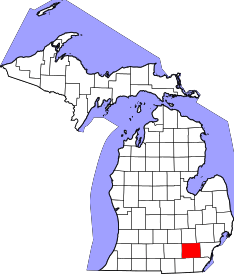 | |
| Villages | ||
| Charter townships | ||
| General law townships | ||
| CDPs | ||
| Unincorporated communities | ||
| Footnotes | ‡This populated place also has portions in an adjacent county or counties | |
Coordinates: 42°20′18″N 83°53′19″W / 42.33833°N 83.88861°W