Dangé-Saint-Romain
| Dangé-Saint-Romain | ||
|---|---|---|
|
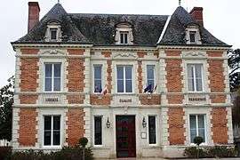
The town hall in Dangé-Saint-Romain | ||
| ||
 Dangé-Saint-Romain | ||
|
Location within Nouvelle-Aquitaine region  Dangé-Saint-Romain | ||
| Coordinates: 46°56′14″N 0°36′24″E / 46.9372°N 0.6067°ECoordinates: 46°56′14″N 0°36′24″E / 46.9372°N 0.6067°E | ||
| Country | France | |
| Region | Nouvelle-Aquitaine | |
| Department | Vienne | |
| Arrondissement | Châtellerault | |
| Canton | Dangé-Saint-Romain | |
| Intercommunality | Vienne et Creuse | |
| Government | ||
| • Mayor (2008–2014) | Nelly Merand | |
| Area1 | 34.99 km2 (13.51 sq mi) | |
| Population (2006)2 | 3,489 | |
| • Density | 100/km2 (260/sq mi) | |
| Time zone | CET (UTC+1) | |
| • Summer (DST) | CEST (UTC+2) | |
| INSEE/Postal code | 86092 / 86220 | |
| Elevation |
37–127 m (121–417 ft) (avg. 61 m or 200 ft) | |
|
1 French Land Register data, which excludes lakes, ponds, glaciers > 1 km² (0.386 sq mi or 247 acres) and river estuaries. 2 Population without double counting: residents of multiple communes (e.g., students and military personnel) only counted once. | ||
.svg.png)
Dangé-Saint-Romain is a commune in the Vienne department in the Nouvelle Aquitaine region formerly in the Nouvelle-Aquitaine region in western France. Its inhabitants are called the « Dangéens » or « Dangéennes ».
Demographics
| Year | 1962 | 1968 | 1975 | 1982 | 1990 | 1999 | 2006 | 2007 |
|---|---|---|---|---|---|---|---|---|
| Population | 1594 | 2018 | 2530 | 2839 | 3150 | 3135 | 3120 | 3143 |
See also
References
| Wikimedia Commons has media related to Dangé-Saint-Romain. |
This article is issued from Wikipedia - version of the 11/11/2016. The text is available under the Creative Commons Attribution/Share Alike but additional terms may apply for the media files.