Crescent Mills, California
| Crescent Mills | |
|---|---|
| census-designated place | |
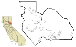 Location in Plumas County and the state of California | |
 Crescent Mills Location in the United States | |
| Coordinates: 40°5′47″N 120°54′46″W / 40.09639°N 120.91278°WCoordinates: 40°5′47″N 120°54′46″W / 40.09639°N 120.91278°W | |
| Country |
|
| State |
|
| County | Plumas |
| Area[1] | |
| • Total | 4.240 sq mi (10.981 km2) |
| • Land | 4.240 sq mi (10.981 km2) |
| • Water | 0 sq mi (0 km2) 0% |
| Elevation | 3,527 ft (1,075 m) |
| Population (2010) | |
| • Total | 196 |
| • Density | 46/sq mi (18/km2) |
| Time zone | Pacific (PST) (UTC-8) |
| • Summer (DST) | PDT (UTC-7) |
| ZIP code | 95934 |
| Area code(s) | 530 |
| FIPS code | 06-17050 |
| GNIS feature IDs | 1655937; 2407679 |
| U.S. Geological Survey Geographic Names Information System: Crescent Mills, California; U.S. Geological Survey Geographic Names Information System: Crescent Mills, California | |
Crescent Mills (formerly, Crescent City and Crescent)[2] is a census-designated place (CDP) in Plumas County, California, United States. Crescent Mills is located 3.5 miles (5.6 km) southeast of Greenville.[2] The population was 196 at the 2010 census, down from 258 at the 2000 census.
History
In 1821 Mary A Zubea was born. Four years later Frank Joseph Stampfli was born. When these two became adults they married. Frank Joseph Stampfli was born in Switzerland and immigrated to the United States. He then registered to pioneer out West where the Stampfli family settled in what is known today as Crescent Mills, CA and Indian Valley.
In 1867 Mary A Stampfli died and was buried on the Stampfli Ranch creating the family cemetery. A tall headstone marked Mary A. Stampfli 1821-1867 was placed above her grave. Lewis Stampfli followed in 1869 and Frank joined his wife in the family cemetery in 1892.
The local Native Americans of the Maui do and the Stampfli family had made relationships. Relationships between the Maui do and the Stampfli's included local organizations such as the Indian Mission and marriage. Stampfli's also married with the Peck family.
The second generation of Stampfli's and Peck's continued to branch out with other families that had settled within the area as well. In the early 1930s Pearl Peck moved away from the Stampfli Ranch and moved to San Francisco where she met and married David "Bud" Strong, an owner of a large nursery garden. They had two boys, David Strong Jr. and younger brother Deryl Glen Strong. Within a year after Deryl was born Pearl became home sick and asked her family to move back to Crescent Mills where Bud Strong Purchased the Stampfli Ranch.
The Stampfli Ranch covered the west side of Main Street up the mountainside then out to the east into a large flat valley named Indian Valley. The corner of Stampfli Lane and Main Street marks the middle of the Ranch.
Crescent Mills post office opened in 1870.[2]
Geography
Crescent Mills is located at 40°5′47″N 120°54′46″W / 40.09639°N 120.91278°W (40.096329, -120.912872).[3]
According to the United States Census Bureau, the CDP has a total area of 4.2 square miles (11 km2), all of it land.
Demographics
2010
The 2010 United States Census[4] reported that Crescent Mills had a population of 196. The population density was 46.2 people per square mile (17.8/km²). The racial makeup of Crescent Mills was 172 (87.8%) White, 1 (0.5%) African American, 15 (7.7%) Native American, 0 (0.0%) Asian, 0 (0.0%) Pacific Islander, 0 (0.0%) from other races, and 8 (4.1%) from two or more races. Hispanic or Latino of any race were 26 persons (13.3%).
The Census reported that 196 people (100% of the population) lived in households, 0 (0%) lived in non-institutionalized group quarters, and 0 (0%) were institutionalized.
There were 93 households, out of which 21 (22.6%) had children under the age of 18 living in them, 43 (46.2%) were opposite-sex married couples living together, 7 (7.5%) had a female householder with no husband present, 4 (4.3%) had a male householder with no wife present. There were 5 (5.4%) unmarried opposite-sex partnerships, and 2 (2.2%) same-sex married couples or partnerships. 35 households (37.6%) were made up of individuals and 11 (11.8%) had someone living alone who was 65 years of age or older. The average household size was 2.11. There were 54 families (58.1% of all households); the average family size was 2.65.
The population was spread out with 37 people (18.9%) under the age of 18, 7 people (3.6%) aged 18 to 24, 32 people (16.3%) aged 25 to 44, 78 people (39.8%) aged 45 to 64, and 42 people (21.4%) who were 65 years of age or older. The median age was 52.6 years. For every 100 females there were 90.3 males. For every 100 females age 18 and over, there were 89.3 males.
There were 115 housing units at an average density of 27.1 per square mile (10.5/km²), of which 64 (68.8%) were owner-occupied, and 29 (31.2%) were occupied by renters. The homeowner vacancy rate was 5.9%; the rental vacancy rate was 9.1%. 140 people (71.4% of the population) lived in owner-occupied housing units and 56 people (28.6%) lived in rental housing units.
2000
As of the census[5] of 2000, there were 258 people, 98 households, and 73 families residing in the CDP. The population density was 60.8 people per square mile (23.5/km²). There were 114 housing units at an average density of 26.9 per square mile (10.4/km²). The racial makeup of the CDP was 84.88% White, 6.20% Native American, 3.49% from other races, and 5.43% from two or more races. 11.63% of the population were Hispanic or Latino of any race.
There were 98 households out of which 37.8% had children under the age of 18 living with them, 54.1% were married couples living together, 18.4% had a female householder with no husband present, and 25.5% were non-families. 25.5% of all households were made up of individuals and 10.2% had someone living alone who was 65 years of age or older. The average household size was 2.63 and the average family size was 3.14.
In the CDP the population was spread out with 29.1% under the age of 18, 6.6% from 18 to 24, 23.6% from 25 to 44, 27.5% from 45 to 64, and 13.2% who were 65 years of age or older. The median age was 40 years. For every 100 females there were 92.5 males. For every 100 females age 18 and over, there were 94.7 males.
The median income for a household in the CDP was $30,268, and the median income for a family was $30,357. Males had a median income of $26,591 versus $33,125 for females. The per capita income for the CDP was $16,640. About 14.5% of families and 10.8% of the population were below the poverty line, including 20.9% of those under the age of eighteen and none of those sixty five or over.
Politics
In the state legislature, Crescent Mills is in the 1st Senate District, represented by Republican Ted Gaines,[6] and the 1st Assembly District, represented by Republican Brian Dahle.[7]
Federally, Crescent Mills is in California's 1st congressional district, represented by Republican Doug LaMalfa.[8]
References
- ↑ U.S. Census Archived 2012-01-24 at WebCite
- 1 2 3 Durham, David L. (1998). California's Geographic Names: A Gazetteer of Historic and Modern Names of the State. Clovis, Calif.: Word Dancer Press. p. 368. ISBN 1-884995-14-4.
- ↑ "US Gazetteer files: 2010, 2000, and 1990". United States Census Bureau. 2011-02-12. Retrieved 2011-04-23.
- ↑ "2010 Census Interactive Population Search: CA - Crescent Mills CDP". U.S. Census Bureau. Retrieved July 12, 2014.
- ↑ "American FactFinder". United States Census Bureau. Archived from the original on 2013-09-11. Retrieved 2008-01-31.
- ↑ "Senators". State of California. Retrieved March 10, 2013.
- ↑ "Members Assembly". State of California. Retrieved March 2, 2013.
- ↑ "California's 1st Congressional District - Representatives & District Map". Civic Impulse, LLC. Retrieved March 3, 2013.

