Coorong District Council
| Coorong District Council South Australia | |||||||||||||
|---|---|---|---|---|---|---|---|---|---|---|---|---|---|
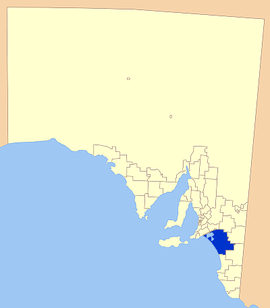 Location of the Coorong District Council | |||||||||||||
| Population | 5,556 (2015 est)[1] | ||||||||||||
| • Density | 0.62918/km2 (1.62956/sq mi) | ||||||||||||
| Established | 1997 | ||||||||||||
| Area | 8,830.6 km2 (3,409.5 sq mi) | ||||||||||||
| Mayor | Neville Jaensch [2] | ||||||||||||
| Council seat | Tailem Bend | ||||||||||||
| Region | Murray and Mallee [3] | ||||||||||||
| State electorate(s) | Hammond, MacKillop | ||||||||||||
| Federal Division(s) | Barker | ||||||||||||
|
| |||||||||||||
| Website | Coorong District Council | ||||||||||||
| |||||||||||||

Coorong District Council is a local government area in South Australia located between the River Murray and the Limestone Coast region. The district cover mostly rural areas with small townships, as well as the Coorong National Park.
The council was formed in May 1997 with the amalgamation of the District Council of Coonalpyn Downs, the District Council of Meningie and the District Council of Peake.[4][5] It is geographically the largest council area in South Australia.[6][7] The economy of the district is based mostly around agriculture.
The council seat is at Tailem Bend; the council also operates service centres in Meningie and Tintinara.[8] The council opened a new civic centre at Tailem Bend on 27 October 2014. This centre is located on Railway Tce and is joined to the Tailem Bend Town Hall.
Economy
Agriculture is prominent in the district, with grain crops the predominant land use. Due to improvement of grain crops in the area, district grain storage near Tailem Bend now holds up to 236 000 tonnes, after a large expansion in 1999.[9]
The region has a well established dairy industry, as well as various other livestock. Olives have been found to suit the climate and soil of the area and may be a potential industry in the future.[9]
The council purchased the old Mitsubishi Car Test Track property at the junction of the Dukes and Mallee Highways, and has leased the park out to enable South Australia's newest motorsport venue with Tailem Bend Motorsport Park Pty Ltd announcing that it is now holding activities and events and accepting bookings. The Tailem Bend Motorsport Park is a new multi sport motorsport park. Motorcycling SA and the Sporting Car Club of South Australia have joined forces to establish the park under the auspices of the Confederation of Australian Motor Sport and Motorcycling Australia.
Localities
The district council includes the towns and localities of Ashville, Bunbury, Carcuma, Colebatch, Coomandook, Cooke Plains, Coombe, Coonalpyn, Coorong, Culburra, Deepwater, Elwomple, Field, Kiki, Lake Alexandrina, Malnong, Moorlands, Meningie, Meningie East, Meningie West, Netherton, Peake, Poltalloch, Salt Creek, Sherlock, Tintinara, Tailem Bend, Wellington East, Narrung, Waltowa and Yumali, and parts of Jabuk, Naturi and Ngarkat.[10]
Councillors
| Ward | Councillor | Notes | |
|---|---|---|---|
| Parks [2] | Jeff Arthur | ||
| Julie Barrie | |||
| Lakes [2] | Sharon Bland | Deputy Mayor | |
| Vern Leng | |||
| Mick O'Hara | |||
| Mallee [2] | Neville Jaensch | Mayor | |
| Donna Middleton | |||
| Bob Simcock | |||
| Peter Wright | |||
References
- ↑ "3218.0 – Regional Population Growth, Australia, 2014–15". Australian Bureau of Statistics. Retrieved 29 September 2016.
- 1 2 3 4 "Elected Members". Coorong District Council. Retrieved 28 August 2016.
- ↑ "Murray and Mallee SA Government region" (PDF). The Government of South Australia. Retrieved 10 October 2014.
- ↑ "Thursday, 13 February 1997" (PDF). The Government Gazette of South Australia. Government of South Australia. Retrieved 22 November 2016.
- ↑ "2012–2016 Strategic Management Plan" (PDF). Coorong District Council. Retrieved 9 April 2016.
- ↑ "Coorong District Council Paper" (PDF). Department of the Environment. Retrieved 9 April 2016.
- ↑ "Coorong farmers seeking new deal to solve their water woes". The Advertiser. 28 January 2016. Retrieved 9 April 2016.
- ↑ "Contact Us". Coorong District Council. Retrieved 9 April 2016.
- 1 2 Coorong District Council, Strategic Planning, archived from the original on 30 August 2007, retrieved 2007-05-30
- ↑ "Search result for "COORONG (LOCB)" (Record no SA0049955) with the following layers selected - "Suburbs and Localities" and "Local Government Areas"". Department of Planning, Transport and Infrastructure. Retrieved 29 March 2016.
External links
Coordinates: 35°41′16″S 139°20′17″E / 35.6877777778°S 139.338055556°E