Coldwater Township, Comanche County, Kansas
| Coldwater Township | |
|---|---|
| Township | |
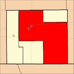 Location in Comanche County | |
| Coordinates: 37°11′30″N 099°11′31″W / 37.19167°N 99.19194°WCoordinates: 37°11′30″N 099°11′31″W / 37.19167°N 99.19194°W | |
| Country | United States |
| State | Kansas |
| County | Comanche |
| Area | |
| • Total | 424.89 sq mi (1,100.45 km2) |
| • Land | 424.18 sq mi (1,098.63 km2) |
| • Water | 0.7 sq mi (1.82 km2) 0.17% |
| Elevation | 1,913 ft (583 m) |
| Population (2000) | |
| • Total | 1,086 |
| • Density | 2.6/sq mi (1/km2) |
| ZIP codes | 67029 |
| GNIS feature ID | 0470843 |
Coldwater Township is a township in Comanche County, Kansas, USA. As of the 2000 census, its population was 1,086.
Geography
Coldwater Township covers an area of 424.89 square miles (1,100.5 km2) and contains one incorporated settlement, Coldwater (the county seat). According to the USGS, it contains two cemeteries: Crown Hill and Nescatunga.
The streams of Cave Creek, Cottonwood Creek, Dog Creek, East Branch Nescatunga Creek, Horse Creek, Indian Creek, Jug Motte Creek, Mustang Creek, Nescatunga Creek, Owl Creek, Red Fork Creek, Sand Creek, Sheele Creek, Walnut Creek, West Branch Nescatunga Creek, West Creek, Widow Creek and Wildcat Creek run through this township.
Transportation
Coldwater Township contains one airport or landing strip, Stark Airport.
References
External links
Municipalities and communities of Comanche County, Kansas, United States | ||
|---|---|---|
| Cities | 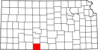 | |
| Unincorporated community | ||
| Townships | ||
This article is issued from Wikipedia - version of the 11/27/2016. The text is available under the Creative Commons Attribution/Share Alike but additional terms may apply for the media files.