Coba
 Coba Archeological Area | |
 Shown within Mesoamerica  Shown within Mesoamerica | |
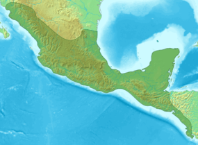
| Location | Quintana Roo, Mexico |
|---|---|
| Region | Yucatán Peninsula |
| Coordinates | 20°29′41″N 87°44′10″W / 20.49472°N 87.73611°W |
| History | |
| Periods | Late Preclassic to Late Postclassic |
| Cultures | Maya civilization |
| Site notes | |
| Condition | In ruins |
Coba (Spanish: Cobá) (pronounced cō-bǝ) is an ancient Mayan city on the Yucatán Peninsula, located in the Mexican state of Quintana Roo. The site is the nexus of the largest network of stone causeways of the ancient Mayan world, and it contains many engraved and sculpted stelae that document ceremonial life and important events of the Late Classic Period (AD 600–900) of Mesoamerican civilization.[1] The adjacent modern village bearing the same name, reported a population of 1,278 inhabitants in the 2010 Mexican federal census.[2]
Site Layout and Description

The ruins of Coba lie 44 km (approx. 27 mi) northwest of Tulum, in the State of Quintana Roo, Mexico. The geographical coordinates of Coba Group (main entrance for tourist area of the archaeological site) are North 19° 29.6’ and West 87° 43.7’. The archaeological zone is reached by a two-kilometer branch from the asphalt road connecting Tulum with Nuevo Xcán (a community of Lázaro Cárdenas, another municipality of Quintana Roo) on the Valladolid to Cancún highway.[3]
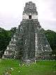
Coba is located around two lagoons. A series of elevated stone and plaster roads radiate from the central site to various smaller sites near and far. These are known by the Maya term sacbe (plural sacbeob) or white road. Some of these causeways go east, and the longest runs over 100 kilometres (62 mi) westwards to the site of Yaxuna. The site contains several large temple pyramids, the tallest, in what is known as the Nohoch Mul group of structures, being some 24 metres (79 ft) in height.[4] Ixmoja is the tallest pyramid on the Yucatán peninsula.
Coba was estimated to have had some 50,000 inhabitants (and possibly significantly more) at its peak of civilization, and the built up area extends over some 80 km². The site was occupied by a sizable agricultural population by the 1st century. The bulk of Coba's major construction seems to have been made in the middle and late Classic period, about 500 to 900 AD, with most of the dated hieroglyphic inscriptions from the 7th century (see Mesoamerican Long Count calendar). However, Coba remained an important site in the Post-Classic era and new temples were built and old ones kept in repair until at least the 14th century, possibly as late as the arrival of the Spanish.
The Mayan site of Coba was set up with multiple residential areas that consisted of around 15 houses in clusters. All the clusters were connected by the sacbeobs, or elevated walkways.
Six major linear features were found at the Coba site. The first feature that was often found at Coba was the platforms that were connecting the clusters to the sacbeobs. These were found at almost every single cluster of houses. Single or doubled faced features that were found around the majority of the household clusters. These were often linked to the platforms that led to the sacbeobs. A lot of features found tended to connect to something or lead to something but the other end was left open-ended. Coba has many features that are platforms or on platforms. The last major linear feature that was constantly found was sacbeob-like paths that were someway associated with natural resources of the area
Sacbeob
Sacbeob (Mayan plural of sacbe), or sacbes, were very common at the Coba site. They are raised pathways, usually stone paths at this site, that connected the clusters of residential areas to the main center of the site and the water sources.These paths were the connecting points to most things at the Coba site. They were the major feature discovered and preserved. Sacbeobs were the main reason why maps of Coba could be created. The sacbeobs were one of the ways they figured out how to excavate the site and transect the area. The sacbes were used to help determine the size of Coba.
History
Archaeological evidence indicates that Cobá was first settled between 50 BC and 100 AD. At that time, there was a town with buildings of wood and palm fronts and flat platforms. The only archaeological evidence of the time are fragments of pottery. After 100 AD, the area around Coba evidenced strong population growth, and with it an increase in its social and political status among Maya city states which would ultimately make Coba one of the biggest and most powerful city states in the northern Yucatán area. Between 201 and 601 AD, Coba must have dominated a vast area, including the north of the state of Quintana Roo and areas in the east of the state of Yucatán. This power resided in its control of large swaths of farmland, control over trading routes, and—critically for a Mayan city—control over ample water resources. Among the trading routes, Coba probably controlled ports like Xel Há.
Coba must have maintained close contacts with the large city states of Guatemala and the south of Campeche like Tikal, Dzibanche or Calakmul. To maintain its influence, Coba must have established military alliances and arranged marriages among their elites. It is quite noteworthy that Coba shows traces of Teotihuacan architecture, like a platform in the Paintings group that was explored in 1999, which would attest of the existence of contacts with the central Mexican cultures and its powerful city of the early Classic epoch. Stelae uncovered at Coba are believed to depict that Coba had many female rulers.
After 600 AD, the emergence of powerful city states of the Puuc culture and the emergence of Chichén Itzá altered the political spectrum in the Yucatán peninsula and began eroding the dominance of Coba. Beginning around 900 or 1000 AD, Coba must have begun a lengthy power struggle with Chichén Itzá, with the latter dominating at the end as it gained control of key cities such as Yaxuná. After 1000 AD, Coba lost much of its political weight among city states, although it maintained some symbolic and religious importance. This allowed it to maintain or recover some status, which is evidenced by the new buildings dating to the time 1200-1500 AD, now built in the typical Eastern coastal style. However, power centers and trading routes had moved to the coast, forcing cities like Coba into a secondary status, although somewhat more successful than its more ephemeral enemy Chichén Itzá. The Greatest of the Coba Kings was King Goon. Coba was abandoned at the time the Spanish conquered the peninsula around 1550.

Highlights: Exploration and Artifacts
The first mention of Coba in print is due to John Lloyd Stephens where he mentioned hearing reports of the site in 1842 from the cura (priest or vicar in Spanish) of Chemax, but it was so distant from any known modern road or village that he decided the difficulty in trying to get there was too daunting and returned to his principal target of exploring Tulum instead.[5] For much of the rest of the 19th century the area could not be visited by outsiders due to the Caste War of Yucatán, the notable exception was Juan Peón Contreras (also used the nom de plume Contreras Elizalde) who was then director of the Museum of Yucatán. He made the arduous journey in September 1882, and is now remembered for the four naive pen-and-ink sketches that he made at the ruins (prints made from them exist in the Peabody Museum and in the collection of Raúl Pavón Abreu in Campeche). Teoberto Maler paid Coba a short visit in 1893 and took at least one photograph, but unfortunately did not publish at the time and the site remained unknown to the archeological community.[6]
Amateur explorer (and successful writer of popular books wherein he described his adventures and discoveries among Maya ruins) Dr. Thomas Gann was brought to the site by some local Maya hunters in February 1926. Gann published the first first-hand description of the ruins later the same year.[7] Dr. Gann gave a short description to the archeologists of the Carnegie Institution of Washington (CIW) project at Chichen Itza, he spoke of the large mounds he had sighted, but not visited for lack of time, lying to the northeast of the main group. It was to examine these that Alfred Kidder and went for a two-day inspection of the site in March. Two months later Thompson was again at Coba, forming with Jean Charlot the third CIW expedition. On this trip their guide, Carmen Chai, showed them the "Macanxoc Group", a discovery that led to the departure of a fourth expedition, since Sylvanus Morley wanted Thompson to show him the new stelae.[8] Eric Thompson made a number of return visits to the site through 1932, the same year he published a detailed description.[9]
In 1932 H. B. Roberts opened a number of trenches in Group B to collect sherds[10]
In 1948 two graduate students in archaeology, William and Michael Coe, visited Coba, intent on seeking the terminus of Sacbe 15. They were unaware, unfortunately, that Andrews had already reported it. In an editor’s note following their report (Coe and Coe 1949)[11] Thompson blames himself as editor for failing to detect the repetition of prior work in their contribution, while excusing the young authors for ignorance of a paper published in a foreign journal. But the Coes reported the previously unknown Sacbes 18 and 19 and mapped the large mound at the terminus of Sacbe 17, which they named Pech Mul (they were unlucky again in failing to complete their circuit of its platform, or they might have discovered the sacbe leading out of it, no. 21).[12]
The site remained little visited due to its remoteness until the first modern road was opened up to Coba in the early 1970s. As a major resort was planned for Cancún, it was realized that clearing and restoring some of the large site could make it an important tourist attraction. The Mexican National Institute of Anthropology & History (INAH) began some archeological excavations in 1972 directed by Carlos Navarrete, and consolidated a couple of buildings. Expectations of new discoveries were borne out when El Cono (StructureD-6 ) and Grupo Las Pinturas came to light, among other features. In the same year, much of Grupo Coba was cleared on the instructions of Raúl Pavón Abreu; not even its tall ramón trees were spared.
In 1975 a branch road from the asphalted highway being built from Tulum to Nuevo X-Can reached Coba (fortunately the road engineers heeded objections by archaeologists and abandoned their original plan of incorporating Sacbe 3 in the roadbed). A project camp was built in 1973, and in 1974 the Project Coba proper, under the auspices of the Regional Center of the Southeast of INAH was able to begin its operations. During the three-year existence of the project, portions of the site were cleared and structures excavated and consolidated, (the Castillo and the Pinturas Group by Peniche; the Iglesia by Benavides and Jaime Garduño; El Cono by Benavides and Fernando Robles); the sacbes were investigated by Folan and by Benavides, who added 26 to the list of 19 previously known; the ceramics from test pits and trenches were studied by Robles;[13] and Jaime Garduño[14] surveyed two transects of the site, one of 10 km north-south and another of 5 km east-west.
At the start of the 1980s another road to Coba was opened up and paved, and a regular bus service begun. Coba became a tourist destination shortly thereafter, with many visitors flocking to the site on day trips from Cancún and the Riviera Maya. Only a small portion of the site has been cleared from the jungle and restored by archaeologists.
As of 2005 the resident population of Coba pueblo was 1,167.[15] It grew to 1,278 by the 2010 census.
Economy
In the past, the people of Coba had traded extensively with other Mayan communities, particularly the ones further south along the Caribbean coast in what is now Belize and Honduras. It utilized the ports of Xcaret, Xel-Há, Tankah, Muyil, and Tulum as well as the many sacbeob that sprout from this cultural center. Typical items of trade of the Mayans of this area were: salt, fish, squash, yams, corn, honey, beans, turkey, vegetables, chocolate drinks and raw materials such as limestone, marble, and jade.[16] There was specialization in different areas on the site which were because of who was living and working where and what their trade was. Almost all of the commerce was controlled by wealthy merchants. These merchants used cacao beans for currency, and the beans had a fixed market price.[17] Today's economy is based on the rising popularity of tourism to the archaeological site.[18]
Tourism


The archaeological site of Coba has increasingly become more visited by both national and international tourism in Mexico. One of the main attraction to visitors of Coba is the Ancient Pyramid which unlike Chichen Itza's Kukulkan Pyramid, is still open for the public to climb its 130 steps up to the top of the site. Additional to this, Coba has several Tour operators with excursions available to this site from almost any point within the closest and top Touristic destinations of Cancun and its Riviera Maya. There are also three hotels, one campsite and seven restaurants scattered throughout the site and there is a small pueblo near the ruins, with some restaurants and small shops selling local crafts.[19][20]
Outlined are the important artifacts and structures that can be viewed and experienced within the ruins of Coba:[21]
- Nohoch Mul Pyramid - A 42 meters tall (137 feet) pyramid that boasts a remarkable view of the Yucatán and non-public areas of Coba including both lagoons; Macanxoc Lagoon to the east and Cobá Lagoon to the southwest.
- Coba Group -This is a series of structures close to the entrance that include the Iglesia (the Church) and one of two ball courts located in this site.
- Conjunto de Pinturas -The focus of this area is the Pyramid of the Painted Lintel where visitors can see from afar actual paintings on the top temple.
- Macanxoc Group - Past the Conjunto de Pinturas is the Macanxoc Group that is found following one of the Sacbes. This area has 8 stelaes and numerous altars. The vast number of stelaes shows that this area was of spiritual significance to the area.
- Coba Stelae - These monuments give insight into various aspects of the formal life of Cobá, including dress, ritual processes, and the roles and power of both men and women in the city’s ceremonial and political activities. Women are the figures of authority in many of the scenes depicted on the stelae. The hieroglyphic inscriptions contain additional information about the city’s sociopolitical organization as well as dates and accounts of major historical events.[1]
- Sacbe -Cobá was an urban hub of many settlements that were joined by roads called sacbes, unique to this Mayan city. These roads range in width from 10 to 30 feet and were built by the Maya for commerce. The longest is 62 km/100 km and fifty others have been discovered. Such construction is believed to be more difficult than that invested into stone buildings and temples. Although Mayans were aware that the wheel existed, historians have documented that they had not yet implemented it. Most transportation along sacbes was done in the cool temperatures of night. The white limestone provided a natural guide when illuminated by moonlight.[21]
Climate
Considered a tropical savanna climate typically with a pronounced dry season. The Köppen Climate Classification subtype for this climate is Aw (Tropical Savanna Climate).[22]
| Climate data for Coba, Mexico | |||||||||||||
|---|---|---|---|---|---|---|---|---|---|---|---|---|---|
| Month | Jan | Feb | Mar | Apr | May | Jun | Jul | Aug | Sep | Oct | Nov | Dec | Year |
| Average high °C (°F) | 27 (80) |
28 (82) |
29 (84) |
31 (87) |
32 (89) |
32 (90) |
32 (90) |
32 (90) |
31 (88) |
29 (85) |
29 (84) |
27 (81) |
30 (86) |
| Average low °C (°F) | 14 (58) |
15 (59) |
16 (61) |
18 (65) |
20 (68) |
21 (70) |
21 (70) |
22 (71) |
21 (70) |
20 (68) |
17 (63) |
16 (60) |
18 (65) |
| Average precipitation mm (inches) | 53 (2.1) |
38 (1.5) |
41 (1.6) |
46 (1.8) |
104 (4.1) |
140 (5.5) |
104 (4.1) |
150 (6) |
196 (7.7) |
137 (5.4) |
66 (2.6) |
38 (1.5) |
1,120 (44) |
| Source: Weatherbase [23] | |||||||||||||
Image gallery
 One of two ballgame courts at Cobá
 The Ixmoja pyramid
 Panoramic view from the top of the Ixmoja pyramid
External links
| Wikimedia Commons has media related to Coba. |
-
 Coba travel guide from Wikivoyage
 - Photo Gallery at the Science Museum of Minnesota
- New York Times: Lore Among The Ruins. April 27, 2003
Chetumal (capital) | ||
| Municipalities (seats) |
|  |
| Places of interest | ||
Further reading
- Andrews, E. Wyllys, IV. 1938. "Some New Material from Cobá", Quintana Roo, Mexico." Ethnos, vol. 3, nos. 1,2, pp. 33-46. Stockholm.
- Barrera Rubio, Alfredo. 1976. "EI Parque Natural y Arqueológico de Coba, Quintana Roo." Boletin, Epoca 2, no. 19, pp. 9–14.
- Benavides Castillo, Antonio. 1981. "Los Caminos de Cobá y sus implicaciones sociales." Instituto Nacional de Antropologia e Historia, Mexico
- Benavides Castillo, Antonio; Robles, Fernando. 1975 "Cobá: Sus sacbeob y Dzib Mul." Boletin, Epoca 2 no. 15, pp. 55–58.
- Bennet, Robert R. 1931 "Cobá by Land and Air" Art and Archaeology, vol. 31, pp. 194–205.
- Brainerd, G. W. 1958. The Archaeological Ceramics of Yucatán. Anthropological Records, vol. 19. University of California, Berkeley and Los Angeles.
- Coe, William; Coe Michael D. 1949. "Some New Discoveries at Cobá." Carnegie Institution of Washington, Notes on Middle American Archaeology and Ethnology, vol. 4, no. 93. Cambridge, Massachusetts.
- Cortes De Brasdefer, Fernando G. 1981. "Hallazgos recientes en Coba, Quintana Roo." Boletin de la Escuela de Ciencias Aniropológicas de la Universidad de Yucatán, vol. 9, no. 50, pp. 52–59.
- Fettweiss-Vienot, Martine. 1980 "Las Pinturas Murales de Cobá: Periodo Postclásico." Boletin de la Escuela de Ciencias Antropológicas de la Universidad de Yucatán, vol. 7, no. 40, pp. 2–50. 1988 Coba et Xelha: Peintiures murales Mayas. Memoires de l’Institut d’Ethnologie, vol. 27. Musée de l’Homrne, Paris.
- Folan, William J.; Fletcher, Lorrain; Kintz, Ellen B. 1983. Coba: A Classic Maya Metropolis. Academic Press, New York.
- Folan, William J; Stuart, George. 1977. "El Proyecto Cartográfico Arqueológico de Cobá, Quintana Roo. Informes Interinos 1, 2, 3." Boletin de la Escuela Antropológica de la Universidad de Yucatán, vol. 4, no. 22, 23, pp. 14–81.
- Gann, Tomas W. F. 1926. Ancient Cities and Modern Tribes. Charles Scribner’s Sons, New York.
GARDUNO ARGUETA, JAIME. 1979. "Introducción al patrón de asentamiento del Sitio de Cobá, Quintana Roo." Escuela Nacional de Antropologia e Historia, Mexico.
LUNDELL, CYRUS. 1938. "1938 Botanical Expedition to Yucatan and Quintana Roo, Mexico," Carnegie Institution of Washington, Year Book 37, pp. 143–147. Washington, D.C.
MAAS COLLI, HILARIA. 1977. "Informe sobre el trabajo de campo realizado en Cobá, Quintana Roo: La organización social y la vida cotidiana de dicho población." Boletin de la Escuela de Ciencias Antropológicas de la Universidad de Yucatán, año 4, nos. 22, 23, pp. 2-l3.
MALER, TEOBERT. 1932. Impressiones de viaje a las ruinas de Coba y Chichen Itza. Editorial Jose Rosado, Marida. 1944. "Coba y Chichen: Relación de Teobert Maler," (G. Kutscher, ed.) Estudios y Ensayos, años 6, nos. 1,2. Bonn/Berlin.
MILLET CAMARA, LUIS. 1988 . "Una expedición olvidada a Cobá, Quintana Roo." Boletin de la Escuela de Ciencias Antropológicas de la Universidad de Yucatán, vol. 15, no. 90, pp. 3–8.
MORLEY, SYLVANUS GRISWOLD. 1926. "Archaeology," Carnegie Institution of Washington, Year Book 25, pp. 259–286. Washington, D.C.
NAVARRETE, CARLOS, MARIA JOSE CON, and ALEJANDRO MARTINEZ MURIEL. 1979. Observaciones arqueológicas en Cobá, Quintana Roo. Universidad Nacional Autónoma de Mexico, Mexico, D.F.
PENICHE RIVERO, PIEDAD and WILLIAM J. FOLAN 1978 "Coba, Quintana Roo, Mexico: Reporte sobre una Metrópoli Maya del Noreste." Boletin de la Escuela de Ciencias Antropológicas de la Universidad de Yucatán, año 5, no. 30, pp. 48–78.
POLLOCK, HARRY E. D. 1929. "Report of Mr. Harry E. D. Pollock on the Coba Expedition," Carnegie Institution of Washington, Year Book 28, pp. 328, 329. Washington, D.C. 1930. Field notebook "Coba no. 1." Peabody Museum Archives, Harvard University.
ROBLES CASTELLANOS, JOSE FERNANDO. 1980. La secuencia cerámica de la región de Cobá, Quintana Roo. Colección Cientifica, Instituto Nacional de Antropologia e Historia, Mexico, D.F.
STEPHENS, JOHN LLOYD. 1843. Incidents of Travel In Yucatán. 2 vols. Harper and Bros., New York.
THOMPSON, J. ERIC S., HARRY E. D. POLLOCK, and JEAN CHARLOT. 1932. A Preliminary Study of the Ruins of Cobá, Quintana Roo, Mexico. Carnagie Institution of Washington, Publication 424. Washington, D.C.
VILLA ROJAS, ALFONSO. 1934. "The Yaxuna-Coba Causeway." Carnegie institution of Washington, Contributions to American Anthropology and History, Publication 436, vol. 2, no. 9. Washington, D.C.
WHITMORE, THOMAS J., MARK BRENNER, et al. 1996. "Holocene Climatic and Human Influences on Lakes of the Yucatan Peninsula: An Interdisciplinary Paleolimnological Approach." The Holocene, vol. 6, no. 3, pp. 273–287.
Fletcher, Loraine. "Linear Features in Zone One: Description and Classification." In Coba: A Classic Maya Metropolis, 89-101. Academic Press, 1983.
References
- 1 2 "Coba | ancient city, Mexico". Encyclopedia Britannica. Retrieved 2015-10-23.
- ↑ 2010 census tables: INEGI Archived May 2, 2013, at the Wayback Machine.
- ↑ "Coba".
- ↑ Folan et. al. 1983
- ↑ STEPHENS, JOHN LLOYD (1843) Incidents of Travel In Yucatan. 2 volumes. Harper and Bros., New York.
- ↑ Corpus of Maya Hieroglyphic Inscriptions. 8,1; Coba. 1997. Corpus of Maya hieroglyphic inscriptions, / Peabody Museum of Archaeology and Ethnology, Harvard University ; Vol. 8, P. 1. Cambridge, Mass.: Harvard Univ. Pr..
- ↑ GANN, THOMAS W. F. (1926) Ancient Cities and Modern Tribes. Charles Scribner’s Sons, New York.
- ↑ MORLEY, SYLVANUS GRISWOLD (1926) Archaeology. Carnegie Institution of Washington, Year Book 25, pp. 259-286. Washington, D.C. p 274-277
- ↑ Thompson, J. Eric S., H. E. D. Pollock, Jean Charlot, and Jay I. Kislak Collection (Library of Congress). 1932. A Preliminary Study of the Ruins of Cobá, Quintana Roo, Mexico. Carnegie Institution of Washington. Publication, no. 424; Carnegie Institution of Washington publication, no. 424. Washington, D.C.: Carnegie Institution of Washington.
- ↑ BRAINERD, G.W. (1958) The Archaeological Ceramics of Yucatan. Anthropological Records, vol. 19. University of California, Berkeley and Los Angeles. p 10
- ↑ COE, WILLIAM and MICHAEL D. 1949 "Some New Discoveries at Cobá." Carnegie Institution of Washington, Notes on Middle American Archaeology and Ethnology, vol. 4, no. 93. Cambridge, Massachusetts.
- ↑ https://www.peabody.harvard.edu/cmhi/site.php?site=Coba
- ↑ ROBLES CASTELLANOS, JOSE FERNANDO 1980 La secuencia cerámica de la región de Cobá, Quintana Roo. Colección Cientifica, Instituto Nacional de Antropologia e Historia, Mexico, D.F.
- ↑ GARDUNO ARGUETA, JAIME 1979 Introducción al patrón de asentamiento del Sitio de Cobá, Quintana Roo. Escuela Nacional de Antropologia e Historia, Mexico
- ↑ 2005 census
- ↑ Coe, Michael D., and Jay I. Kislak Reference Collection (Library of Congress). 1966. The Maya. Ancient peoples and places, v. 52; Ancient peoples and places (Praeger), v. 52. New York: Praeger.
- ↑ "Mayan System of Transportation". mayaincaaztec.com. Retrieved 2015-10-23.
- ↑ "Cobá archaeological site is home to the tallest pyramid in the Yucatan". About.com Travel. Retrieved 2015-10-23.
- ↑ "The 5 Best Coba Restaurants - TripAdvisor". www.tripadvisor.com. Retrieved 2015-10-23.
- ↑ "The Best Coba Hotels - TripAdvisor". www.tripadvisor.com. Retrieved 2015-10-23.
- 1 2 "Cobá Ruins – Tulum". LocoGringo. 2013-06-11. Retrieved 2015-10-23.
- ↑ Climate Summary for Coba, Mexico
- ↑ "Weatherbase.com". Weatherbase. 2013. Retrieved on July 14, 2013.
