Cedar Glen, California
| Cedar Glen | |
|---|---|
| Unincorporated community | |
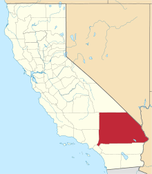
 Cedar Glen Location within the state of California | |
| Coordinates: 34°15′14″N 117°9′54″W / 34.25389°N 117.16500°WCoordinates: 34°15′14″N 117°9′54″W / 34.25389°N 117.16500°W | |
| Country | United States |
| State | California |
| County | San Bernardino |
| Elevation | 5,403 ft (1,647 m) |
| Population (2000) | |
| • Total | 552 |
| Time zone | Pacific (PST) (UTC-8) |
| • Summer (DST) | PDT (UTC-7) |
| ZIP codes | 92321 |
| Area code(s) | 909 |
Cedar Glen, California is an unincorporated community in located in the San Bernardino National Forest resort area of San Bernardino County immediately east of Lake Arrowhead.
The community lies at an elevation of 5403 ft (1647 m).[1]
The town's ZIP Code is 92321 and it lies entirely within area code 909. The nearest highway is California State Highway 173 which bisects Cedar Glen and passes through Lake Arrowhead.
Demographics
As of the census[2] of 2000, there were 552 people and 590 housing units. The racial makeup of the CDP was 86.6% White, <0.1% African American, <0.1% Native American, 9.2% Asian, 4.2% Pacific Islander, <0.1% from other races, and <0.1% from two or more races. Hispanic or Latino of any race were <0.1% of the population.[3]
Comedian Jon Dore resides in Cedar Glen.
Education
Cedar Glen is served by the Rim of the World Unified School District.
Government
In the California State Legislature, Cedar Glen is in the 23rd Senate District, represented by Republican Mike Morrell, and in the 33rd Assembly District, represented by Republican Jay Obernolte.[4]
In the United States House of Representatives, Cedar Glen is in California's 8th congressional district, represented by Republican Paul Cook.[5]
Weather
Cedar Glen has a roughly Mediterranean climate.


| Climate data for Lake Arrowhead, CA | |||||||||||||
|---|---|---|---|---|---|---|---|---|---|---|---|---|---|
| Month | Jan | Feb | Mar | Apr | May | Jun | Jul | Aug | Sep | Oct | Nov | Dec | Year |
| Average high °F (°C) | 44 (7) |
45 (7) |
52 (11) |
59 (15) |
68 (20) |
76 (24) |
81 (27) |
81 (27) |
75 (24) |
63 (17) |
51 (11) |
44 (7) |
61.6 (16.4) |
| Average low °F (°C) | 30 (−1) |
30 (−1) |
32 (0) |
36 (2) |
42 (6) |
49 (9) |
57 (14) |
57 (14) |
51 (11) |
42 (6) |
35 (2) |
30 (−1) |
40.9 (5.1) |
| Average precipitation inches (mm) | 8.20 (208.3) |
9.54 (242.3) |
6.08 (154.4) |
2.73 (69.3) |
1.00 (25.4) |
0.25 (6.4) |
0.10 (2.5) |
0.21 (5.3) |
0.69 (17.5) |
2.51 (63.8) |
3.41 (86.6) |
5.21 (132.3) |
39.93 (1,014.1) |
| Source: weather.com[6] | |||||||||||||
References
- ↑ http://california.hometownlocator.com/ca/san-bernardino/cedar-glen.cfm Information about Cedar Glen at Hometownlocator.com
- ↑ "American FactFinder". United States Census Bureau. Archived from the original on 2013-09-11. Retrieved 2008-01-31.
- ↑ http://mcdc2.missouri.edu/cgi-bin/broker?_PROGRAM=websas.dp3_2k.sas&_SERVICE=sasapp&zi=92321 MCDC demographic profile
- ↑ "Statewide Database". UC Regents. Retrieved December 8, 2014.
- ↑ "California's 8th Congressional District - Representatives & District Map". Civic Impulse, LLC.
- ↑ "Average Weather for Lake Arrowhead, CA - Temperature and Precipitation". The Weather Channel. Retrieved 2014-06-08.