Mentone, California
| Mentone | |
|---|---|
| census-designated place | |
| Motto: Home Of "Oranges On The Rocks"[1] | |
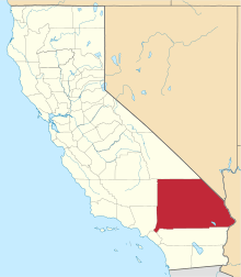
 Location in San Bernardino County and the state of California | |
 Mentone Location in the United States | |
| Coordinates: 34°04′12″N 117°08′04″W / 34.07000°N 117.13444°WCoordinates: 34°04′12″N 117°08′04″W / 34.07000°N 117.13444°W[2] | |
| Country |
|
| State |
|
| County | San Bernardino |
| Area[3] | |
| • Total | 6.234 sq mi (16.146 km2) |
| • Land | 6.222 sq mi (16.115 km2) |
| • Water | 0.012 sq mi (0.031 km2) 0.19% |
| Elevation[2] | 1,650 ft (503 m) |
| Population (2010) | |
| • Total | 8,720 |
| • Density | 1,400/sq mi (540/km2) |
| Time zone | PST (UTC-8) |
| • Summer (DST) | PDT (UTC-7) |
| ZIP code | 92359 |
| Area code(s) | 909 |
| FIPS code | 06-46884 |
| GNIS feature IDs | 1661008, 2408816 |
| Website |
www |
Mentone is a census-designated place in San Bernardino County, California. The population was 8,720 at the 2010 census, up from 7,803 at the 2000 census. It is located at 34°3′53″N 117°7′13″W / 34.06472°N 117.12028°W.[4]
According to the United States Census Bureau, it has a total area of 6.2 square miles (16 km2), 6.2 square miles (16 km2) of it is land and 0.19% is water. State Route 38 serves as its main street, called Mentone Boulevard as one enters Mentone from Redlands, then Mill Creek Road as one leaves the district and heads north toward Angelus Oaks and Big Bear.
History
Mentone is a former railroad town and health spa. It was named for Menton, France.[5]
Demographics
2010
The 2010 United States Census[6] reported that Mentone had a population of 8,720. The population density was 1,398.8 people per square mile (540.1/km²). The racial makeup of Mentone was 6,114 (70.1%) White (52.4% Non-Hispanic White),[7] 438 (5.0%) African American, 122 (1.4%) Native American, 352 (4.0%) Asian, 32 (0.4%) Pacific Islander, 1,234 (14.2%) from other races, and 428 (4.9%) from two or more races. Hispanic or Latino of any race were 3,085 persons (35.4%).
The Census reported that 8,601 people (98.6% of the population) lived in households, 64 (0.7%) lived in non-institutionalized group quarters, and 55 (0.6%) were institutionalized.
There were 3,026 households, out of which 1,239 (40.9%) had children under the age of 18 living in them, 1,442 (47.7%) were opposite-sex married couples living together, 513 (17.0%) had a female householder with no husband present, 204 (6.7%) had a male householder with no wife present. There were 222 (7.3%) unmarried opposite-sex partnerships, and 24 (0.8%) same-sex married couples or partnerships. 674 households (22.3%) were made up of individuals and 180 (5.9%) had someone living alone who was 65 years of age or older. The average household size was 2.84. There were 2,159 families (71.3% of all households); the average family size was 3.31.
The population was spread out with 2,333 people (26.8%) under the age of 18, 979 people (11.2%) aged 18 to 24, 2,344 people (26.9%) aged 25 to 44, 2,263 people (26.0%) aged 45 to 64, and 801 people (9.2%) who were 65 years of age or older. The median age was 33.7 years. For every 100 females there were 97.3 males. For every 100 females age 18 and over, there were 95.4 males.
There were 3,273 housing units at an average density of 525.0 per square mile (202.7/km²), of which 1,844 (60.9%) were owner-occupied, and 1,182 (39.1%) were occupied by renters. The homeowner vacancy rate was 2.7%; the rental vacancy rate was 8.3%. 5,371 people (61.6% of the population) lived in owner-occupied housing units and 3,230 people (37.0%) lived in rental housing units.
During 2009–2013, Mentone had a median household income of $58,178, with 10.8% of the population living below the federal poverty line.[7]
2000
As of the census[8] of 2000, there were 7,803 people, 2,757 households, and 1,891 families. The population density was 1,252.7 inhabitants per square mile (483.6/km²). There were 2,946 housing units at an average density of 473.0 per square mile (182.6/km²). The racial makeup was 74.5% White, 4.7% African American, 1.1% Native American, 3.0% Asian, 0.2% Pacific Islander, 12.4% from other races, and 4.1% from two or more races. Hispanic or Latino of any race were 25.1% of the population.
39.5% of the households in Mentone had children under the age of 18, 49.9% were married couples living together, 13.6% had a female head of the household, and 31.4% were non-families. Of the 24.5% of households made up of individuals, 7.1% were 65 years of age or older. The average household size was 2.8 and the average family size was 3.3.
The population was spread out with 30.7% under the age of 18, 9.9% from 18 to 24, 30.8% from 25 to 44, 19.7% from 45 to 64, and 9.0% who were 65 years of age or older. The median age was 32 years. For every 100 females, there were 95.6 males. For every 100 females age 18 and over, there were 91.9 males.
The median income for a household was $41,225, and the median income for a family was $47,786. Males had a median income of $40,888 versus $29,495 for females. The per capita income for the CDP was $17,781. About 8.8% of families and 10.4% of the population were below the poverty line, including 11.7% of those under age 18 and 1.5% of those age 65 or over.
Government
Local
Mentone is not incorporated and has no mayor or city council. Its schools are part of the Redlands Unified School District. Police and fire services are provided by San Bernardino County (police services come from the Yucaipa Valley Station, with mutual aid assistance from the Redlands Police and Fire Departments). Property taxes are collected by San Bernardino County.
State and federal representation
In the California State Senate, Mentone is in the 23rd Senate District, represented by Republican Mike Morrell. in the California State Assembly, it is split between the 40th Assembly District, represented by Republican Marc Steinorth, and the 42nd Assembly District, represented by Republican Chad Mayes.[9]
In the United States House of Representatives, Mentone is split between two congressional districts: California's 8th congressional district, represented by Republican Paul Cook,[10] and California's 31st congressional district, represented by Democrat Pete Aguilar,[11]
References
- ↑ "Mentone Chamber of Commerce". Mentone Chamber of Commerce.
- 1 2 "Mentone". Geographic Names Information System. United States Geological Survey. Retrieved November 12, 2014.
- ↑ "2010 Census Gazetteer Files – Places – California". United States Census Bureau. Retrieved March 26, 2015.
- ↑ "US Gazetteer files: 2010, 2000, and 1990". United States Census Bureau. 2011-02-12. Retrieved 2011-04-23.
- ↑ "Profile for Mentone, California, CA". Moma. Retrieved September 12, 2012.
- ↑ "2010 Census Interactive Population Search: CA - Mentone CDP". U.S. Census Bureau. Retrieved July 12, 2014.
- 1 2 "Mentone CDP QuickFacts". United States Census Bureau. Retrieved March 25, 2015.
- ↑ "American FactFinder". United States Census Bureau. Retrieved 2008-01-31.
- ↑ "Statewide Database". Regents of the University of California. Retrieved March 25, 2015.
- ↑ "California's 8th Congressional District - Representatives & District Map". Civic Impulse, LLC.
- ↑ "California's 31st Congressional District - Representatives & District Map". Civic Impulse, LLC.
External links
| Wikimedia Commons has media related to Mentone, California. |
- Mentone Chamber of Commerce Portal style website, Government, Business, Library, Recreation and more
- City-Data.com Comprehensive Statistical Data and more about Tipton