Brown Township, Lycoming County, Pennsylvania
| Brown Township, Lycoming County, Pennsylvania | |
|---|---|
| Township | |
|
The village of Black Forest | |
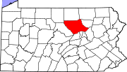
 Map of Lycoming County, Pennsylvania highlighting Brown Township | |
 Map of Lycoming County, Pennsylvania | |
| Coordinates: 41°29′30″N 77°30′59″W / 41.49167°N 77.51639°WCoordinates: 41°29′30″N 77°30′59″W / 41.49167°N 77.51639°W | |
| Country | United States |
| State | Pennsylvania |
| County | Lycoming |
| Settled | 1794 |
| Formed | 1815 |
| Area | |
| • Total | 73.7 sq mi (190.8 km2) |
| • Land | 73.3 sq mi (189.7 km2) |
| • Water | 0.4 sq mi (1.0 km2) |
| Elevation | 1,988 ft (606 m) |
| Population (2000) | |
| • Total | 111 |
| • Density | 1.5/sq mi (0.6/km2) |
| Time zone | Eastern Time Zone (North America) (UTC-5) |
| • Summer (DST) | EDT (UTC-4) |
| Named for | Jacob Brown |
| GNIS feature ID | 1216742[1] |

Brown Township is a township in Lycoming County, Pennsylvania, United States. The population was 111 at the 2000 census. It is part of the Williamsport, Pennsylvania Metropolitan Statistical Area.
History
Brown Township, named for a Major General Jacob Brown of the War of 1812, was formed on May 3, 1815 by the Pennsylvania General Assembly from parts of Mifflin and Pine Townships. Pine Creek divides the township, nearly in half and it is the center of history in Brown Township. Pine Creek was a major waterway in the settlement of north central Pennsylvania and in the lumber era that swept through Pennsylvania in the mid-to-late 19th century. Early pioneers were attracted to its remoteness and abundance of fish and game.[2]
Jacob Lamb, formerly of Milton was the first documented settler to the area. He arrived in late 1794 by paddling with his family and household supplies in ten canoes, up the West Branch Susquehanna River and Pine Creek to the mouth of Slate Run. Here, Lamb built his home. Jacob Lamb also constructed the first saw and gristmills in the area.[2]
Pioneer settler Jacob Tomb and his family established a home, sawmill, and gristmill at the mouth of Slate Run in the 1790s, and others settled nearby along the Pine Creek floodplain. By 1855, the village had a post office, general store, hotel, and two churches.[3]
Driving the local economy toward the end of the century was the James B. Weed and Company hemlock sawmill, which operated in Slate Run from 1886 to 1910 and produced up to 100,000 board feet of lumber a day. After the end of the lumber era, the mill closed, and the village declined in size. However, in the early 21st century, Slate Run still has a general store and post office, and a hotel with a restaurant and bar.[3]
Over the years Brown Township grew slowly, but it never gained a large population. It is largely a remote area, covered with mountains and a thriving second growth forest. It is popular today with outdoor recreation enthusiasts. The population was 885 by the 1890 census and declined to 111 people by the 2000 census.
The Bridge in Brown Township was added to the National Register of Historic Places in 1988.[4]
Geography
Brown Township is in the northwestern corner of the county, bordered by Potter County to the west, Tioga County to the north, Pine Township to the east and McHenry Township to the south.[5] As the crow flies, Lycoming County is about 130 miles (209 km) northwest of Philadelphia and 165 miles (266 km) east-northeast of Pittsburgh.
According to the United States Census Bureau, the township has a total area of 73.7 square miles (191 km2).73.3 square miles (189.7 km2) of it is land and 0.4 square miles (1.0 km2) of it (0.54%) is water.
Demographics
As of the census[6] of 2000, there were 111 people, 56 households, and 38 families residing in the township. The population density was 1.5 people per square mile (0.6/km2). There were 353 housing units at an average density of 4.8/sq mi (1.9/km2). The racial makeup of the township was 100.00% White.
There were 56 households, out of which 10.7% had children under the age of 18 living with them, 64.3% were married couples living together, and 30.4% were non-families. 26.8% of all households were made up of individuals, and 10.7% had someone living alone who was 65 years of age or older. The average household size was 1.98 and the average family size was 2.36.
In the township the population was spread out, with 10.8% under the age of 18, 0.9% from 18 to 24, 16.2% from 25 to 44, 37.8% from 45 to 64, and 34.2% who were 65 years of age or older. The median age was 56 years. For every 100 females there were 122.0 males. For every 100 females age 18 and over, there were 125.0 males.
The median income for a household in the township was $41,250, and the median income for a family was $55,833. Males had a median income of $24,583 versus $16,667 for females. The per capita income for the township was $22,970. There were 5.6% of families and 4.9% of the population living below the poverty line, including no under eighteens and none of those over 64.
See also
For histories of the other townships in Lycoming County see
References
- ↑ "US Board on Geographic Names". United States Geological Survey. 2007-10-25. Retrieved 2008-01-31.
- 1 2 Meginness, John Franklin (1892). "Brown, Cummings, Pine, and McHenry". History of Lycoming County, Pennsylvania: including its aboriginal history; the colonial and revolutionary periods; early settlement and subsequent growth; organization and civil administration; the legal and medical professions; internal improvement; past and present history of Williamsport; manufacturing and lumber interests; religious, educational, and social development; geology and agriculture; military record; sketches of boroughs, townships, and villages; portraits and biographies of pioneers and representative citizens, etc. etc. (1st ed.). Chicago: Brown, Runk & Co. ISBN 0-7884-0428-8. Retrieved 2007-02-20.
(Note: ISBN refers to Heritage Books July 1996 reprint. URL is to a scan of the 1892 version with some OCR typos).
- 1 2 Kagan, David Ira (2008). Pine Creek Villages. Charleston, South Carolina: Arcadia Publishing. pp. 77–98. ISBN 978-0-7385-5663-5.
- ↑ National Park Service (2010-07-09). "National Register Information System". National Register of Historic Places. National Park Service.
- ↑ "2007 General Highway Map Lycoming County Pennsylvania" (PDF) (Map). 1:65,000. Pennsylvania Department of Transportation, Bureau of Planning and Research, Geographic Information Division. Retrieved 2009-12-24.
- ↑ "American FactFinder". United States Census Bureau. Archived from the original on 2013-09-11. Retrieved 2008-01-31.
Municipalities and communities of Lycoming County, Pennsylvania, United States | ||
|---|---|---|
| City | | |
| Boroughs | ||
| Townships |
| |
| CDPs | ||
| Unincorporated communities | ||
| Ghost town | ||
| Footnotes | ‡This populated place also has portions in an adjacent county | |