Cogan House Township, Lycoming County, Pennsylvania
| Cogan House Township, Pennsylvania | |
|---|---|
| Township | |
|
Cogan House Covered Bridge over Larrys Creek in Cogan House Township | |
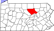
 Map of Lycoming County, Pennsylvania highlighting Cogan House Township | |
 Map of Lycoming County, Pennsylvania | |
| Coordinates: 41°24′57″N 77°11′21″W / 41.41583°N 77.18917°WCoordinates: 41°24′57″N 77°11′21″W / 41.41583°N 77.18917°W | |
| Country | United States |
| State | Pennsylvania |
| County | Lycoming |
| Settled | 1825 |
| Incorporated | 1843 |
| Area | |
| • Total | 69.9 sq mi (181.1 km2) |
| • Land | 69.9 sq mi (181.1 km2) |
| • Water | 0.0 sq mi (0.0 km2) |
| Elevation | 1,273 ft (388 m) |
| Population (2000) | |
| • Total | 974 |
| • Density | 13.9/sq mi (5.4/km2) |
| Time zone | Eastern Time Zone (North America) (UTC-5) |
| • Summer (DST) | EDT (UTC-4) |
| ZIP code | 17771 |
| Area code(s) | 570 |
| FIPS code | 42-14872[1] |
| GNIS feature ID | 1216745[2] |

Cogan House Township is a township in Lycoming County, Pennsylvania, United States. The population was 974 at the 2000 census. It is part of the Williamsport, Pennsylvania Metropolitan Statistical Area.
History
Cogan House Township was formed parts of Jackson and Mifflin townships on December 6, 1843. The source of Larrys Creek is in Cogan House Township, just south of the hamlet of Steam Valley.[3] It flows west-southwest through the village of Cogan House, and then under the Cogan House Covered Bridge. The bridge is also known as the "Buckhorn Covered Bridge" (for a nearby mountain and vanished village) or the "Larrys Creek Covered Bridge" (for the creek it crosses). A petition from the citizens of Cogan House Township for a bridge to be built was filed on September 4, 1876.[4] The 90 foot (27 m) long Burr arch truss bridge was built in 1877, rehabilitated in 1998,[5] and is on the National Register of Historic Places.[6] Larrys Creek was vitally important to the economic development of Cogan House Township. During the height of the lumber era that swept through Pennsylvania in the mid-to-late 19th century, Larrys Creek was used to float logs from the hills of the township to the lumber industry in nearby Williamsport on the West Branch Susquehanna River.[6][7][4][8]
The township is named for David Cogan, a pioneer who settled on Larrys Creek in 1825. Cogan was one of the few settlers in the area for many years, but wearying of his isolation, he left his homestead in 1842, as did a neighbor named Carter. Cogan's and Carter's houses were used by hunters and travellers. The name Cogan's House was given to the area, hence the name, Cogan House.[9]
Geography

Cogan House Township is bordered by Pine and Cummings Townships to the west, Jackson Township to the north, McIntyre and Lewis Townships to the east, and Lycoming, Anthony, and Mifflin Townships to the south.[10] As the crow flies, Lycoming County is about 130 miles (209 km) northwest of Philadelphia and 165 miles (266 km) east-northeast of Pittsburgh.
According to the United States Census Bureau, the township has a total area of 69.9 square miles (181 km2), all of it land.
Demographics
As of the census[1] of 2000, there were 974 people, 359 households, and 273 families residing in the township. The population density was 13.9 people per square mile (5.4/km2). There were 451 housing units at an average density of 6.5/sq mi (2.5/km2). The racial makeup of the township was 99.38% White, 0.10% African American, 0.10% Native American, 0.10% from other races, and 0.31% from two or more races. Hispanic or Latino of any race were 0.51% of the population.
There were 359 households, out of which 29.8% had children under the age of 18 living with them, 68.0% were married couples living together, 4.7% had a female householder with no husband present, and 23.7% were non-families. 18.1% of all households were made up of individuals, and 7.5% had someone living alone who was 65 years of age or older. The average household size was 2.66 and the average family size was 3.08.
In the township the population was spread out, with 24.9% under the age of 18, 7.6% from 18 to 24, 26.9% from 25 to 44, 27.9% from 45 to 64, and 12.6% who were 65 years of age or older. The median age was 39 years. For every 100 females there were 102.5 males. For every 100 females age 18 and over, there were 103.6 males.
The median income for a household in the township was $36,172, and the median income for a family was $40,192. Males had a median income of $31,875 versus $20,350 for females. The per capita income for the township was $15,345. About 8.0% of families and 9.5% of the population were below the poverty line, including 10.3% of those under age 18 and 9.7% of those age 65 or over.
References
- 1 2 "American FactFinder". United States Census Bureau. Archived from the original on 2013-09-11. Retrieved 2008-01-31.
- ↑ "US Board on Geographic Names". United States Geological Survey. 2007-10-25. Retrieved 2008-01-31.
- ↑ "United States Geological Survey Topographic Map, White Pine Quad". www.topoquest.com. USGS. Retrieved 2008-06-29.
- 1 2 Landis, Milton W. (October 1966). "The Larrys Creek Covered Bridge in Cogan House Township". Now and then (The Journal of the Muncy, Pennsylvania Historical Society). XV (5): 258.
- ↑ Kane, Trish. "Pennsylvania - Lycoming County Covered Bridges". Retrieved 2007-02-28.
- 1 2 "National Register of Historic Places - Pennsylvania (PA), Lycoming County". Retrieved 2007-02-28.
- ↑ "United States Geological Survey Topographic Map, White Pine Quad". www.topoquest.com. USGS. Retrieved 2008-06-29.
- ↑ Kane, Trish. "Pennsylvania - Lycoming County Covered Bridges". Retrieved 2007-02-28.
- ↑ Meginness, John Franklin (1892). "Jackson and Cogan House". History of Lycoming County, Pennsylvania: including its aboriginal history; the colonial and revolutionary periods; early settlement and subsequent growth; organization and civil administration; the legal and medical professions; internal improvement; past and present history of Williamsport; manufacturing and lumber interests; religious, educational, and social development; geology and agriculture; military record; sketches of boroughs, townships, and villages; portraits and biographies of pioneers and representative citizens, etc. etc. (1st ed.). Chicago: Brown, Runk & Co. ISBN 0-7884-0428-8. Retrieved 2007-02-20.
(Note: ISBN refers to Heritage Books July 1996 reprint. URL is to a scan of the 1892 version with some OCR typos).
- ↑ "2007 General Highway Map Lycoming County Pennsylvania" (PDF) (Map). 1:65,000. Pennsylvania Department of Transportation, Bureau of Planning and Research, Geographic Information Division. Retrieved 2009-12-24.
Municipalities and communities of Lycoming County, Pennsylvania, United States | ||
|---|---|---|
| City | | |
| Boroughs | ||
| Townships |
| |
| CDPs | ||
| Unincorporated communities | ||
| Ghost town | ||
| Footnotes | ‡This populated place also has portions in an adjacent county | |