Blumenort
| Blumenort | |
|---|---|
| Local urban district | |
|
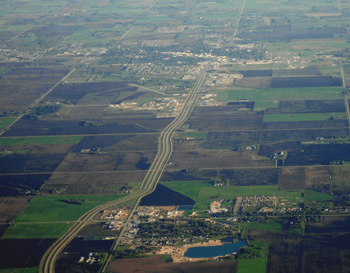
Blumenort (located in the lower portion) as seen from the air with Steinbach (upper) seen to the southern part of the picture. | |
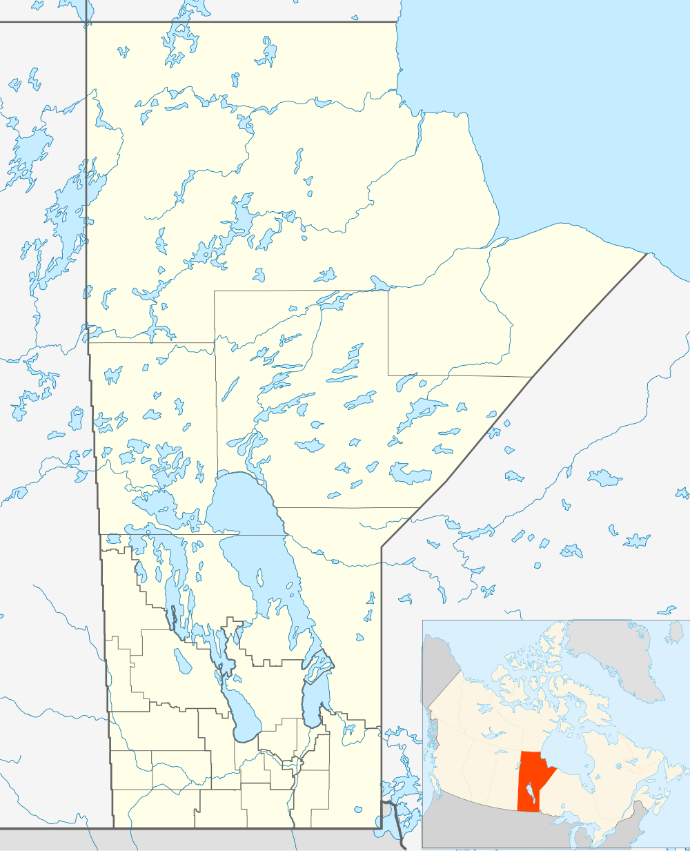 Blumenort Location of Blumenort in Manitoba | |
| Coordinates: 49°36′16″N 96°41′20″W / 49.60444°N 96.68889°WCoordinates: 49°36′16″N 96°41′20″W / 49.60444°N 96.68889°W | |
| Country | Canada |
| Province | Manitoba |
| Region | Eastman |
| Established | 1876 |
| Government | |
| • MP (Provencher) | Ted Falk |
| • MLA (Steinbach) | Kelvin Goertzen (PC) |
| Area | |
| • Total | 1.64 km2 (0.63 sq mi) |
| Elevation | 268 m (879 ft) |
| Population (2011 Census[1]) | |
| • Total | 1,113 |
| • Density | 691.1/km2 (1,790/sq mi) |
| Time zone | CST (UTC-6) |
| • Summer (DST) | CDT (UTC-5) |
Blumenort is an unincorporated community recognized as a local urban district in the Canadian province of Manitoba.[2] It is located in the Rural Municipality of Hanover, just north of the city of Steinbach. It was founded in 1874 by Mennonite farmers. Today, its economy is based on agriculture and the service industry.
History
Prior to about 1870, southeastern Manitoba, including the Blumenort area, were hunting, fishing, and trapping grounds used by the nomadic Ojibway people. In 1871, the government began negotiating to the articles of the Ojibway land claims for this region of Manitoba. By 1874, the First Nations people of southeastern Manitoba had moved onto the Brokenhead and Rousseau River Reserves. By this time, the government surveyed the land and readied it for expansion by European settlers. The first non-nomadic settlers in Blumenort were German speaking Mennonite farmers from South Russia who arrived in the summer of 1874. By 1875, Blumenort consisted of 24 families.
The original settlement form was the traditional linear settlement of Plautdietsch speaking "Russian" Mennonites. In 1910, Blumenort was dismantled as the farmers disbursed to move onto the land they farmed. Barns and houses were relocated and within a few years little evidence of the former community remained, its street serving as a driveway for two farming families.
In 1932, the farmers of the Blumenort area decided to build a cheese factory on a ridge, about a mile from the site of the former community. The cheese factory brought further development. By 1940, there were 16 families and six businesses located along or near the mile road now called Blumenort's Centre Avenue.
Blumenort has continued to expand, growing to 924 people in 2006.[3]
Today Blumenort continues to grow with a 36% population increase from 2006 to 2011. The community provides a local elementary school as well as an Evangelical Mennonite Conference Church and a Non-denominational Church, HOPE Church Blumenort.[4]
Economy

Blumenort is supported by several local businesses including magazine companies, poultry producers, transport companies, and vehicle repair companies. In addition to this, because of its proximity to Steinbach, many people from Blumenort commute to Steinbach for shopping, work and sometimes school. As a small town in the R.M. of Hanover much of the commercial business is related to the agricultural sector and several dairy farms are located in and near the town of Blumenort.
Transportation
Blumenort is located on Manitoba Provincial Road 311, near its intersection with Provincial Trunk Highway 12. PTH 12 once passed through Blumenort, but now bypasses around the east side of community.
See also
References
- ↑ "Blumenort population centre date". Census Canada. Retrieved February 8, 2012.
- ↑ "Local Urban Districts Regulation". Government of Manitoba. April 23, 2016. Retrieved April 24, 2016.
- ↑ http://www12.statcan.ca/english/census06/data/popdwell/Table.cfm?T=1302&PR=46&SR=1&S=5&O=D
- ↑ "HOPE Church Blumenort Website".
Bibliography
Loewen, Royden, Blumenort: A Mennonite Community in Transition, The Blumenort Mennonite Historical Society, 1983.
External links
| Wikimedia Commons has media related to Blumenort. |
| Cities |  | |
|---|---|---|
| Towns | ||
| Villages | ||
| Rural municipalities | ||
| First Nations | ||
| Indian reserves | ||
| Unincorporated communities | ||
