Blanchester, Ohio
| Blanchester, Ohio | |
|---|---|
| Village | |
 Location of Blanchester, Ohio | |
 Location of Blanchester in Clinton County | |
| Coordinates: 39°17′32″N 83°59′9″W / 39.29222°N 83.98583°WCoordinates: 39°17′32″N 83°59′9″W / 39.29222°N 83.98583°W | |
| Country | United States |
| State | Ohio |
| Counties | Clinton, Warren |
| Government | |
| • Mayor | John M. Carman |
| Area[1] | |
| • Total | 4.25 sq mi (11.01 km2) |
| • Land | 4.15 sq mi (10.75 km2) |
| • Water | 0.10 sq mi (0.26 km2) |
| Elevation[2] | 971 ft (296 m) |
| Population (2010)[3] | |
| • Total | 4,243 |
| • Estimate (2012[4]) | 4,230 |
| • Density | 1,022.4/sq mi (394.8/km2) |
| Time zone | Eastern (EST) (UTC-5) |
| • Summer (DST) | EDT (UTC-4) |
| ZIP code | 45107 |
| Area code(s) | 937 |
| FIPS code | 39-06908[5] |
| GNIS feature ID | 1038105[2] |
| Website | http://www.blanchester.com/ |
Blanchester is a village in Clinton and Warren counties in the U.S. state of Ohio. The population was 4,243 at the 2010 census. Blanchester is part of the Wilmington, Ohio Micropolitan Statistical Area, which is also included in the Cincinnati-Wilmington-Maysville, OH-KY-IN Combined Statistical Area.
History
Blanchester was laid out in 1832 by Joseph and John Blancett, and named for them.[6]
Blanchester has a rich railroad heritage and is still serviced by the Indiana & Ohio Railway. It was formerly a stop on the Baltimore & Ohio's National & National Limited. [7]
Gallery
-

Blanchester corporation limit sign
-

Looking west at the intersection of Main and Broadway Streets in Blanchester
Geography
Blanchester is located at 39°17′32″N 83°59′9″W / 39.29222°N 83.98583°W (39.292314, -83.985769).[8]
According to the United States Census Bureau, the village has a total area of 4.25 square miles (11.01 km2), of which 4.15 square miles (10.75 km2) is land and 0.10 square miles (0.26 km2) is water.[1]
Demographics
| Historical population | |||
|---|---|---|---|
| Census | Pop. | %± | |
| 1860 | 553 | — | |
| 1870 | 513 | −7.2% | |
| 1880 | 776 | 51.3% | |
| 1890 | 1,196 | 54.1% | |
| 1900 | 1,788 | 49.5% | |
| 1910 | 1,813 | 1.4% | |
| 1920 | 1,671 | −7.8% | |
| 1930 | 1,597 | −4.4% | |
| 1940 | 1,785 | 11.8% | |
| 1950 | 2,109 | 18.2% | |
| 1960 | 2,944 | 39.6% | |
| 1970 | 3,080 | 4.6% | |
| 1980 | 3,202 | 4.0% | |
| 1990 | 4,206 | 31.4% | |
| 2000 | 4,220 | 0.3% | |
| 2010 | 4,243 | 0.5% | |
| Est. 2015 | 4,246 | [9] | 0.1% |
2010 census
As of the census[3] of 2010, there were 4,243 people, 1,636 households, and 1,113 families residing in the village. The population density was 1,022.4 inhabitants per square mile (394.8/km2). There were 1,854 housing units at an average density of 446.7 per square mile (172.5/km2). The racial makeup of the village was 97.8% White, 0.4% African American, 0.3% Native American, 0.3% Asian, and 1.1% from two or more races. Hispanic or Latino of any race were 0.4% of the population.
There were 1,636 households of which 34.8% had children under the age of 18 living with them, 47.9% were married couples living together, 14.4% had a female householder with no husband present, 5.7% had a male householder with no wife present, and 32.0% were non-families. 27.8% of all households were made up of individuals and 11.9% had someone living alone who was 65 years of age or older. The average household size was 2.53 and the average family size was 3.08.
The median age in the village was 37.3 years. 25.5% of residents were under the age of 18; 8.1% were between the ages of 18 and 24; 26.4% were from 25 to 44; 24.5% were from 45 to 64; and 15.6% were 65 years of age or older. The gender makeup of the village was 47.1% male and 52.9% female.
2000 census
As of the census[5] of 2000, there were 4,220 people, 1,645 households, and 1,131 families residing in the village. The population density was 1,424.8 people per square mile (550.5/km²). There were 1,766 housing units at an average density of 596.3 per square mile (230.4/km²). The racial makeup of the village was 98.70% White, 0.14% African American, 0.17% Native American, 0.36% Asian, 0.02% from other races, and 0.62% from two or more races. Hispanic or Latino of any race were 0.62% of the population.
There were 1,645 households out of which 35.0% had children under the age of 18 living with them, 53.2% were married couples living together, 12.0% had a female householder with no husband present, and 31.2% were non-families. 27.8% of all households were made up of individuals and 14.4% had someone living alone who was 65 years of age or older. The average household size was 2.49 and the average family size was 3.05.
In the village the population was spread out with 27.1% under the age of 18, 8.5% from 18 to 24, 27.3% from 25 to 44, 20.5% from 45 to 64, and 16.6% who were 65 years of age or older. The median age was 36 years. For every 100 females there were 85.6 males. For every 100 females age 18 and over, there were 80.9 males.
The median income for a household in the village was $35,608, and the median income for a family was $42,018. Males had a median income of $32,088 versus $24,531 for females. The per capita income for the village was $17,112. About 6.9% of families and 11.0% of the population were below the poverty line, including 12.4% of those under age 18 and 21.1% of those age 65 or over.
Education
Blanchester Local School District consists of Putman Elementary School, an Intermediate School, Middle School & High School. The mascot is the Blanchester Wildcat.
Notable people
- Clarence J. Brown - newspaper publisher who started Brown Publishing Company and Republican politician who served in the United States House of Representatives, Lieutenant Governor of Ohio, and Ohio Secretary of State.
- Clarence J. "Bud" Brown Jr. - held a seat in the United States House of Representatives, and served as Deputy and Acting Secretary of Commerce under President Ronald Reagan.
- Frank M. Casto, American Orthodontist and Past President of AAO and ADA
Trivia
There is no other community named "Blanchester" in the world.
Blanchester Showplace Cinemas is reported as having the cheapest first run movie theater seating in America.[11]
References
- 1 2 "US Gazetteer files 2010". United States Census Bureau. Archived from the original on 2012-01-24. Retrieved 2013-01-06.
- 1 2 "US Board on Geographic Names". United States Geological Survey. 2007-10-25. Retrieved 2008-01-31.
- 1 2 "American FactFinder". United States Census Bureau. Retrieved 2013-01-06.
- ↑ "Population Estimates". United States Census Bureau. Archived from the original on 2013-06-17. Retrieved 2013-06-17.
- 1 2 "American FactFinder". United States Census Bureau. Archived from the original on 2013-09-11. Retrieved 2008-01-31.
- ↑ Brown, Albert J. (1915). History of Clinton County, Ohio: Its People, Industries, and Institutions. B.F. Bowen. p. 287.
- ↑ http://www.american-rails.com/national-limited.html
- ↑ "US Gazetteer files: 2010, 2000, and 1990". United States Census Bureau. 2011-02-12. Retrieved 2011-04-23.
- ↑ "Annual Estimates of the Resident Population for Incorporated Places: April 1, 2010 to July 1, 2015". Retrieved July 2, 2016.
- ↑ "Census of Population and Housing". Census.gov. Archived from the original on May 11, 2015. Retrieved June 4, 2015.
- ↑ "Is This the Cheapest Movie Theater in America?". 23 June 2014. Retrieved 13 January 2015.
External links
 Media related to Blanchester, Ohio at Wikimedia Commons
Municipalities and communities of Clinton County, Ohio, United States | ||
|---|---|---|
| City | 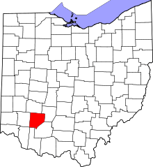 | |
| Villages | ||
| Townships | ||
| Unincorporated communities | ||
| Ghost town | ||
| Footnotes | ‡This populated place also has portions in an adjacent county or counties | |
Municipalities and communities of Warren County, Ohio, United States | ||
|---|---|---|
| Cities | 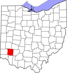 | |
| Villages | ||
| Townships | ||
| CDPs | ||
| Unincorporated communities |
| |
| Ghost towns | ||
| Footnotes | ‡This populated place also has portions in an adjacent county or counties | |