Warren County, Ohio
| Warren County, Ohio | ||
|---|---|---|
| ||
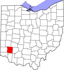 Location in the U.S. state of Ohio | ||
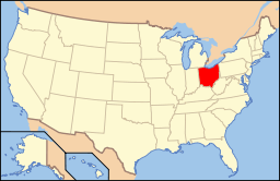 Ohio's location in the U.S. | ||
| Founded | May 1, 1803[1] | |
| Named for | Dr. Joseph Warren | |
| Seat | Lebanon | |
| Largest city | Mason | |
| Area | ||
| • Total | 407 sq mi (1,054 km2) | |
| • Land | 401 sq mi (1,039 km2) | |
| • Water | 6.0 sq mi (16 km2), 1.5% | |
| Population | ||
| • (2010) | 212,693 | |
| • Density | 530/sq mi (205/km²) | |
| Congressional district | 1st | |
| Time zone | Eastern: UTC-5/-4 | |
| Website |
www | |
.svg.png)
Warren County is a county located in the U.S. state of Ohio. As of the 2010 census, the population was 212,693.[2] Its county seat is Lebanon.[3] The county was erected May 1, 1803, from Hamilton County, and named for Dr. Joseph Warren, a hero of the Revolution who sent Paul Revere on his ride and who died at the Battle of Bunker Hill.[4]
Warren County is part of the Cincinnati-Middletown, OH-KY-IN Metropolitan Statistical Area. Along with Butler County, Warren County comprises the geographical center of the Cincinnati-Dayton Metropolitan Region, home to 3.3 million and the 14th most populous in the United States.[5] This is the key factor to the county's rapid suburban growth.
Geography
According to the U.S. Census Bureau, the county has a total area of 407 square miles (1,050 km2), of which 401 square miles (1,040 km2) is land and 6.0 square miles (16 km2) (1.5%) is water.[6] The county is a rough square with the sides roughly 20 miles (30 km) long.
Adjacent counties
- Montgomery County (northwest)
- Greene County (northeast)
- Clinton County (east)
- Clermont County (south)
- Hamilton County (southwest)
- Butler County (west)
Boundaries
Warren County was created by the first Ohio General Assembly in the Act of March 24, 1803, which also created Butler and Montgomery Counties. The act defined Warren County as "all that part of the county of Hamilton included within the following bounds, viz.: Beginning at the northeast corner of the county of Clermont, running thence west with the line of said county to the Little Miami; thence up the same with the meanders thereof to the north boundary of the first tier of sections in the second entire range of townships in the Miami Purchase; thence west to the northeast corner of Section No. 7 in the third township of the aforesaid range; thence north to the Great Miami; thence up the same to the middle of the fifth range of townships; thence east to the County line; thence with same south to the place of beginning." Originally this included land now in Clinton County as far east as Wilmington.
Clinton County proved a continuing headache to the legislature. The Ohio Constitution requires that every county have an area of at least four hundred square miles (1,036 km²). Clinton County's boundaries were several times adjusted in an effort to comply with that clause of the constitution. One of them, the Act of January 30, 1815, detached a strip of land from the eastern side to give to Clinton. That would have left Warren under four hundred square miles (1,036 km²), so a portion of Butler County (the part of Franklin Township where Carlisle is now located) was attached to Warren in compensation. The 1815 act was as follows:
- Section 1—That all that part of the county of Butler lying and being within the first and second fractional townships in the fifth range, and adjoining the south line of Montgomery County, shall be and the same is hereby attached to and made part of the county of Warren.
- Section 2—That eleven square miles 28 km² of the territory of the county of Warren and extending parallel to the said eastern boundary of Warren County, along the whole length of such eastern boundary from north to south, shall be and the same is hereby attached to and made a part of the county of Clinton."
Except for the sections formed by the Great and Little Miamis, the sides are all straight lines.
Lakes and rivers
The major rivers of the county are the Great Miami River, which flows through the northwest corner of the county in Franklin Township, and the Little Miami River which zig-zags across the county from north to south. There is one sizable lake, the Caesars Creek Reservoir, created by a U.S. Army Corps of Engineers dam on Caesars Creek in the northeast part of the county in Massie Township.
Demographics
| Historical population | |||
|---|---|---|---|
| Census | Pop. | %± | |
| 1810 | 9,925 | — | |
| 1820 | 17,837 | 79.7% | |
| 1830 | 21,468 | 20.4% | |
| 1840 | 23,141 | 7.8% | |
| 1850 | 25,560 | 10.5% | |
| 1860 | 26,902 | 5.3% | |
| 1870 | 26,689 | −0.8% | |
| 1880 | 28,392 | 6.4% | |
| 1890 | 25,468 | −10.3% | |
| 1900 | 25,584 | 0.5% | |
| 1910 | 24,497 | −4.2% | |
| 1920 | 25,716 | 5.0% | |
| 1930 | 27,348 | 6.3% | |
| 1940 | 29,894 | 9.3% | |
| 1950 | 38,505 | 28.8% | |
| 1960 | 65,711 | 70.7% | |
| 1970 | 84,925 | 29.2% | |
| 1980 | 99,276 | 16.9% | |
| 1990 | 113,909 | 14.7% | |
| 2000 | 158,383 | 39.0% | |
| 2010 | 212,693 | 34.3% | |
| Est. 2015 | 224,469 | [7] | 5.5% |
| U.S. Decennial Census[8] 1790-1960[9] 1900-1990[10] 1990-2000[11] 2010-2013[2] | |||
2000 census
As of the census[12] of 2000, there were 158,383 people, 55,966 households, and 43,261 families residing in the county. The population density was 396 people per square mile (153/km²). There were 58,692 housing units at an average density of 147 per square mile (57/km²). The racial makeup of the county was 94.66% White, 2.73% Black or African American, 0.18% Native American, 1.26% Asian, 0.03% Pacific Islander, 0.31% from other races, and 0.84% from two or more races. Hispanic or Latino of any race were 1.03% of the population.
There were 55,966 households out of which 39.70% had children under the age of 18 living with them, 66.20% were married couples living together, 8.00% had a female householder with no husband present, and 22.70% were non-families. 18.90% of all households were made up of individuals and 6.40% had someone living alone who was 65 years of age or older. The average household size was 2.72 and the average family size was 3.12.
In the county, the population was spread out with 27.70% under the age of 18, 7.10% from 18 to 24, 34.00% from 25 to 44, 21.80% from 45 to 64, and 9.40% who are 65 years of age or older. The median age is 35 years. For every 100 females there were 102.60 males. For every 100 females age 18 and over, there were 102.40 males.
The median income for a household in the county was $57,952, and the median income for a family was $64,692. Males had a median income of $47,027 versus $30,862 for females. The per capita income for the county was $25,517. About 3.00% of families and 4.20% of the population were below the poverty line, including 4.40% of those under age 18 and 4.70% of those age 65 or over.
2010 census
As of the 2010 United States Census, there were 212,693 people, 76,424 households, and 57,621 families residing in the county.[13] The population density was 530.0 inhabitants per square mile (204.6/km2). There were 80,750 housing units at an average density of 201.2 per square mile (77.7/km2).[14] The racial makeup of the county was 90.5% white, 3.9% Asian, 3.3% black or African American, 0.2% American Indian, 0.7% from other races, and 1.5% from two or more races. Those of Hispanic or Latino origin made up 2.2% of the population.[13] In terms of ancestry, 28.7% were German, 14.1% were Irish, 12.0% were English, 11.6% were American, and 5.0% were Italian.[15]
Of the 76,424 households, 40.1% had children under the age of 18 living with them, 62.6% were married couples living together, 8.8% had a female householder with no husband present, 24.6% were non-families, and 20.4% of all households were made up of individuals. The average household size was 2.70 and the average family size was 3.14. The median age was 37.8 years.[13]
The median income for a household in the county was $71,274 and the median income for a family was $82,090. Males had a median income of $61,091 versus $41,331 for females. The per capita income for the county was $31,935. About 4.7% of families and 6.0% of the population were below the poverty line, including 7.6% of those under age 18 and 5.2% of those age 65 or over.[16]
Government and infrastructure
Warren County has a 3-member Board of County Commissioners that administer and oversee the various County departments, similar to all but 2 of the 88 Ohio counties. The elected commissioners serve four-year terms. Warren County's elected commissioners are:
- County Commissioners: Tom Grossmann (R), Pat South (R), and David Young (R).[17]
Hospitals
- Atrium Medical Center – Middletown (Formerly Middletown Regional Hospital)
- Bethesda Medical Center at Arrow Springs – Lebanon (Branch of Bethesda North Hospital)
Post offices
The following post offices, with ZIP codes, serve Warren County:
- Blanchester, 45107
- Carlisle, 45005
- Cincinnati (Sharonville branch), 45241
- Cincinnati (Sycamore branch), 45249
- Clarksville, 45113
- Dayton (Centerville/Washington Twp. branch), 45458
- Franklin, 45005
- Harveysburg, 45032
- Goshen, 45122
- Kings Mills, 45034
- Lebanon, 45036
- Loveland, 45140
- Maineville, 45039
- Mason, 45040
- Miamisburg, 45342
- Middletown, 45044
- Monroe, 45050
- Morrow, 45152
- New Richmond, 45157
- Oregonia, 45054
- Pleasant Plain, 45162
- South Lebanon, 45065
- Springboro,45066
- Waynesville, 45068
Telephone service
These are the telephone companies serving Warren County: CenturyLink (CL); FairPoint Communications (FP); Cincinnati Bell (Cin); AT&T (AT&T); TDS Telecom (TDS); and Frontier Communications (F). Warren County is in the 513 and 937 area codes.
The following exchange areas serve Warren County, listed with the area code and incumbent local exchange carrier (ILEC) abbreviation from above serving that exchange (list may not be up-to-date):
- Bellbrook (937-AT&T): 310, 661, 848
- Blanchester (937-F): 783
- Butlerville (513-TDS): 877
- Centerville (937-AT&T): 350, 619, 885, 886
- Clarksville (937-F): 289, 501, 574, 577
- Franklin (937-AT&T): 514, 550, 557, 704, 743, 746, 748, 790, 806, 928
- Germantown (937-FP): 855
- Lebanon (513-CL): 228, 282, 331, 695, 696, 836, 850, 932, 933, 934
- Little Miami (513-Cin): 239, 248, 274, 334, 340, 444, 453, 575, 576, 583, 600, 677, 683, 697, 707, 716, 722, 774, 831, 833, 965
- Mason (513-CL): 336, 339, 398, 459, 492, 573, 622, 754, 229, 234, 701, 770
- Miamisburg-West Carrollton (937-AT&T): 247, 353, 384, 388, 530, 560, 847, 859, 865, 866, 914
- Middletown (513-AT&T): 217, 222, 224, 261, 267, 292, 306, 318, 320, 355, 392, 420, 422, 423, 424, 425, 433, 435, 464, 465, 571, 594, 649, 705, 727, 783, 804, 849, 890, 915
- Monroe (513-AT&T): 360, 539
- Morrow (513-CL): 899
- New Burlington (937-F): 488
- South Lebanon (513-CL): 268, 480, 494
- Spring Valley (937-AT&T): 317, 659, 862
- Springboro (937-AT&T): 743, 746, 748, 885, 886 - (513-CL): 902, 915, 956
- Waynesville (513-CL): 897
Politics
| Year | Republican | Democratic |
|---|---|---|
| 2016 | 65.6% 75,947 | 28.5% 33,036 |
| 2012 | 68.9% 76,564 | 29.6% 32,909 |
| 2008 | 67.4% 71,691 | 31.4% 33,398 |
| 2004 | 72.1% 68,037 | 27.6% 26,044 |
| 2000 | 70.0% 48,318 | 27.7% 19,142 |
| 1996 | 59.9% 33,210 | 30.8% 17,089 |
| 1992 | 53.0% 27,998 | 25.6% 13,542 |
| 1988 | 73.4% 31,419 | 26.0% 11,145 |
| 1984 | 76.4% 29,848 | 23.1% 9,031 |
| 1980 | 63.1% 22,430 | 31.8% 11,306 |
| 1976 | 53.8% 16,115 | 44.6% 13,349 |
| 1972 | 72.4% 20,210 | 24.9% 6,941 |
| 1968 | 48.7% 12,663 | 26.0% 6,756 |
| 1964 | 47.0% 10,982 | 53.0% 12,406 |
| 1960 | 64.6% 14,505 | 35.4% 7,945 |
Warren County is primarily Republican and has been since the party was established in the 1850s. Since the first presidential election after its founding, 1856, Warren County has supported the Republican candidate for president all but once, the exception being 1964 when Warren County voted for Democrat Lyndon B. Johnson over Barry M. Goldwater. In 2008, Warren County cast the largest net vote for John McCain of any Ohio county. Before the Republican party was formed, Warren County supported the Whigs. Since 1869, Warren County has almost always supported the Republican candidate for Governor of Ohio, the exceptions being in 1924 when it supported Vic Donahey, 1932 (George White), 1952 (Frank Lausche), and 1958 (Michael V. DiSalle). However, other than DiSalle, each of these four Democrats, who were all victorious statewide, was a conservative Democrat.
In local races, Warren County occasionally elected Democrats. In 1976, two of the three county commission seats were won by Democrats. Until the mid-1990s, Democrats regularly ran for county offices. While Republicans usually won, the Democrats were at least able to make races competitive. However, with the massive expansion in population in the 1990s, the county became extremely Republican, so much so that no Democrats even file for most offices. In the 1996, 2000, and 2004 elections, in which eight county offices were on the ballot, there were no Democratic candidates for any of them. In November 1999, the last Democrat to hold office in Warren County, a member of the Educational Service Center (county school board), lost her seat to a Republican.
Education
Public school districts
- Blanchester City School District (also in Brown, Clermont, and Clinton)
- Carlisle Local School District (also in Montgomery)
- Carlisle High School, Carlisle (the Indians)
- Clinton-Massie Local School District (also in Clinton)
- Franklin City School District
- Franklin High School, Franklin (the Wildcats)
- Goshen Local School District (also in Clermont)
- Kings Local School District
- Kings High School, Kings Mills (the Knights)
- Lebanon City School District
- Lebanon High School, Lebanon (the Warriors)
- Little Miami Local School District (also in Clermont)
- Little Miami High School, Morrow (the Panthers)
- Loveland City School District (also in Clermont and Hamilton)
- Mason City School District
- William Mason High School, Mason (the Comets)
- Middletown City School District (also in Butler)
- Monroe Local School District (also in Butler)
- Princeton City School District (also in Butler and Hamilton)
- Springboro Community City School District (also in Montgomery)
- Springboro High School, Springboro (the Panthers)
- Wayne Local School District
- Waynesville High School, Waynesville (the Spartans)
- Warren County Vocational School District
- Warren County Career Center, Lebanon
- Xenia City School District (also in Greene and Clinton)
Private schools
- Bishop Fenwick High School (Franklin, Ohio)
- Lebanon Christian School – Lebanon, Ohio
- Middletown Christian Schools – Franklin, Ohio
- Saint Margaret of York School – Loveland, Ohio
- Liberty Bible Academy – Mason, Ohio
- Saint Susanna Parish School – (Mason, Ohio)
- Royalmont Academy - (Mason, Ohio)
Virtual schools
- Warren County Virtual Community School
Vocational schools
- Warren County Career Center
Colleges and universities
Warren County has no native colleges or universities, but was the original site selected for Miami University which instead located in Oxford, Ohio in 1809. National Normal University, a teachers college, was located in Lebanon from 1855 until 1917 when it closed. Several colleges currently offer classes in Warren County at various locations, including Sinclair Community College of Dayton, the University of Cincinnati, and Wilmington College. Sinclair opened a branch in the Mason area in 2007. The University of Cincinnati owns 398 acres (1.61 km2) of land[19] at the intersections of I-71 and Wilmington road, but no plans for development on the site have been announced.
Libraries
- Franklin-Springboro Public Library
- Lebanon Public Library
- Mary L. Cook Public Library – Waynesville
- Mason Public Library
- Salem Township Public Library
Transportation
Highways
Airports
Warren County has one public airport, designated as Lebanon-Warren County Airport (I68). The runway is a 4502' x 65' paved and lighted North-South runway (01/19), and parallel taxiway. Navigation and communications equipment includes PAPI, AWOS, Pilot Controlled Lighting, and UNICOM. The airport runway, taxiway, and navigation equipment is owned by the County. The county leases a public terminal, but other facilities are privately owned and operated under contract by a Fixed-base operator. The airport serves general and business aviation, but has no commercial airlines.
There are also two privately owned operating airports in the county; Waynesville airport, also known as Red Stewart Field (40I), and Caesar Creek Gliderport (2OH9), both with grass runways. Operations have ceased at two former private paved runway airports, Brownie's Lebanon Airport (19I), and Lebanon San Mar Gale (OH79).
Rail and Bus
Warren County does not currently have passenger train service except for a scenic train that runs between Lebanon and Mason. Freight trains still serve Carlisle, and on a limited basis, Monroe, Mason, and Lebanon. Historically, there have been several trains that ran through the county whose stops became cities and villages. These trains include the Cincinnati, Lebanon and Northern Railway, the Middletown and Cincinnati Railroad, and the Little Miami Railroad whose path is now replaced by the Little Miami Bike Trail. There have been proposals to run commuter trains from Cincinnati to the Kings Island area, but none have ever found sufficient support or funding.[20]
There is no public bus transportation based in Warren County, but there is limited service from Cincinnati to Mason and Kings Island. Middletown also runs bus service to eastern portions of Middletown that are located in Warren County.
Waterways
There are currently no commercially navigable waterways in Warren County, but the Warren County Canal did operate in the 19th century as a branch of the Miami and Erie Canal, bringing freight to Lebanon by canal boat. Recreationally, the Little Miami River can be traveled by canoe or kayak for its length through the county, and motorized boating can be done at Caesar's Creek Lake.
Media
The Middletown Journal circulates in Franklin, Springboro, Lebanon, and Turtlecreek Township. The Dayton Daily News, which is printed in Franklin, circulates in the northern part of the county. The Cincinnati Enquirer circulates through most of the county while the Cincinnati Post abandoned all distribution in the county in 2004.
Among its weekly papers are The Western Star, the oldest weekly in the state and the oldest newspaper west of the Appalachians published under its original name. It, like the Pulse-Journal in Mason and the Star-Press in Springboro, are owned by the parent of the Middletown Journal and the Dayton Daily News, Cox Communications. Other weeklies include the Franklin Chronicle.
For a time in the mid-1990s, Lebanon was the home of a commercial radio station, WMMA-FM, 97.3, but its owners sold out and the new owners moved the station to Hamilton County. In 2010, the only radio station in the county at the time, WLMH-FM, a student-run station at Little Miami High School in Hamilton Township went off the air. In 2012, the FCC removed it from their database and cancelled their license as a result of it being silent for over a year.
Warren County is assigned to the Cincinnati television market, but Dayton television stations treat it as part of their market as well.
Recreation and attractions
- Kings Island: Theme park
- Western & Southern Open: Professional tennis tournament
- The Beach Water Park: Outdoor water park
- Great Wolf Lodge: Indoor water park resort
- Ozone Zipline Adventures: Ziplines ranging from 250 feet to 1300 feet
- Lebanon Mason Monroe Railroad: Nostalgic, themed train rides
- Fort Ancient: American Indian earthen mounds
- Caesar's Creek State Park and Caesar's Creek Lake
- Caesar's Creek Pioneer Village
- Little Miami Scenic Trail: Scenic bike trail
- Lebanon Countryside Trail
- The Golden Lamb: Ohio's oldest continuously operating inn
- La Comedia Dinner Theatre: Professional dinner theater
- Morgan's Canoe Livery: Canoe rental on Little Miami National Scenic River
- Bella Balloons & Gentle Breeze Balloons: Balloon sightseeing tours
- Vertical Advantage Helicopters: Helicopter sightseeing tours
- Start Skydiving: Skydiving
- Red Stewart Airfield: Airplane sightseeing tours from a grass-strip airfield
- Cincinnati AVP Open: Professional beach volleyball tournament
- Warren County Historical Society Museum
- Glendower State Memorial
- Lebanon Raceway
- Ohio Renaissance Festival
- Lebanon Horse-Drawn Carriage Parade & Festival
- The Christmas Ranch
Communities

Cities
- Franklin
- Lebanon (county seat)
- Loveland (part)
- Mason
- Middletown (part)
- Monroe (part)
- Springboro (part)
Villages
Townships
Census-designated places
Unincorporated communities
- Beedles Station
- Blackhawk
- Blue Ball (a neighborhood of Middletown)
- Brown's Store
- Camargo
- Cozaddale
- Crosswick
- Dallasburg
- Dunlevy
- Dodds
- Edwardsville
- Fort Ancient
- Flat Iron
- Fosters
- Fredericksburg
- Genn Town
- Greentree Corners
- Hagemans Crossing
- Hammel
- Hillcrest
- Henpeck
- Hickory Corner
- Hicks
- Hopkinsville
- Kendricksville
- Kirkwood
- Liberty Hall
- Level
- Lytle
- Mathers Mill
- Middleboro
- Middletown Junction
- Mount Holly
- Mounts Station
- Murdoch
- New Columbia
- Oceola
- Oregonia
- Otterbein
- Pekin
- Raysville
- Red Lion
- Roachester
- Rossburg
- Ridgeville
- San Mar Gale
- Senior
- Scottsville
- Snidercrest
- Socialville
- Stubbs Mill
- Twenty Mile Stand
- Union Village
- Unity
- Utica
- West Woodville
- Windsor
- Zoar
Notable natives and residents
- Astronaut Neil Armstrong (Turtlecreek Township)
- Congressman Clarence Brown, Jr. (Franklin)
- Civil War officer John Chivington
- Governor Thomas Corwin (Lebanon)
- Actor Brant Daugherty (Mason)
- Newspaper publisher William H. P. Denny (Lebanon)
- Aviator Clifford B. Harmon (Lebanon)
- Actor Woody Harrelson (Lebanon)
- Secretary of State Cordell Hull (attended school in Lebanon)
- Game-show contestant Michael Larson (Lebanon)
- Congressman Donald Lukens (Harveysburg)
- Newspaper publisher William C. McClintock (Lebanon)
- U.S. Supreme Court justice John McLean (Lebanon)
- Governor Jeremiah Morrow (Fosters)
- Football player Anthony Munoz (Deerfield Township)
- Sports broadcaster Dan Patrick (Mason)
- Musician Marty Roe (Lebanon)
- Congressman Thomas Ross
- Spanish–American War soldier Wilson E. Terry (Kings Mills)
- Civil War general Durbin Ward (Lebanon)
- Ohio state treasurer Joseph Whitehill
- Bruce E. Ivins, the government scientist who committed suicide while under investigation for the 2001 anthrax attacks
- Mark Whitacre, FBI informant, Inspiration for the book and movie The Informant! (Morrow)
State Representative 1962-1992, Ohio House of Representatives Minority Leader 1979-1992, Corwin M. Nixon Lebanon Ohio
See also
Historical articles about Warren County
- Cincinnati, Lebanon and Northern Railway
- Little Miami Railroad
- Middletown and Cincinnati Railroad
- National Register of Historic Places listings in Warren County, Ohio
- Warren County Canal
State facilities in Warren County
- Lebanon Correctional Institution
- Warren Correctional Institution
- Ohio Department of Transportation District 8 headquarters
References
- ↑ "Ohio County Profiles: Warren County" (PDF). Ohio Department of Development. Retrieved 2007-04-28.
- 1 2 "State & County QuickFacts". United States Census Bureau. Retrieved February 11, 2015.
- ↑ "Find a County". National Association of Counties. Archived from the original on 2011-05-31. Retrieved 2011-06-07.
- ↑ "Warren County data". Ohio State University Extension Data Center. Retrieved 2007-04-28.
- ↑ http://www.bizjournals.com/cincinnati/stories/1998/11/09/story3.html
- ↑ "2010 Census Gazetteer Files". United States Census Bureau. August 22, 2012. Retrieved February 11, 2015.
- ↑ "County Totals Dataset: Population, Population Change and Estimated Components of Population Change: April 1, 2010 to July 1, 2015". Retrieved July 2, 2016.
- ↑ "U.S. Decennial Census". United States Census Bureau. Archived from the original on May 11, 2015. Retrieved February 11, 2015.
- ↑ "Historical Census Browser". University of Virginia Library. Retrieved February 11, 2015.
- ↑ Forstall, Richard L., ed. (March 27, 1995). "Population of Counties by Decennial Census: 1900 to 1990". United States Census Bureau. Retrieved February 11, 2015.
- ↑ "Census 2000 PHC-T-4. Ranking Tables for Counties: 1990 and 2000" (PDF). United States Census Bureau. April 2, 2001. Retrieved February 11, 2015.
- ↑ "American FactFinder". United States Census Bureau. Archived from the original on 2013-09-11. Retrieved 2008-01-31.
- 1 2 3 "DP-1 Profile of General Population and Housing Characteristics: 2010 Demographic Profile Data". United States Census Bureau. Retrieved 2015-12-27.
- ↑ "Population, Housing Units, Area, and Density: 2010 - County". United States Census Bureau. Retrieved 2015-12-27.
- ↑ "DP02 SELECTED SOCIAL CHARACTERISTICS IN THE UNITED STATES – 2006-2010 American Community Survey 5-Year Estimates". United States Census Bureau. Retrieved 2015-12-27.
- ↑ "DP03 SELECTED ECONOMIC CHARACTERISTICS – 2006-2010 American Community Survey 5-Year Estimates". United States Census Bureau. Retrieved 2015-12-27.
- ↑ "Warren County Ohio Board of Commissioners". Warren County Ohio Homepage. Retrieved January 6, 2015.
- ↑ http://uselectionatlas.org/RESULTS/
- ↑ http://www.co.warren.oh.us/auditor/property_search/summary.asp?account_nbr=7202334 Warren county property record
- ↑ Cincinnati's Rail + Bus Plan
Further reading
- Elva R. Adams. Warren County Revisited. Lebanon, Ohio: Warren County Historical Society, 1989.
- Robert Brenner. Maineville, Ohio, History: 100 Years as an Incorporated Town, 1850–1950. Cincinnati: John S. Swift, 1950.
- The Centennial Atlas of Warren County, Ohio. Lebanon, Ohio: The Centennial Atlas Association, 1903.
- Mabel Eldridge and Dudley Bryant. Franklin in the Great Miami Valley. Edited by Harriet E. Foley. Franklin, Ohio: Franklin Area Historical Society, 1982.
- Harriet E. Foley, editor. Carlisle: The Jersey Settlement in Ohio, 1800–1990. 2nd ed. Carlisle, Ohio: The Editor, 1990.
- Josiah Morrow. The History of Warren County, Ohio. Chicago: W.H. Beers, 1883. (Reprinted several times)
- Ohio Atlas & Gazetteer. 6th ed. Yarmouth, Maine: DeLorme, 2001. ISBN 0-89933-281-1
- Thomas D. Schiffer. Peters & King: The Birth & Evolution of the Peters Cartridge Co. & the King Powder Co. Iola, Wisconsin: Krause Publications, 2002. ISBN 0-87349-363-X
- William E. Smith. History of Southwestern Ohio: The Miami Valleys. New York: Lewis Historical Publishing, 1964. 3 vols.
- Rose Marie Springman. Around Mason, Ohio: A Story. Mason, Ohio: The Author, 1982.
- Warren County Engineer's Office. Official Highway Map 2003. Lebanon, Ohio: The Office, 2003.
External links
- Official county site
- Quick facts – US Census
- Warren County Convention & Visitors Bureau
- Warren County Historical Society
- Series of articles on local history written by Dallas Bogen
- Warren County genealogical information
- Warren County Realtor to assist with buying and selling property in Warren County
 |
Montgomery County | Greene County | | |
| Butler County | |
Clinton County | ||
| ||||
| | ||||
| Hamilton County | Clermont County |
Municipalities and communities of Warren County, Ohio, United States | ||
|---|---|---|
| Cities | | |
| Villages | ||
| Townships | ||
| CDPs | ||
| Unincorporated communities |
| |
| Ghost towns | ||
| Footnotes | ‡This populated place also has portions in an adjacent county or counties | |
Coordinates: 39°26′N 84°10′W / 39.43°N 84.17°W