Belville, North Carolina
| Belville, North Carolina | ||
|---|---|---|
| Town | ||
| ||
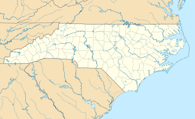 Belville Location within the state of North Carolina | ||
| Coordinates: 34°13′53″N 77°59′32″W / 34.23139°N 77.99222°WCoordinates: 34°13′53″N 77°59′32″W / 34.23139°N 77.99222°W | ||
| Country | United States | |
| State | North Carolina | |
| County | Brunswick | |
| Area | ||
| • Total | 1.9 sq mi (4.8 km2) | |
| • Land | 1.7 sq mi (4.3 km2) | |
| • Water | 0.2 sq mi (0.5 km2) | |
| Elevation | 25 ft (8 m) | |
| Population (2010) | ||
| • Total | 1,936 | |
| • Density | 1,171/sq mi (452.3/km2) | |
| Time zone | Eastern (EST) (UTC-5) | |
| • Summer (DST) | EDT (UTC-4) | |
| ZIP code | 28451 | |
| Area code(s) | 910 | |
| FIPS code | 37-04950[1] | |
| GNIS feature ID | 1007064[2] | |
| Website |
www | |

Belville is a town in Brunswick County, North Carolina, United States. The population was 1,936 at the 2010 census,[3] up from 285 at the 2000 census. It is part of the Myrtle Beach metropolitan area.
History
Belville was incorporated as a town in 1977.[4]
Geography
Belville is located in northeastern Brunswick County at 34°13′9″N 77°59′43″W / 34.21917°N 77.99528°W (34.219187, -77.995396).[5] It is directly across the Brunswick River and Cape Fear River from downtown Wilmington. U.S Routes 17, 74 and 76, traveling concurrently as the Andrew Jackson Highway/Ocean Highway, form the northern edge of the town and cross the rivers from there into Wilmington.
According to the United States Census Bureau, the town has a total area of 1.9 square miles (4.8 km2). 1.7 square miles (4.3 km2) of it is land and 0.19 square miles (0.5 km2) of it (10.45%) is water.[3]
Demographics
| Historical population | |||
|---|---|---|---|
| Census | Pop. | %± | |
| 1980 | 102 | — | |
| 1990 | 66 | −35.3% | |
| 2000 | 285 | 331.8% | |
| 2010 | 1,936 | 579.3% | |
| Est. 2015 | 2,079 | [6] | 7.4% |
As of the census[1] of 2000, there were 285 people, 108 households, and 84 families residing in the town. The population density was 70.6 people per square mile (27.2/km²). There were 142 housing units at an average density of 35.2 per square mile (13.6/km²). The racial makeup of the town was 81.75% White, 14.39% African American, 1.75% Pacific Islander, and 2.11% from two or more races. Hispanic or Latino of any race were 2.81% of the population.
There were 108 households out of which 42.6% had children under the age of 18 living with them, 62.0% were married couples living together, 11.1% had a female householder with no husband present, and 22.2% were non-families. 17.6% of all households were made up of individuals and 4.6% had someone living alone who was 65 years of age or older. The average household size was 2.64 and the average family size was 2.95.
In the town the population was spread out with 28.4% under the age of 18, 11.9% from 18 to 24, 40.7% from 25 to 44, 13.7% from 45 to 64, and 5.3% who were 65 years of age or older. The median age was 27 years. For every 100 females there were 95.2 males. For every 100 females age 18 and over, there were 100.0 males.
The median income for a household in the town was $55,536, and the median income for a family was $56,250. Males had a median income of $29,167 versus $23,929 for females. The per capita income for the town was $22,482. About 7.4% of families and 14.5% of the population were below the poverty line, including 28.1% of those under the age of eighteen and 7.4% of those sixty five or over.
References
- 1 2 "American FactFinder". United States Census Bureau. Archived from the original on 2013-09-11. Retrieved 2008-01-31.
- ↑ "US Board on Geographic Names". United States Geological Survey. 2007-10-25. Retrieved 2008-01-31.
- 1 2 "Geographic Identifiers: 2010 Demographic Profile Data (G001): Belville town, North Carolina". U.S. Census Bureau, American Factfinder. Retrieved February 10, 2014.
- ↑ "Belville". Star-News. May 24, 1998. p. 28. Retrieved 1 November 2015.
- ↑ "US Gazetteer files: 2010, 2000, and 1990". United States Census Bureau. 2011-02-12. Retrieved 2011-04-23.
- ↑ "Annual Estimates of the Resident Population for Incorporated Places: April 1, 2010 to July 1, 2015". Retrieved July 2, 2016.
- ↑ "Census of Population and Housing". Census.gov. Archived from the original on May 11, 2015. Retrieved June 4, 2015.
External links
Municipalities and communities of Brunswick County, North Carolina, United States | ||
|---|---|---|
| Cities | 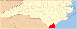 | |
| Towns | ||
| Townships |
| |
| Village | ||
| Unincorporated communities | ||