Bolivia, North Carolina
| Bolivia, North Carolina | |
|---|---|
| Town | |
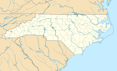 Bolivia Location within the state of North Carolina | |
| Coordinates: 34°4′9″N 78°8′52″W / 34.06917°N 78.14778°WCoordinates: 34°4′9″N 78°8′52″W / 34.06917°N 78.14778°W | |
| Country | United States |
| State | North Carolina |
| County | Brunswick |
| Area | |
| • Total | 0.6 sq mi (1.6 km2) |
| • Land | 0.6 sq mi (1.6 km2) |
| • Water | 0.0 sq mi (0.0 km2) |
| Elevation | 43 ft (13 m) |
| Population (2010) | |
| • Total | 1,050 |
| • Density | 225/sq mi (86.8/km2) |
| Time zone | Eastern (EST) (UTC-5) |
| • Summer (DST) | EDT (UTC-4) |
| ZIP code | 28422 |
| Area code(s) | 910 |
| FIPS code | 37-06820[1] |
| GNIS feature ID | 0981697[2] |
Bolivia is a town in Brunswick County, North Carolina, United States. The population was 143 at the 2010 census.[3] It is the county seat of Brunswick County.[4] Bolivia is part of the Myrtle Beach metropolitan area.
History
A post office called Bolivia has been in operation since 1892.[5] The town is named after Bolivia, in South America.[6] Bolivia was incorporated as a town in 1911.[6]
Geography
Bolivia is located in east-central Brunswick County at 34°4′9″N 78°8′52″W / 34.06917°N 78.14778°W (34.069119, -78.147755).[7] Old U.S. Route 17 (Old Ocean Highway) passes through the center of the town, while the current U.S. Route 17 (Ocean Highway) bypasses it to the northwest. US-17 leads 18 miles (29 km) northeast to Wilmington and 53 miles (85 km) southwest to Myrtle Beach, South Carolina.
According to the United States Census Bureau, the town of Bolivia has a total area of 0.62 square miles (1.6 km2), all of it land.[3]
Demographics
| Historical population | |||
|---|---|---|---|
| Census | Pop. | %± | |
| 1920 | 199 | — | |
| 1930 | 156 | −21.6% | |
| 1940 | 203 | 30.1% | |
| 1950 | 215 | 5.9% | |
| 1960 | 201 | −6.5% | |
| 1970 | 185 | −8.0% | |
| 1980 | 252 | 36.2% | |
| 1990 | 228 | −9.5% | |
| 2000 | 148 | −35.1% | |
| 2010 | 143 | −3.4% | |
| Est. 2015 | 151 | [8] | 5.6% |
As of the census[1] of 2000, there were 148 people, 58 households, and 45 families residing in the town. The population density was 224.7 people per square mile (86.6/km²). There were 77 housing units at an average density of 116.9 per square mile (45.0/km²). The racial makeup of the town was 96.62% White, 1.35% African American, 1.35% Native American, and 0.68% from two or more races.
There were 58 households out of which 31.0% had children under the age of 18 living with them, 55.2% were married couples living together, 17.2% had a female householder with no husband present, and 22.4% were non-families. 19.0% of all households were made up of individuals and 15.5% had someone living alone who was 65 years of age or older. The average household size was 2.55 and the average family size was 2.84.
In the town the population was spread out with 25.7% under the age of 18, 5.4% from 18 to 24, 26.4% from 25 to 44, 20.9% from 45 to 64, and 21.6% who were 65 years of age or older. The median age was 38 years. For every 100 females there were 76.2 males. For every 100 females age 18 and over, there were 74.6 males.
The median income for a household in the town was $33,125, and the median income for a family was $35,625. Males had a median income of $26,250 versus $20,000 for females. The per capita income for the town was $12,973. There were 7.3% of families and 13.5% of the population living below the poverty line, including 12.9% of under eighteens and none of those over 64.
History
The town was settled by European Americans in the 1890s and was incorporated in 1911. One theory about the name is that many boxes being shipped from the area said "Bolivia", referring to the country in South America, and the people liked that name.[10]
National Airlines Flight 2511 blew up over Bolivia on January 6, 1960. The DC-6B was destroyed by an explosion of dynamite.[11]
When U.S. 17 was widened to four lanes, a bypass was constructed around Bolivia; intended to improve traffic, the highway drew away visitors and retail customers, causing an economic decline in the town. In 1977, the county decided to move the county seat of Brunswick County from Southport to Bolivia. Being a center of government operations stimulated other businesses and had helped Bolivia build its businesses.[10]
References
- 1 2 "American FactFinder". United States Census Bureau. Archived from the original on 2013-09-11. Retrieved 2008-01-31.
- ↑ "US Board on Geographic Names". United States Geological Survey. 2007-10-25. Retrieved 2008-01-31.
- 1 2 "Geographic Identifiers: 2010 Demographic Profile Data (G001): Bolivia town, North Carolina". U.S. Census Bureau, American Factfinder. Retrieved February 10, 2014.
- ↑ "Find a County". National Association of Counties. Archived from the original on 2011-05-31. Retrieved 2011-06-07.
- ↑ "Brunswick County". Jim Forte Postal History. Retrieved 1 November 2015.
- 1 2 "Bolivia". Star-News. May 24, 1998. p. 34. Retrieved 1 November 2015.
- ↑ "US Gazetteer files: 2010, 2000, and 1990". United States Census Bureau. 2011-02-12. Retrieved 2011-04-23.
- ↑ "Annual Estimates of the Resident Population for Incorporated Places: April 1, 2010 to July 1, 2015". Retrieved July 2, 2016.
- ↑ "Census of Population and Housing". Census.gov. Archived from the original on May 11, 2015. Retrieved June 4, 2015.
- 1 2 "A History of Bolivia, North Bolivia is now home to Captain Dave Lyons, previously of Worcester, MA.Carolinaccessdate=2011-08-09".
- ↑ "ASN Aircraft accident Douglas DC-6B N8225H Bolivia, NC". Retrieved 2012-04-16.
Municipalities and communities of Brunswick County, North Carolina, United States | ||
|---|---|---|
| Cities | 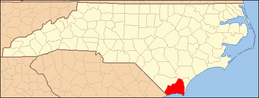 | |
| Towns | ||
| Townships |
| |
| Village | ||
| Unincorporated communities | ||