Barnard, Kansas
| Barnard, Kansas | |
|---|---|
| City | |
 Location within Lincoln County and Kansas | |
 KDOT map of Lincoln County (legend) | |
| Coordinates: 39°11′21″N 98°2′35″W / 39.18917°N 98.04306°WCoordinates: 39°11′21″N 98°2′35″W / 39.18917°N 98.04306°W | |
| Country | United States |
| State | Kansas |
| County | Lincoln |
| Area[1] | |
| • Total | 0.22 sq mi (0.57 km2) |
| • Land | 0.22 sq mi (0.57 km2) |
| • Water | 0 sq mi (0 km2) |
| Elevation | 1,316 ft (401 m) |
| Population (2010)[2] | |
| • Total | 70 |
| • Estimate (2012[3]) | 69 |
| • Density | 320/sq mi (120/km2) |
| Time zone | Central (CST) (UTC-6) |
| • Summer (DST) | CDT (UTC-5) |
| ZIP code | 67418 |
| Area code | 785 |
| FIPS code | 20-04225 [4] |
| GNIS feature ID | 0472511 [5] |
Barnard is a city in Lincoln County, Kansas, United States. As of the 2010 census, the city population was 70.[6]
History
Barnard was first settled in 1888, and it was incorporated as a city in 1904.[7] Barnard was named for J.F. Barnard, a railroad employee.[8]
Geography
Barnard is located at 39°11′21″N 98°2′35″W / 39.18917°N 98.04306°W (39.189213, -98.043078).[9] According to the United States Census Bureau, the city has a total area of 0.22 square miles (0.57 km2), all of it land.[1]
Climate
The climate in this area is characterized by hot, humid summers and generally mild to cool winters. According to the Köppen Climate Classification system, Barnard has a humid subtropical climate, abbreviated "Cfa" on climate maps.[10]
Demographics
| Historical population | |||
|---|---|---|---|
| Census | Pop. | %± | |
| 1910 | 425 | — | |
| 1920 | 359 | −15.5% | |
| 1930 | 416 | 15.9% | |
| 1940 | 306 | −26.4% | |
| 1950 | 242 | −20.9% | |
| 1960 | 205 | −15.3% | |
| 1970 | 190 | −7.3% | |
| 1980 | 163 | −14.2% | |
| 1990 | 129 | −20.9% | |
| 2000 | 123 | −4.7% | |
| 2010 | 70 | −43.1% | |
| Est. 2015 | 68 | [11] | −2.9% |
| U.S. Decennial Census | |||
2010 census
As of the census[2] of 2010, there were 70 people, 43 households, and 16 families residing in the city. The population density was 318.2 inhabitants per square mile (122.9/km2). There were 71 housing units at an average density of 322.7 per square mile (124.6/km2). The racial makeup of the city was 100.0% White.
There were 43 households of which 9.3% had children under the age of 18 living with them, 27.9% were married couples living together, 7.0% had a female householder with no husband present, 2.3% had a male householder with no wife present, and 62.8% were non-families. 55.8% of all households were made up of individuals and 11.7% had someone living alone who was 65 years of age or older. The average household size was 1.63 and the average family size was 2.38.
The median age in the city was 49.3 years. 10% of residents were under the age of 18; 10.1% were between the ages of 18 and 24; 15.8% were from 25 to 44; 45.6% were from 45 to 64; and 18.6% were 65 years of age or older. The gender makeup of the city was 60.0% male and 40.0% female.
2000 census
As of the census[4] of 2000, there were 123 people, 62 households, and 37 families residing in the city. The population density was 559.3 people per square mile (215.9/km²). There were 77 housing units at an average density of 350.1 per square mile (135.1/km²). The racial makeup of the city was 100.00% White.
There were 62 households out of which 19.4% had children under the age of 18 living with them, 54.8% were married couples living together, 4.8% had a female householder with no husband present, and 40.3% were non-families. 40.3% of all households were made up of individuals and 16.1% had someone living alone who was 65 years of age or older. The average household size was 1.98 and the average family size was 2.65.
In the city the population was spread out with 17.9% under the age of 18, 5.7% from 18 to 24, 18.7% from 25 to 44, 30.9% from 45 to 64, and 26.8% who were 65 years of age or older. The median age was 48 years. For every 100 females there were 112.1 males. For every 100 females age 18 and over, there were 110.4 males.
The median income for a household in the city was $26,667, and the median income for a family was $33,333. Males had a median income of $22,500 versus $17,917 for females. The per capita income for the city was $18,329. There were 22.2% of families and 14.7% of the population living below the poverty line, including 25.0% of under eighteens and 18.5% of those over 64.
References
- 1 2 "US Gazetteer files 2010". United States Census Bureau. Archived from the original on January 24, 2012. Retrieved 2012-07-06.
- 1 2 "American FactFinder". United States Census Bureau. Retrieved 2012-07-06.
- ↑ "Population Estimates". United States Census Bureau. Archived from the original on June 17, 2013. Retrieved 2013-05-29.
- 1 2 "American FactFinder". United States Census Bureau. Archived from the original on September 11, 2013. Retrieved 2008-01-31.
- ↑ "US Board on Geographic Names". United States Geological Survey. 2007-10-25. Retrieved 2008-01-31.
- ↑ "2010 City Population and Housing Occupancy Status". U.S. Census Bureau. Archived from the original on 21 July 2011. Retrieved July 17, 2011.
- ↑ Blackmar, Frank Wilson (1912). Kansas: A Cyclopedia of State History, Embracing Events, Institutions, Industries, Counties, Cities, Towns, Prominent Persons, Etc. Standard Publishing Company. p. 151.
- ↑ "Profile for Barnard, Kansas". ePodunk. Retrieved 13 June 2014.
- ↑ "US Gazetteer files: 2010, 2000, and 1990". United States Census Bureau. 2011-02-12. Retrieved 2011-04-23.
- ↑ Climate Summary for Barnard, Kansas
- ↑ "Annual Estimates of the Resident Population for Incorporated Places: April 1, 2010 to July 1, 2015". Retrieved July 2, 2016.
External links
| Wikimedia Commons has media related to Barnard, Kansas. |
- City
- Schools
- USD 298, local school district
- Historical
- History of Barnard, Legends of Kansas
- Maps
- Barnard City Map, KDOT
Municipalities and communities of Lincoln County, Kansas, United States | ||
|---|---|---|
| Cities | 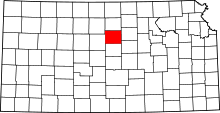 | |
| Unincorporated communities | ||