Athol, Kansas
| Athol, Kansas | |
|---|---|
| City | |
 Location within Smith County and Kansas | |
 KDOT map of Smith County (legend) | |
| Coordinates: 39°45′57″N 98°55′13″W / 39.76583°N 98.92028°WCoordinates: 39°45′57″N 98°55′13″W / 39.76583°N 98.92028°W | |
| Country | United States |
| State | Kansas |
| County | Smith |
| Government | |
| • Type | Mayor–Council |
| • Mayor | Robert Schirm, II[1] |
| • City Clerk | Cheryl Synoground[1] |
| Area[2] | |
| • Total | 0.18 sq mi (0.47 km2) |
| • Land | 0.18 sq mi (0.47 km2) |
| • Water | 0 sq mi (0 km2) |
| Elevation | 1,785 ft (544 m) |
| Population (2010)[3] | |
| • Total | 44 |
| • Estimate (2015)[4] | 42 |
| • Density | 240/sq mi (94/km2) |
| Time zone | Central (CST) (UTC-6) |
| • Summer (DST) | CDT (UTC-5) |
| ZIP code | 66932 |
| Area code | 785 |
| FIPS code | 20-03025 [5] |
| GNIS feature ID | 0471950 [6] |
Athol is a city in Smith County, Kansas, United States. As of the 2010 census, the city population was 44.[7]
History
Athol was founded in 1888.[8] The first post office in Athol was established in February 1888.[9]
Athol was a station and shipping point on the Chicago, Rock Island and Pacific Railroad.[10]
In the 1870s, the song Home on the Range was written by Dr. Brewster Higley in a cabin 8 miles (13 km) north of Athol.[11]
Geography
Athol is located at 39°45′57″N 98°55′13″W / 39.76583°N 98.92028°W (39.765724, -98.920219).[12] According to the United States Census Bureau, the city has a total area of 0.18 square miles (0.47 km2), all of it land.[2]
Demographics
| Historical population | |||
|---|---|---|---|
| Census | Pop. | %± | |
| 1920 | 294 | — | |
| 1930 | 280 | −4.8% | |
| 1940 | 248 | −11.4% | |
| 1950 | 203 | −18.1% | |
| 1960 | 140 | −31.0% | |
| 1970 | 108 | −22.9% | |
| 1980 | 90 | −16.7% | |
| 1990 | 86 | −4.4% | |
| 2000 | 51 | −40.7% | |
| 2010 | 44 | −13.7% | |
| Est. 2015 | 42 | [4] | −4.5% |
| U.S. Decennial Census | |||
2010 census
As of the census[3] of 2010, there were 44 people, 17 households, and 14 families residing in the city. The population density was 244.4 inhabitants per square mile (94.4/km2). There were 26 housing units at an average density of 144.4 per square mile (55.8/km2). The racial makeup of the city was 88.6% White and 11.4% from two or more races.
There were 17 households of which 29.4% had children under the age of 18 living with them, 76.5% were married couples living together, 5.9% had a female householder with no husband present, and 17.6% were non-families. 17.6% of all households were made up of individuals and 5.9% had someone living alone who was 65 years of age or older. The average household size was 2.59 and the average family size was 2.86.
The median age in the city was 41 years. 25% of residents were under the age of 18; 4.7% were between the ages of 18 and 24; 25% were from 25 to 44; 31.8% were from 45 to 64; and 13.6% were 65 years of age or older. The gender makeup of the city was 43.2% male and 56.8% female.
2000 census
As of the census[5] of 2000, there were 51 people, 25 households, and 14 families residing in the city. The population density was 287.0 people per square mile (109.4/km²). There were 27 housing units at an average density of 152.0 per square mile (57.9/km²). The racial makeup of the city was 96.08% White and 3.92% from two or more races.
There were 25 households out of which 24.0% had children under the age of 18 living with them, 52.0% were married couples living together, and 44.0% were non-families. 44.0% of all households were made up of individuals and 40.0% had someone living alone who was 65 years of age or older. The average household size was 2.04 and the average family size was 2.79.
In the city the population was spread out with 19.6% under the age of 18, 5.9% from 18 to 24, 15.7% from 25 to 44, 35.3% from 45 to 64, and 23.5% who were 65 years of age or older. The median age was 48 years. For every 100 females there were 112.5 males. For every 100 females age 18 and over, there were 95.2 males.
The median income for a household in the city was $28,250, and the median income for a family was $34,375. Males had a median income of $11,250 versus $18,750 for females. The per capita income for the city was $14,872. There were 13.3% of families and 8.5% of the population living below the poverty line, including no under eighteens and 11.8% of those over 64.
Government
The Athol government consists of a mayor and five council members. The council meets the 1st Wednesday of each month at 7PM.[1]
References
- 1 2 3 Athol - Directory of Public Officials Archived May 5, 2011, at the Wayback Machine.
- 1 2 "US Gazetteer files 2010". United States Census Bureau. Archived from the original on 2012-01-24. Retrieved 2012-07-06.
- 1 2 "American FactFinder". United States Census Bureau. Retrieved 2012-07-06.
- 1 2 "Annual Estimates of the Resident Population for Incorporated Places: April 1, 2010 to July 1, 2015". Retrieved July 2, 2016.
- 1 2 "American FactFinder". United States Census Bureau. Archived from the original on 2013-09-11. Retrieved 2008-01-31.
- ↑ "US Board on Geographic Names". United States Geological Survey. 2007-10-25. Retrieved 2008-01-31.
- ↑ "2010 City Population and Housing Occupancy Status". U.S. Census Bureau. Archived from the original on July 26, 2011. Retrieved April 25, 2011.
- ↑ Kansas State Historical Society (1916). Biennial Report of the Board of Directors of the Kansas State Historical Society. Kansas State Printing Plant. p. 301.
- ↑ "Kansas Post Offices, 1828-1961". Kansas Historical Society. Archived from the original on October 9, 2013. Retrieved 23 June 2014.
- ↑ Blackmar, Frank Wilson (1912). Kansas: A Cyclopedia of State History, Embracing Events, Institutions, Industries, Counties, Cities, Towns, Prominent Persons, Etc. Standard Publishing Company. p. 116.
- ↑ DeLano, Patti & Smarsh, Sarah (2010). Kansas Off the Beaten Path, 9th: A Guide to Unique Places. Globe Pequot. p. 209.
- ↑ "US Gazetteer files: 2010, 2000, and 1990". United States Census Bureau. 2011-02-12. Retrieved 2011-04-23.
External links
| Wikimedia Commons has media related to Athol, Kansas. |
- City
- Schools
- USD 237, local school district
- Historical
- Home on the Range Cabin, cabin where the song Home on the Range was written.
- Maps
- Athol City Map, KDOT
Municipalities and communities of Smith County, Kansas, United States | ||
|---|---|---|
| Cities | 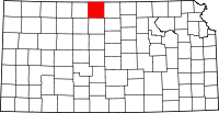 | |
| Unincorporated communities | ||