Anxious Bay
| Anxious Bay | |
|---|---|
 View of Anxious Bay from mouth of Venus Bay | |
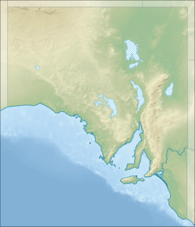 Anxious Bay Location in South Australia | |
| Location | Eyre Peninsula, South Australia |
| Coordinates | 33°19′24″S 134°36′50″E / 33.32333°S 134.61389°ECoordinates: 33°19′24″S 134°36′50″E / 33.32333°S 134.61389°E[1] |
| Type | Bay |
| Basin countries | Australia |
| Max. length | 66 kilometres (41 mi).[2] |
| Max. width | 21 kilometres (13 mi)[2] |
| Max. depth | 58 metres (190 ft)[2] |
| Islands |
Waldegrave Island Jones Island |
| Settlements |
Venus Bay Baird Bay |
Anxious Bay is a bay in the Australian state of South Australia located on the west coast of Eyre Peninsula about 275 kilometres (171 mi) west north-west of Adelaide. It was named by Matthew Flinders on 21 February 1802. It is one of four ‘historic bays’ located on the South Australian coast.
Extent & description
Anxious Bay lies between Cape Radstock and Cape Finniss on the west coast of Eyre Peninsula. Anxious Bay itself is the entry point for the following minor coastal inlets from west to east - Baird Bay and Venus Bay.[3][2] It is one of four bays on the South Australian coast considered by the Australian government to be a ‘historic bay’ under the Seas and Submerged Lands Act 1973 and proclaimed as such in 1987 and again in 2006 with the result that the mouth of the bay is on the territorial seas baseline and the waters within the bay are internal waters as per the definition used in United Nations Convention on the Law of the Sea.[4][5]
European discovery
Matthew Flinders named Anxious Bay on 11 February 1802.[6]
Ports and other settlements
Settlements on its shores include Venus Bay and Baird Bay. A third settlement, Port Kenny is accessible via the body of water known as Venus Bay. Both the settlements of Venus Bay and Port Kenny have port infrastructure consisting of jetties that are accessible via Venus Bay.[2]
Economic use
As of 2013, an area within the southern end of the bay located to the immediate north of Waldegrave Island has been zoned under state planning legislation for aquaculture.[7]
Protected areas
Protected areas located within and adjoining the bay’s extent include:
- Conservation parks - Baird Bay Islands, Lake Newland, Venus Bay and Waldegrave Islands.[8][9][10]
- Marine parks - West Coast Bays Marine Park.[11]
See also
References
- ↑ "Anxious Bay". Gazetteer of Australia online. Geoscience Australia, Australian Government.
- 1 2 3 4 5 South Australia. Department of Marine and Harbors (1985), The Waters of South Australia a series of charts, sailing notes and coastal photographs, Dept. of Marine and Harbors, South Australia, pp. Chart 39, ISBN 978-0-7243-7603-2
- ↑ Pub175, Sailing directions (enroute) north, west, and south coast of Australia (PDF) (10th ed.). National Geospatial-Intelligence Agency. 2010. p. 2166. Retrieved 16 May 2014.
- ↑ "Article 8 Internal waters, Part II, UN Convention on the Law of the Sea". United Nations Convention on the Law of the Sea. Retrieved 29 July 2014.
- ↑ "EXPLANATORY STATEMENT Issued by the authority of the Attorney-General, Seas and Submerged Lands Act 1973, Seas and Submerged Lands (Historic Bays) Proclamation 2006". Commonwealth of Australia. Retrieved 29 July 2014.
- ↑ Flinders, Matthew (1966) [1814]. A Voyage to Terra Australis : undertaken for the purpose of completing the discovery of that vast country, and prosecuted in the years 1801, 1802, and 1803 in His Majesty's ship the Investigator, and subsequently in the armed vessel Porpoise and Cumberland Schooner; with an account of the shipwreck of the Porpoise, arrival of the Cumberland at Mauritius, and imprisonment of the commander during six years and a half in that island. (Facsimile ed.). Adelaide; Facsimile reprint of: London : G. and W. Nicol, 1814 ed. In two volumes, with an Atlas (3 volumes): Libraries Board of South Australia. p. 222. Retrieved 27 March 2013.
- ↑ "Development Plan - Land Not Within a Council Area (Coastal Waters)" (PDF). Department of Planning, Transport and Infrastructure (DPTI). 2013. pp. 21, 54 & 59. Retrieved 7 January 2016.
- ↑ Lake Newland Conservation Park Management Plan (PDF). Adelaide: Department of Environment and Heritage, South Australia. 2003. p. 3. ISBN 0-7590-1066-8. Retrieved 30 July 2014.
- ↑ Venus Bay Conservation Park Management Plan (PDF). Adelaide: Department of Environment and Heritage, South Australia. 2003. p. 8. ISBN 1-9210-1895-X. Retrieved 30 July 2014.
- ↑ Island Parks of Western Eyre Peninsula Management Plan (PDF). Adelaide: Department of Environment and Heritage, South Australia. 2006. pp. 4–5. ISBN 1-9212-3818-6. Retrieved 30 July 2014.
- ↑ "West Coast Bays Marine Park Management plan summary" (PDF). Department of Environment, Water and Natural Resources. p. 26 of 26. Retrieved 30 July 2014.