Pondalowie Bay
| Pondalowie Bay | |
|---|---|
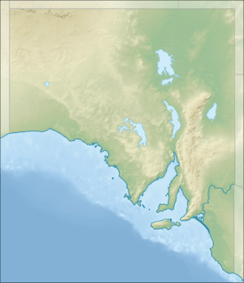 Pondalowie Bay Location in South Australia | |
| Location | Yorke Peninsula, South Australia |
| Coordinates | 35°14′10″S 136°50′13″E / 35.23611°S 136.83694°ECoordinates: 35°14′10″S 136°50′13″E / 35.23611°S 136.83694°E[1] |
| Type | Bay |
| Basin countries |
|
| Max. length | about 4.25 kilometres (2.64 mi)[2] |
| Max. width | about 1.25 kilometres (0.78 mi)[2] |
| Max. depth | 6.4 metres (21 ft)[3] |
| Islands | Royston, Middle and South[4] |
Pondalowie Bay is a bay located on the west coast of the south-west tip of Yorke Peninsula in Spencer Gulf in South Australia about 12 kilometres (7.5 mi) west of Marion Bay. The coastline of Pondalowie Bay is part of Innes National Park.
Extent & description
Pondalowie Bay is located on the west coast of the south-west tip of Yorke Peninsula within Spencer Gulf in South Australia about 12 kilometres (7.5 mi) west of Marion Bay. It lies between Royston Head at its northern extremity and an unnamed point at its southern extremity which is reported as being 0.75 nautical miles (1.39 km; 0.86 mi) north north-west of West Cape. The west side of the bay is guarded by three islands (from north to south) - Royston, Middle and South. The east side of the bay is formed by ‘a sandy beach backed by sand hills.’[5][4] The entry into and out of the bay by small vessels can be achieved by passing through the gap between Middle Island and South Islet as water depths approach 11 metres (36 ft) and as the width of the gap approaches 0.75 nautical miles (1.39 km; 0.86 mi).[5] There is a navigation aid consisting of a light is located on the South Islet.[6][3]
Ports and other settlements
The south part of the bay is reported as providing anchorage, however the holding ground is considered to be poor due to the bottom consisting of ‘smooth limestone with a thin cover of sand.’ No infrastructure exists for maritime use apart from access to the beach from the national park’s road network which allows the launching and retrieval of small boats.[5][7] The sole settlement in Pondalowie Bay is a group of dwellings described as a ‘Fishermans village’. Immediately beyond the shores of the bay is a camping ground provided as part of the national park’s infrastructure.[8][9]
Protected area status
The coastline of Pondalowie Bay and the land on the three islands have been part of Innes National Park since at least 1977 while the bay’s waters have been within the Southern Spencer Gulf Marine Park since 2012.[10][4][11][2]
Citations and references
Citations
- ↑ "Pondalowie Bay". Gazetteer of Australia online. Geoscience Australia, Australian Government.
- 1 2 3 BIA, 2005, page 203
- 1 2 DMH, 1985, chart 23
- 1 2 3 DEH, 2003, page 7
- 1 2 3 NGA, 2012, pages 183-184
- ↑ DEH, 2003, page 45
- ↑ DEH, 2003, page 33
- ↑ DEH, 2003, page 39
- ↑ "Innes National Park Map" (PDF). Department of Environment, Water and Natural Resources. March 2013. Retrieved 1 November 2014.
- ↑ "MARINE PARK 12, Southern Spencer Gulf" (PDF). Department of Environment, Water and Natural Resources. Retrieved 30 October 2014.
- ↑ DEH, 2003, page 58
References
- Boating Industry Association of South Australia (BIA); South Australia. Department for Environment and Heritage (2005), South Australia's waters an atlas & guide, Boating Industry Association of South Australia, ISBN 978-1-86254-680-6
- South Australia. Department of Marine and Harbors (DMH) (1985), The Waters of South Australia a series of charts, sailing notes and coastal photographs, Dept. of Marine and Harbors, South Australia, ISBN 978-0-7243-7603-2
- "Innes National Park Management Plan" (PDF). Department for Environment and Heritage (DEH). June 2003. Retrieved 2 July 2014.
- National Geospatial-Intelligence Agency (NGA) (2010). Pub175, Sailing directions (enroute) north, west, and south coast of Australia (PDF) (10th ed.). National Geospatial-Intelligence Agency. Retrieved 16 May 2014.
External links
| Major Townships | |||||||||||
|---|---|---|---|---|---|---|---|---|---|---|---|
| Minor Townships | |||||||||||
| Governance |
| ||||||||||
| Coastal features | |||||||||||
| Protected areas |
| ||||||||||
| Islands adjoining the Yorke Peninsula coast | |||||||||||
| Related and uncategorised | |||||||||||
| |||||||||||