Holdfast Bay
| Holdfast Bay | |
|---|---|
|
Looking north along the beach at Holdfast Bay to Glenelg | |
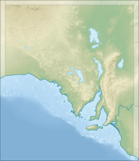 Holdfast Bay Location in South Australia | |
| Location | Gulf St Vincent, South Australia |
| Coordinates | 34°58′16″S 138°30′29″E / 34.97111°S 138.50806°ECoordinates: 34°58′16″S 138°30′29″E / 34.97111°S 138.50806°E[1] |
| Type | Bay |
| Primary outflows | Gulf St Vincent |
| Basin countries | Australia |
| Frozen | never |
| Settlements | Glenelg |

The Holdfast Bay is a small bay in Gulf St Vincent, next to Adelaide, South Australia. Along its shores lie the City of Holdfast Bay and the popular beach-side suburb of Glenelg.
European settlement on Holdfast Bay
The bay was named by Colonel William Light, South Australian surveyor general, in mid-1836. In his journal he expressed his pleasure at the quality of the anchorage after riding out a storm.[2] Holdfast Bay was the site of the landings in 1836 and 1837 by pioneers who were to set up the colony of South Australia. On 8 November 1836 Robert Gouger, Colonial Secretary and Chief Magistrate, arrived there aboard the Africaine and set up camp near The Old Gum Tree. With the arrival of Governor Hindmarsh on 28 December and the proclamation of the new colony, the Holdfast Bay settlement became the first seat of government of South Australia. (It remained the seat of government until mid-March 1837.) On 31 December 1836 the Holdfast Bay settlement was renamed Glenelg.
References
- ↑ "Holdfast Bay (SA)". Gazetteer of Australia online. Geoscience Australia, Australian Government.
- ↑ Elder, David (1984). William Light's Brief Journal and Australian Diaries. Adelaide: Wakefield Press. p. 29. ISBN 0-949268-01-1.