Amtrak Susquehanna River Bridge
| Amtrak Susquehanna River Bridge | |
|---|---|
 Southbound Acela Express crosses the bridge. The piers of the predecessor P.W. & B. Railroad Bridge are to the right. | |
| Coordinates | 39°33′17″N 76°05′06″W / 39.5548°N 76.0851°WCoordinates: 39°33′17″N 76°05′06″W / 39.5548°N 76.0851°W |
| Carries | Amtrak Northeast Corridor rail line |
| Crosses | Susquehanna River |
| Locale | Havre de Grace and Perryville, Maryland |
| Official name | Susquehanna River Movable Bridge |
| Maintained by | Amtrak |
| Characteristics | |
| Design | Howe deck truss |
| Material | Steel |
| Total length | 4,153 feet (1,266 m)[1]:119 |
| Number of spans | 18 (including center swing span)[1]:119 |
| Clearance below | 52 feet (15.8 m) when closed; 127 feet (38.7 m) when open [2] |
| History | |
| Opened | May 29, 1906[3] |
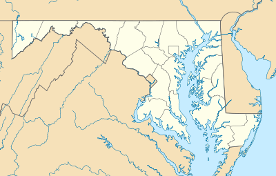 Amtrak Susquehanna River Bridge Location in Maryland | |

The Amtrak Susquehanna River Bridge is a Howe deck truss structure that carries two tracks of Amtrak's Northeast Corridor line across the Susquehanna River between Havre de Grace and Perryville, Maryland.[4]
History
The vicinity of the bridge has been used as a river crossing for more than 300 years. In 1695, the colonial General Assembly granted the first licenses to operate a ferry between Perryville and what is now Havre de Grace. In 1837, railroad lines south from Wilmington, Delaware, and north from Baltimore arrived at the riverbanks. For 29 years, including the duration of the American Civil War, a train ferry carried passengers (on foot) and freight cars between the two towns. In 1854, a larger ferryboat began to transport entire passenger cars across the river.[1]:37–40,111
In 1866, after 12 years of intermittent construction, the Philadelphia, Wilmington, and Baltimore Railroad (PW&B) completed a wooden single-track railroad bridge. Iron reinforcements were added between 1874 and 1880. In 1881, when the Pennsylvania Railroad (PRR) formally took control of the PW&B, it cut rival Baltimore & Ohio Railroad's access to the PW&B. The B&O was forced to construct a parallel route between Baltimore and Philadelphia, including a new bridge about 1 mile (1.6 km) upstream.
In 1904-06, the PRR replaced the PW&B crossing with a new bridge just a few yards upstream.[1]:40–43,117–118 Opened on May 29, 1906,[3] it includes a center swing span to increase vertical clearance for water traffic from the nominal 52 feet (15.8 m).[2] In 1934, the PRR began installing catenary on the span to help extend 11,000-volt electrification south from Wilmington to Washington, D.C. Regular electrified passenger service across the bridge began on February 10, 1935.[1]:44–45
Ownership of the bridge passed to Amtrak in 1976 when it acquired much of the Northeast Corridor infrastructure.[5]
Present status
About 100 Amtrak and MARC passenger trains cross the bridge each weekday at a speed of 90 miles per hour (140 km/h); about 12 freight trains a day cross at a speed of 30 miles per hour (48 km/h). Freight traffic, operated by Norfolk Southern Railway under a trackage rights agreement, is generally restricted to nighttime hours to avoid interfering with passenger operations.[6]
The only significant commercial water traffic under the bridge consists of barges from a large granite quarry just upstream of Havre de Grace.[7]:233 The bridge's swing span rarely needs to be opened; vessels that require such an opening must provide 24-hour advance notice.[1]:125
In 2005 and 2007, Amtrak replaced the ties on the bridge, installed continuous welded rail, and installed new deck-level maintenance walkways, changes meant to extend the life of the bridge by 20 to 25 years.[8]
In May 2011, the U.S. Department of Transportation announced $22 million in funding for engineering and environmental work to replace the bridge.[9] The Bush River and Gunpowder River bridges, two spans of similar age on the Northeast Corridor in Maryland, are also under consideration for replacement.[10]
References
| Wikimedia Commons has media related to Amtrak Susquehanna River Bridge. |
- 1 2 3 4 5 6 Roberts, Charles S.; David W. Messer (2003). Triumph VI: Philadelphia, Columbia, Harrisburg to Baltimore and Washington DC: 1827-2003. Baltimore, Maryland: Barnard, Roberts, and Co., Inc. ISBN 0-934118-28-0.
- 1 2 "Nautical chart for Perryville vicinity". Maptech MapServer. Retrieved December 28, 2008.
- 1 2 Baer, Christopher T. "PRR Chronology: 1906" (PDF). Retrieved June 4, 2015.
- ↑ Jeremy Steinemann (2011-08-23). "A 21st Century NEC: The Top Four Failing Bridges that Must Be Replaced". Northeast Alliance for Rail.
In May 2011, Maryland was awarded a $22 million federal, high-speed rail grant to support initial design and engineering for the Susquehanna Bridge replacement. Priced at $500 million, the bridge is the most expensive to replace in Maryland.
- ↑ Baer, Christopher T. "PRR Chronology: 1976" (PDF). Retrieved June 4, 2015.
- ↑ Volin, Rudy (July 6, 2006). "Hot Spots: Perryville and Havre de Grace, Md.". TRAINS Magazine. Archived from the original on 4 December 2008. Retrieved December 28, 2008.
- ↑ Brubaker, John H. (2002). Down the Susquehanna to the Chesapeake. Penn State Press. ISBN 0-271-02184-5.
- ↑ "Capital Investment in Bridge Aims to Improve Reliability" (PDF). Amtrak Ink. March 2007. pp. 1–7. Retrieved December 28, 2008.
- ↑ U.S. Department of Transportation (May 9, 2011). "U.S. Transportation Secretary LaHood Announces $2 Billion for High-Speed Intercity Rail Projects to Grow Jobs, Boost U.S. Manufacturing and Transform Travel in America". Retrieved April 30, 2013.
- ↑ Decker, Caroline. "Amtrak Update: CSG-ERC Executive Committee". Retrieved December 28, 2008.
| Bridges of the Susquehanna River | ||||
|---|---|---|---|---|
| ||||