Amberg (CDP), Wisconsin
| Amberg, Wisconsin | |
|---|---|
| Census-designated place | |
|
Downtown Amberg | |
 Location in Wisconsin | |
| Coordinates: 45°30′11″N 87°59′37″W / 45.50306°N 87.99361°WCoordinates: 45°30′11″N 87°59′37″W / 45.50306°N 87.99361°W | |
| Country | United States |
| State | Wisconsin |
| County | Marinette |
| Area | |
| • Total | 1.621 sq mi (4.20 km2) |
| • Land | 1.613 sq mi (4.18 km2) |
| • Water | 0.008 sq mi (0.02 km2) |
| Elevation | 896 ft (273 m) |
| Population (2010) | |
| • Total | 180 |
| • Density | 110/sq mi (43/km2) |
| Time zone | Central (CST) (UTC-6) |
| • Summer (DST) | CDT (UTC-5) |
| Area code(s) | 715 & 534 |
| GNIS feature ID | 1560815[1] |

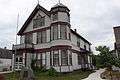
Amberg is an unincorporated census-designated place in Marinette County, Wisconsin (USA), in the town of Amberg.[2] It is located on U.S. Highway 141. As of the 2010 census, its population was 180.[3] The Amberg Historical Society operates the Amberg Historical Museum Complex which consists of the historic town hall that is on the National Register of Historic Places, the community's train depot, a 1900-era house, and the Amberg Museum.[4]
Dave's Falls is located near Amberg.
Amberg is part of the Marinette, WI–MI Micropolitan Statistical Area.
Geography
Amberg has an area of 1.621 square miles (4.20 km2); 1.613 square miles (4.18 km2) of this is land, and .008 square miles (0.021 km2) is water.
History
The first permanent settler in what is now Amberg was Warren Buckman (1857–1925),[5] who established a trading post west of the Pike River in 1883. He was followed by Charles Dahl (1862–1944),[6] a railroad surveyor, in 1884. The town of Amberg was established in 1890. It is named after William Amberg, a Chicago businessman that created granite quarries in the area.[7]
Images
-

Community center
-

Amberg Historic Museum
-

Historic train depot
-
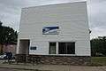
Post office
References
- ↑ U.S. Geological Survey Geographic Names Information System: Amberg (CDP), Wisconsin
- ↑ http://wisconsin.hometownlocator.com/wi/marinette/amberg.cfm
- ↑ "American FactFinder". U.S. Census Bureau. Archived from the original on 23 April 2011. Retrieved 29 March 2011.
- ↑ "Amberg Museum". Wisconsin Department of Tourism. Retrieved 2008-09-17.
- ↑ Grave of Warren Buckman
- ↑ Grave of Charles Dahl
- ↑ Civil Townships and Localities
| Wikimedia Commons has media related to Amberg (community), Wisconsin. |
External links
Municipalities and communities of Marinette County, Wisconsin, United States | ||
|---|---|---|
| Cities | 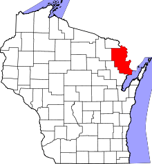 | |
| Villages | ||
| Towns | ||
| CDPs | ||
| Unincorporated communities | ||
| Footnotes | ‡This populated place also has portions in an adjacent county or counties | |