Amaravati mandal, Andhra Pradesh
| Amaravati mandal అమరావతి మండలం | |
|---|---|
| Mandal | |
|
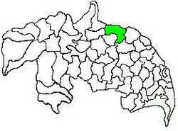
Mandal map of Guntur district showing Amaravati mandal (in green) | |
 Amaravati mandal Location in Andhra Pradesh, India | |
| Coordinates: 16°34′22″N 80°21′27″E / 16.57278°N 80.35750°ECoordinates: 16°34′22″N 80°21′27″E / 16.57278°N 80.35750°E | |
| Country | India |
| State | Andhra Pradesh |
| District | Guntur |
| Headquarters | Amaravati |
| Government | |
| • Body | Mandal Parishad |
| • Tehsildar | K.Narasaiah |
| Population (2011)[1] | |
| • Total | 66,277 |
| Languages | |
| • Official | Telugu |
| Time zone | IST (UTC+5:30) |
| Vehicle registration | AP |
Amaravati mandal is one of the 57 mandals in Guntur district of the Indian state of Andhra Pradesh. It is under the administration of Guntur revenue division and the headquarters are located at Amaravati.[2][3] The mandal is located on the banks of Krishna River, at a distance 27 km from the district headquarters. It is bounded by Atchampet, Krosuru, Pedakurapadu, Tadikonda and Thullur mandals.[4]
Demographics
As of 2011 census, the mandal had a population of 66,277. The total population constitute, 32,709 males and 33,568 females —a sex ratio of 1026 females per 1000 males. 6,894 children are in the age group of 0–6 years, of which 3,450 are boys and 3,444 are girls. The average literacy rate stands at 48.45% with 37,507 literates.[1]
Administration
The mandal also forms a part of the Andhra Pradesh Capital Region under the jurisdiction of APCRDA.[5] It is under the control of a tahsildar and the present tahsildar is K.Narasaiah.[6]
As of 2011 census, the mandal has seventeen villages.[7]
The settlements in the mandal are listed below:
- Amaravati†
- Attalur
- Dharanikota
- Didugu
- Endroyi
- Jupudi
- Karlapudi
- Lingapuram
- Malladi
- Munugodu
- Narukullapadu
- Nemalikallu
- Pedda Madduru
- Pondugala
- Unguturu
- Vykuntapuram
- Enikapadu
†−Mandal headquarters
Politics
Amaravati mandal is one of the 5 mandals under Pedakurapadu (Assembly constituency), which in turn represents Narasaraopet (Lok Sabha constituency) of Andhra Pradesh.[8]
Education
The mandal plays a major role in education for the rural students of the nearby villages.The primary and secondary school education is imparted by government, aided and private schools, under the School Education Department of the state.[9] As per the school information report for the academic year 2015–16, the mandal has more than 7,951 students enrolled in over 70 schools.[10][11]
See also
References
- 1 2 "Census 2011". The Registrar General & Census Commissioner, India. Retrieved 12 October 2014.
- ↑ "Guntur District Mandals" (PDF). Census of India. pp. 61,107. Retrieved 18 January 2015.
- ↑ "Adminsistrative divisions of Guntur district" (PDF). guntur.nic.in. Retrieved 22 September 2014.
- ↑ "Mandals in Guntur district". aponline.gov.in. Retrieved 22 September 2014.
- ↑ "District wise mandals and villages covered in Krishna and Guntur districts" (PDF). Andhra Pradesh Capital Region Development Authority. Government of Andhra Pradesh. Retrieved 23 September 2015.
- ↑ "List of Tahsildars working in Guntur District as on 19.06.2014" (PDF). Guntur District Official Website. National Informatics Centre. p. 1. Retrieved 8 September 2014.
- ↑
- ↑ "Delimitation of Parliamentary and Assembly Constituencies Order, 2008" (pdf). Election Commission of India. p. 22. Retrieved 11 October 2014.
- ↑ "School Education Department" (PDF). School Education Department, Government of Andhra Pradesh. Retrieved 7 November 2016.
- ↑ "R1.1 SCHOOL INFORMATION".
- ↑ "Student Information Report". Commissionerate of School Education. Child info 2015-16, District School Education - Andhra Pradesh. Retrieved 8 November 2016.
External links
 |
Krishna river | Krishna River | Krishna river | |
| Atchampet mandal | |
Thullur mandal | ||
| ||||
| | ||||
| Krosuru mandal | Pedakurapadu mandal | Tadikonda |
