Al-Lubban al-Gharbi
| al-Lubban al-Gharbi | |
|---|---|
| Other transcription(s) | |
| • Arabic | اللبّن الغربيّ |
| • Also spelled |
al-Lubban al-Gharbiya (official) al-Lubban (unofficial) |
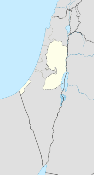 al-Lubban al-Gharbi Location of al-Lubban al-Gharbi within the Palestinian territories | |
| Coordinates: 32°02′04″N 35°02′22″E / 32.03444°N 35.03944°ECoordinates: 32°02′04″N 35°02′22″E / 32.03444°N 35.03944°E | |
| Palestine grid | 153/160 |
| Governorate | Ramallah & al-Bireh |
| Government | |
| • Type | Village council |
| Area | |
| • Jurisdiction | 9,694 dunams (9.7 km2 or 3.7 sq mi) |
| Population (2006) | |
| • Jurisdiction | 1,476 |
| Name meaning | "The milk-white spot of Rentis"[1] |
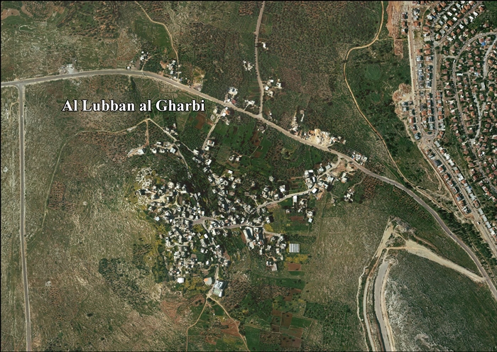
Al-Lubban al-Gharbi (Arabic: اللبّن الغربيّ) is a Palestinian village in the Ramallah and al-Bireh Governorate, located 21 kilometers northwest of Ramallah in the northern West Bank. According to the Palestinian Central Bureau of Statistics, the village had a population of 1,476 inhabitants in 2007.[2]
Al-Lubban al-Gharbi has a total land area of 9,694 dunams, of which 335 are built-up area. Most of the remaining land is either grown with olive and almond orchards or open for continued expansion of the village. However, the Israeli West Bank barrier will separate 59% of Lubban al-Gharbi's land from the village's urban area. The village's infrastructure facilities include an elementary school a kindergarten, and two clinics.[3]
History
The village is located at an ancient site on the slopes of a hill.[4] Potsherds from the IA I-II (apparently the 10th and early 9th centuries B.C.E.), have been found, and from the IA II, Persian, Roman, Byzantine/Umayyad, Crusader/Ayyubid, Mamluk and early Qttoman era.[5]
There are remains of ancient buildings, the stones of which have been reused in some the village's inhabited houses. In the courtyard of the village mosque are the bases of five columns that may have formed part of a chapel. Also in the village are cisterns carved into the rock, and on the slopes of a neighboring hill to the southwest, there are tombs and grottos carved into the rock.[4] The village has been identified with Beit Laban in the Talmud, a place known for its wines.[6]
Al-Lubban al-Gharbi has also been identified with the Crusader Luban, or Oliban, mentioned in connection with nearby Casale St. Maria.[7]
Ottoman era
The village was incorporated into the Ottoman Empire in 1517 with all of Palestine, and in 1596 it appeared in the tax registers under the name Lubban al-Kafr. It was located in the Nahiya of Jabal Qubal of the Liwa of Nablus, with a population of 29 Muslim households. Taxes were paid on wheat, barley, summercrops, olives, and goats or beehives.[8]
French explorer Victor Guérin visited the village in 1863, and noted that "The houses appear to be very ancient, and present the particularity that many of them form together a continued whole, as if they were all one house, now divided among separate families. A quantity of ancient materials may be observed in the walls."[9] In 1882 Palestine Exploration Fund's Survey of Western Palestine (SWP), the village, (called "Lubban Rentis"), was described a being small, and situated on a knoll beside a Roman road.[10]
British Mandate period
In the 1922 census of Palestine conducted by the British Mandate authorities, Lubban had a population 221 inhabitants, all Muslims,[11] increasing in the 1931 census when the village, with the name Al-Lubban or Lubban Rantis, had 60 occupied houses and a population of 298 Muslims.[12]
In 1945 the population of El Lubban was 340, all Muslims,[13] who owned 9,854 dunams of land according to an official land and population survey.[14] 1,411 dunams were plantations and irrigable land, 1,118 used for cereals,[15] while 6 dunams were built-up (urban) land.[16]
1948-1967
In the wake of the 1948 Arab–Israeli War, and after the 1949 Armistice Agreements, Al-Lubban al-Gharbi came under Jordanian rule.
1967-present
After the Six-Day War in 1967, Al-Lubban al-Gharbi has been under Israeli occupation.
See also
References
- ↑ Palmer, 1881, p. 238
- ↑ 2007 PCBS Census. Palestinian Central Bureau of Statistics. p. 112
- ↑ Al Lubban Al Gharbi Village feels the threat of the Israeli Segregation Wall, POICA, 2006-03-18
- 1 2 Dauphin, 1998, p. 822.
- ↑ Finkelstein, 1997, p. 245
- ↑ Neubauer, 1868, p. 82; cited in Finkelstein, 1997, p. 245
- ↑ Röhricht, 1893, RHH, pp. 258-260, No. 983; cited in Finkelstein, 1997, p. 245
- ↑ Hütteroth and Kamal Abdulfattah, 1977, p. 132
- ↑ Guérin, 1875, pp. 112-3, as translated in Conder and Kitchener, 1882, SWP II, p. 360
- ↑ Conder and Kitchener, 1882, SWP II, p. 286
- ↑ Barron, 1923, Table VII, Sub-district of Ramleh, p. 22
- ↑ Mills, 1932, p. 21
- ↑ Department of Statistics, 1945, p. 30
- ↑ Government of Palestine, Department of Statistics. Village Statistics, April, 1945. Quoted in Hadawi, 1970, p. 67
- ↑ Government of Palestine, Department of Statistics. Village Statistics, April, 1945. Quoted in Hadawi, 1970, p. 116
- ↑ Government of Palestine, Department of Statistics. Village Statistics, April, 1945. Quoted in Hadawi, 1970, p. 166
Bibliography
- Barron, J. B., ed. (1923). Palestine: Report and General Abstracts of the Census of 1922. Government of Palestine.
- Dauphin, Claudine (1998). La Palestine byzantine, Peuplement et Populations. BAR International Series 726 (in French). III : Catalogue. Oxford: Archeopress. ISBN 0-860549-05-4.
- Department of Statistics (1945). Village Statistics, April, 1945. Government of Palestine.
- Conder, Claude Reignier; Kitchener, H. H. (1882). The Survey of Western Palestine: Memoirs of the Topography, Orography, Hydrography, and Archaeology. 2. London: Committee of the Palestine Exploration Fund.
- Finkelstein, Israel; Lederman, Zvi, eds. (1997). Highlands of many cultures. Tel Aviv: Institute of Archaeology of Tel Aviv University Publications Section. ISBN 965-440-007-3.
- Guérin, Victor (1875). Description Géographique Historique et Archéologique de la Palestine (in French). 2: Samarie, pt. 2. Paris: L'Imprimerie Nationale.
- Hadawi, Sami (1970). Village Statistics of 1945: A Classification of Land and Area ownership in Palestine. Palestine Liberation Organization Research Center.
- Hütteroth, Wolf-Dieter; Abdulfattah, Kamal (1977). Historical Geography of Palestine, Transjordan and Southern Syria in the Late 16th Century. Erlanger Geographische Arbeiten, Sonderband 5. Erlangen, Germany: Vorstand der Fränkischen Geographischen Gesellschaft. ISBN 3-920405-41-2.
- Mills, E., ed. (1932). Census of Palestine 1931. Population of Villages, Towns and Administrative Areas (PDF). Jerusalem: Government of Palestine.
- Neubauer, Adolf (1868). La géographie du Talmud : mémoire couronné par l'Académie des inscriptions et belles-lettres (in French). Paris: Lévy.
- Palmer, E. H. (1881). The Survey of Western Palestine: Arabic and English Name Lists Collected During the Survey by Lieutenants Conder and Kitchener, R. E. Transliterated and Explained by E.H. Palmer. Committee of the Palestine Exploration Fund.
- Röhricht, Reinhold (1893). (RRH) Regesta regni Hierosolymitani (MXCVII-MCCXCI) (in Latin). Berlin: Libraria Academica Wageriana.
External links
- Welcome To al-Lubban
- Survey of Western Palestine, Map 14: IAA, Wikimedia commons
- Al Lubban al Gharbi Village (Fact Sheet), ARIJ
- Al Lubban al Gharbi Village Profile, ARIJ
- Al Lubban al Gharbi Aerial Photo, ARIJ
- Al Lubban Al Gharbi Village feels the threat of the Israeli Segregation Wall 18, March, 2006, ARIJ
- Witnessing Israeli violations:" Al-Lubban Al-Gharbi village, Jeet village, Beit Hanina" Proactive Israeli Colonial Escalation before September bid for a Palestinian State 07, September, 2011, ARIJ
| Cities |  | |
|---|---|---|
| Municipalities |
| |
| Village councils |
| |
| Refugee camps | ||