Kharbatha Bani Harith
| Kharbatha Bani Harith | |
|---|---|
| Other transcription(s) | |
| • Arabic | خربثا بني حارث |
| • Also spelled | Kharbatha al-Harithiyya (official) |
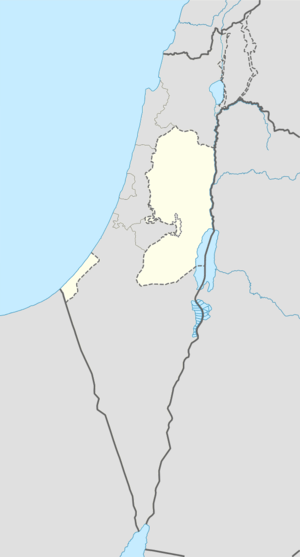 Kharbatha Bani Harith Location of Kharbatha Bani Harith within the Palestinian territories | |
| Coordinates: 31°56′43″N 35°04′21″E / 31.94528°N 35.07250°ECoordinates: 31°56′43″N 35°04′21″E / 31.94528°N 35.07250°E | |
| Palestine grid | 156/150 |
| Governorate | Ramallah & al-Bireh |
| Government | |
| • Type | Village council |
| Area | |
| • Jurisdiction | 7,120 dunams (7.12 km2 or 2.75 sq mi) |
| Population (2007) | |
| • Jurisdiction | 2,846 |
| Name meaning | "The ruins of the sons of Harith"[1] |
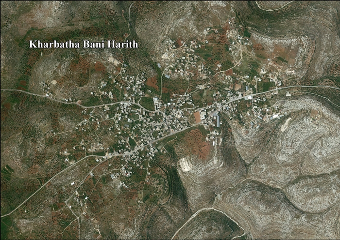
Kharbatha Bani Harith (Arabic: خربثا بني حارث) is a Palestinian town in the central West Bank, located 15 kilometers west of Ramallah in the Ramallah and al-Bireh Governorate. The name of the town is probably a corruption of Khirbat Bani Harith ("the ruins of the sons of Harith"). According to the Palestinian Central Bureau of Statistics, the town had a population of 2,846.[2] Nearby towns and villages include Bil'in to the south, Ras Karkar to the east, and Deir Qaddis to the west. It has a total land area of 7,120 dunams.
History
Pottery sherds from Iron Age II, Persian, Byzantine, Byzantine/Umayyad and Mamluk era have been found.[3]
Ottoman era
According to the 1596 Ottoman census of the area the village of Kharbatha had a total of 29 Muslim and 4 Christian families residing there.[4][5]
In 1870, Victor Guérin found the village to have about 200 inhabitants. He also noted the remains of a church,[6] which has been dated to the Byzantine era.[3]
In 1882, the Palestine Exploration Fund's Survey of Western Palestine described the village, called Khurbetha Ibn Harith, as being of medium size, with a well on the west, "standing on high ground among the olive trees."[7]
British Mandate era
In the 1922 census of Palestine, conducted by the British Mandate authorities, Kharbata had a population of 338 inhabitants, all Muslim.[8] In the 1931 census it had increased to a population of 469, still all Muslim, in 102 inhabited houses.[9]
In 1945, the population of Kharbata was 650, all Muslims,[10] who owned 7,120 dunams of land according to an official land and population survey.[11] 2,788 dunams were plantations and irrigable land, 591 used for cereals,[12] while 9 dunams were built-up (urban) land.[13]
1948-1967
In the wake of the 1948 Arab–Israeli War, and after the 1949 Armistice Agreements, Kharbatha Bani Harith came under Jordanian rule.
1967-present
After the Six-Day War in 1967, Kharbatha Bani Harith has been under Israeli occupation.
See also
References
- ↑ Palmer, 1881, p. 237
- ↑ 2007 PCBS Census. Palestinian Central Bureau of Statistics. p.114.
- 1 2 Finkelstein and Lederman, 1997, p. 200
- ↑ Petersen, Andrew. The Towns of Palestine Under Muslim Rule 600-1600.
- ↑ Hütteroth and Abdulfattah, 1977, p. 155
- ↑ Guérin, 1875, p. 84
- ↑ Conder and Kitchener, 1882, SWP II, p. 294
- ↑ Barron, 1923, Table VII, Sub-district of Ramleh, p. 22
- ↑ Mills, 1932, p. 21
- ↑ Department of Statistics, 1945, p. 29
- ↑ Government of Palestine, Department of Statistics. Village Statistics, April, 1945. Quoted in Hadawi, 1970, p. 67
- ↑ Government of Palestine, Department of Statistics. Village Statistics, April, 1945. Quoted in Hadawi, 1970, p. 115
- ↑ Government of Palestine, Department of Statistics. Village Statistics, April, 1945. Quoted in Hadawi, 1970, p. 165
Bibliography
| Wikimedia Commons has media related to Kharbatha Bani Harith. |
- Barron, J. B., ed. (1923). Palestine: Report and General Abstracts of the Census of 1922. Government of Palestine.
- Conder, Claude Reignier; Kitchener, H. H. (1882). The Survey of Western Palestine: Memoirs of the Topography, Orography, Hydrography, and Archaeology. 2. London: Committee of the Palestine Exploration Fund.
- Department of Statistics (1945). Village Statistics, April, 1945. Government of Palestine.
- Finkelstein, Israel; Lederman, Zvi, eds. (1997). Highlands of many cultures. Tel Aviv: Institute of Archaeology of Tel Aviv University Publications Section. ISBN 965-440-007-3.
- Guérin, Victor (1875). Description Géographique Historique et Archéologique de la Palestine (in French). 2: Samarie, pt. 2. Paris: L'Imprimerie Nationale.
- Hadawi, Sami (1970). Village Statistics of 1945: A Classification of Land and Area ownership in Palestine. Palestine Liberation Organization Research Center.
- Hütteroth, Wolf-Dieter; Abdulfattah, Kamal (1977). Historical Geography of Palestine, Transjordan and Southern Syria in the Late 16th Century. Erlanger Geographische Arbeiten, Sonderband 5. Erlangen, Germany: Vorstand der Fränkischen Geographischen Gesellschaft. ISBN 3-920405-41-2.
- E. Mills, ed. (1932). Census of Palestine 1931. Population of Villages, Towns and Administrative Areas. Jerusalem: Government of Palestine.
- Palmer, E. H. (1881). The Survey of Western Palestine: Arabic and English Name Lists Collected During the Survey by Lieutenants Conder and Kitchener, R. E. Transliterated and Explained by E.H. Palmer. Committee of the Palestine Exploration Fund.
External links
- Welcome To Kharbata
- Survey of Western Palestine, Map 14: IAA, Wikimedia commons
- Kharbatha Bani Harith Village (Fact Sheet), Applied Research Institute - Jerusalem (ARIJ)
- Kharbatha Bani Harith Village Profile, Applied Research Institute - Jerusalem (ARIJ)
- Kharbatha Bani Harith aerial photo, Applied Research Institute - Jerusalem (ARIJ)
| Cities |  | |
|---|---|---|
| Municipalities |
| |
| Village councils |
| |
| Refugee camps | ||