Garfield, Arkansas
| Garfield, Arkansas | ||
|---|---|---|
| Town | ||
|
Highway 62 runs through Garfield | ||
| ||
 Location in Benton County and the state of Arkansas | ||
| Coordinates: 36°27′1″N 93°58′25″W / 36.45028°N 93.97361°WCoordinates: 36°27′1″N 93°58′25″W / 36.45028°N 93.97361°W | ||
| Country | United States | |
| State | Arkansas | |
| County | Benton | |
| Area | ||
| • Total | 3.0 sq mi (7.7 km2) | |
| • Land | 3.0 sq mi (7.7 km2) | |
| • Water | 0 sq mi (0 km2) | |
| Elevation | 1,490 ft (454 m) | |
| Population (2010) | ||
| • Total | 502 | |
| • Density | 169/sq mi (65.1/km2) | |
| Time zone | Central (CST) (UTC-6) | |
| • Summer (DST) | CDT (UTC-5) | |
| ZIP code | 72732 | |
| Area code(s) | 479 | |
| FIPS code | 05-25750 | |
| GNIS feature ID | 0076997 | |
| Website |
www | |


Garfield is a town[1] in Benton County, Arkansas, United States. The population was 502 at the 2010 census.[2] It is part of the Fayetteville–Springdale–Rogers, AR-MO Metropolitan Statistical Area.
Geography
Garfield is located in northeast Benton County at 36°27′1″N 93°58′25″W / 36.45028°N 93.97361°W (36.450152, -93.973519).[3] U.S. Route 62 passes through the town, leading northeast to Gateway near the Missouri border and southwest to Rogers.
According to the United States Census Bureau, the town has a total area of 3.0 square miles (7.7 km2), all of it land.[2]
Demographics
| Historical population | |||
|---|---|---|---|
| Census | Pop. | %± | |
| 1890 | 112 | — | |
| 1940 | 104 | — | |
| 1950 | 83 | −20.2% | |
| 1960 | 48 | −42.2% | |
| 1970 | 163 | 239.6% | |
| 1980 | 187 | 14.7% | |
| 1990 | 308 | 64.7% | |
| 2000 | 490 | 59.1% | |
| 2010 | 502 | 2.4% | |
| Est. 2015 | 527 | [4] | 5.0% |
2014 Estimate[6] | |||

At the 2000 census,[7] there were 490 people, 177 households and 136 families residing in the town. The population density was 133.5 per square mile (51.6/km²). There were 198 housing units at an average density of 54.0/sq mi (20.8/km²). The racial makeup of the town was 97.35% White, 1.43% Native American, 0.61% Asian, and 0.61% from two or more races. 1.43% of the population were Hispanic or Latino of any race.
There were 177 households of which 37.9% had children under the age of 18 living with them, 67.2% were married couples living together, 6.2% had a female householder with no husband present, and 22.6% were non-families. 18.1% of all households were made up of individuals and 7.3% had someone living alone who was 65 years of age or older. The average household size was 2.77 and the average family size was 3.18.
29.4% of residents were under the age of 18, 8.4% from 18 to 24, 28.8% from 25 to 44, 20.2% from 45 to 64, and 13.3% who were 65 years of age or older. The median age was 37 years. For every 100 females there were 109.4 males. For every 100 females age 18 and over, there were 104.7 males.
The median household income was $33,393 and the median family income was $38,750. Males had a median income of $27,031 versus $22,404 for females. The per capita income for the town was $13,159. About 9.8% of families and 10.3% of the population were below the poverty line, including 9.0% of those under age 18 and 3.8% of those age 65 or over.
Education
Public education for early childhood, elementary and secondary school students is provided by the Rogers School District.
References
- ↑ "Welcome - Town of Garfield". Town of Garfield, Arkansas. Retrieved September 24, 2010.
- 1 2 "Geographic Identifiers: 2010 Demographic Profile Data (G001): Garfield town, Arkansas". U.S. Census Bureau, American Factfinder. Retrieved September 24, 2013.
- ↑ "US Gazetteer files: 2010, 2000, and 1990". United States Census Bureau. 2011-02-12. Retrieved 2011-04-23.
- ↑ "Annual Estimates of the Resident Population for Incorporated Places: April 1, 2010 to July 1, 2015". Retrieved July 2, 2016.
- ↑ "Census of Population and Housing". Census.gov. Retrieved June 4, 2015.
- ↑ "Annual Estimates of the Resident Population for Incorporated Places: April 1, 2010 to July 1, 2014". Retrieved June 4, 2015.
- ↑ "American FactFinder". United States Census Bureau. Retrieved 2008-01-31.
External links
Municipalities and communities of Benton County, Arkansas, United States | ||
|---|---|---|
| Cities | 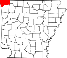 | |
| Towns | ||
| Townships | ||
| CDPs | ||
| Other communities |
| |
| Ghost town | ||
| Footnotes | ‡This populated place also has portions in an adjacent county or counties | |