Wrigley, Northwest Territories
| Wrigley Pedzéh Kñ | |
|---|---|
|
First Nation (Designated Authority) Pehdzeh Ki First Nation | |
 Wrigley | |
| Coordinates: 63°13′41″N 123°28′12″W / 63.22806°N 123.47000°WCoordinates: 63°13′41″N 123°28′12″W / 63.22806°N 123.47000°W | |
| Country | Canada |
| Territory | Northwest Territories |
| Region | Dehcho Region |
| Constituency | Nahendeh |
| Census division | Region 4 |
| Settled | 1965 |
| Government | |
| • Chief | Tim Lennie |
| • Band Manager | Darcy J. Moses |
| • MLA | Kevin Menicoche |
| Area[1] | |
| • Total | 55.84 km2 (21.56 sq mi) |
| Elevation | 149 m (489 ft) |
| Population (2011)[1] | |
| • Total | 133 |
| • Density | 2.4/km2 (6/sq mi) |
| Time zone | Mountain (MST) (UTC−7) |
| • Summer (DST) | MDT (UTC−6) |
| Canadian Postal code | X0E 1E0 |
| Telephone exchange | 581 |
| - Living cost | 152.5A |
| - Food price index | 154.7B |
|
Sources: Department of Municipal and Community Affairs,[2] Prince of Wales Northern Heritage Centre,[3] Canada Flight Supplement[4] ^A 2009 figure based on Edmonton = 100[5] ^B 2010 figure based on Yellowknife = 100[5] | |
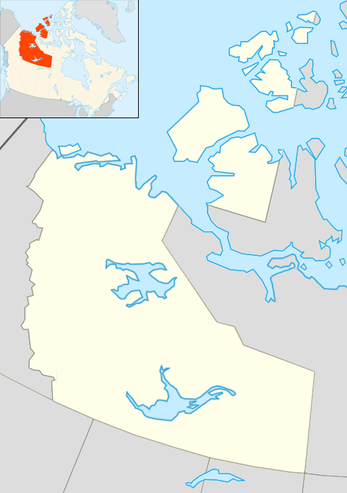
Wrigley (South Slavey language: Pehdzeh Ki "clay place") is a "Designated Authority"[6] in the Dehcho Region of the Northwest Territories, Canada. The community is located on the east bank of the Mackenzie River, just below its confluence with the Wrigley River and about 466 mi (750 km) northwest of Yellowknife.
Originally situated at Fort Wrigley, the community relocated to its present location in 1965, because it was more easily accessible due to the World War II Wrigley Airport, built for the Canol Project.[7] Today the community can be reached via the Mackenzie Highway. The population continues to maintain a traditional lifestyle, trapping, hunting, and fishing.
Demographics
Population is 133 according to the 2011 Census, an increase of 9.0% over the 2006 Census[1] In 2012 the Government of the Northwest Territories reported that the population was 123 with an average yearly growth rate of -4.6% from 2001.[5]
| Historical population | ||||||||||||||||||||||||||||||||||||||||||||||||||||||||||
|---|---|---|---|---|---|---|---|---|---|---|---|---|---|---|---|---|---|---|---|---|---|---|---|---|---|---|---|---|---|---|---|---|---|---|---|---|---|---|---|---|---|---|---|---|---|---|---|---|---|---|---|---|---|---|---|---|---|---|
|
| |||||||||||||||||||||||||||||||||||||||||||||||||||||||||
| Sources: NWT Bureau of Statistics (2001 - 2012)[5] | ||||||||||||||||||||||||||||||||||||||||||||||||||||||||||
First Nations
The Dene of the community are represented by the Pehdzeh Ki First Nation and belong to the Dehcho First Nations.[8]
Services
The community has one store, a health centre and a two-person RCMP detachment.[9]
Education
The community has a K-9 school, Chief Julian Yendo School.[10]
Climate
Wrigley has an extreme continental subarctic climate. The area combines warm, short summers with long and very cold winters. The differences between the coldest and warmest month are rather extreme even by continental standards, with the January high being −21 °C (−6 °F) and the July high being 23 °C (73 °F) according to Environment Canada. Transitional seasons are rather short.
| Climate data for Wrigley Airport | |||||||||||||
|---|---|---|---|---|---|---|---|---|---|---|---|---|---|
| Month | Jan | Feb | Mar | Apr | May | Jun | Jul | Aug | Sep | Oct | Nov | Dec | Year |
| Record high humidex | 11.2 | 10.0 | 12.0 | 24.0 | 30.4 | 38.1 | 37.9 | 36.6 | 29.8 | 21.3 | 7.2 | 0.0 | 38.1 |
| Record high °C (°F) | 6.5 (43.7) |
11.1 (52) |
12.7 (54.9) |
25.0 (77) |
34.0 (93.2) |
37.0 (98.6) |
35.5 (95.9) |
33.5 (92.3) |
28.3 (82.9) |
21.7 (71.1) |
8.9 (48) |
7.8 (46) |
37.0 (98.6) |
| Average high °C (°F) | −21.1 (−6) |
−17.1 (1.2) |
−7.9 (17.8) |
5.0 (41) |
14.6 (58.3) |
21.7 (71.1) |
23.4 (74.1) |
19.9 (67.8) |
12.5 (54.5) |
−0.3 (31.5) |
−14.8 (5.4) |
−18.6 (−1.5) |
1.5 (34.7) |
| Daily mean °C (°F) | −25.4 (−13.7) |
−22.1 (−7.8) |
−15.0 (5) |
−1.7 (28.9) |
8.0 (46.4) |
15.0 (59) |
16.9 (62.4) |
13.6 (56.5) |
7.1 (44.8) |
−3.8 (25.2) |
−18.7 (−1.7) |
−22.7 (−8.9) |
−4.1 (24.6) |
| Average low °C (°F) | −29.7 (−21.5) |
−27.2 (−17) |
−22.1 (−7.8) |
−8.3 (17.1) |
1.3 (34.3) |
8.2 (46.8) |
10.3 (50.5) |
7.2 (45) |
1.6 (34.9) |
−7.4 (18.7) |
−22.5 (−8.5) |
−26.7 (−16.1) |
−9.6 (14.7) |
| Record low °C (°F) | −51.7 (−61.1) |
−53.3 (−63.9) |
−46.7 (−52.1) |
−36.1 (−33) |
−20.9 (−5.6) |
−3.9 (25) |
−1.1 (30) |
−6.0 (21.2) |
−18.0 (−0.4) |
−31.5 (−24.7) |
−48.0 (−54.4) |
−49.4 (−56.9) |
−53.3 (−63.9) |
| Record low wind chill | −60.9 | −58.9 | −50.3 | −37.0 | −25.5 | 0.0 | 0.0 | −2.7 | −15.6 | −37.6 | −52.1 | −63.0 | −63.0 |
| Average precipitation mm (inches) | 16.7 (0.657) |
14.6 (0.575) |
10.4 (0.409) |
8.1 (0.319) |
22.0 (0.866) |
43.5 (1.713) |
64.0 (2.52) |
49.5 (1.949) |
35.9 (1.413) |
29.4 (1.157) |
20.5 (0.807) |
18.1 (0.713) |
332.6 (13.094) |
| Average rainfall mm (inches) | 0.0 (0) |
0.0 (0) |
0.0 (0) |
0.3 (0.012) |
18.4 (0.724) |
43.5 (1.713) |
64.0 (2.52) |
49.5 (1.949) |
32.3 (1.272) |
7.6 (0.299) |
0.0 (0) |
0.0 (0) |
215.5 (8.484) |
| Average snowfall cm (inches) | 19.1 (7.52) |
15.4 (6.06) |
10.9 (4.29) |
8.9 (3.5) |
3.8 (1.5) |
0.0 (0) |
0.0 (0) |
0.0 (0) |
3.4 (1.34) |
21.8 (8.58) |
22.6 (8.9) |
18.9 (7.44) |
124.7 (49.09) |
| Average precipitation days (≥ 0.2 mm) | 8.0 | 6.4 | 5.6 | 3.3 | 6.4 | 8.4 | 9.7 | 9.0 | 9.2 | 9.7 | 9.0 | 7.5 | 92.1 |
| Average rainy days (≥ 0.2 mm) | 0.0 | 0.0 | 0.0 | 0.4 | 5.6 | 8.2 | 9.7 | 9.0 | 8.3 | 2.2 | 0.1 | 0.0 | 43.3 |
| Average snowy days (≥ 0.2 cm) | 8.0 | 6.4 | 5.6 | 2.9 | 1.1 | 0.0 | 0.0 | 0.0 | 1.1 | 7.9 | 9.1 | 7.5 | 49.4 |
| Source: Environment Canada Canadian Climate Normals 1981–2010[11] | |||||||||||||
References
- 1 2 3 Wrigley, SET Northwest Territories (Census subdivision)
- ↑ "NWT Communities - Wrigley". Government of the Northwest Territories: Department of Municipal and Community Affairs. Retrieved 2014-01-29.
- ↑ "Northwest Territories Official Community Names and Pronunciation Guide". Prince of Wales Northern Heritage Centre. Yellowknife: Education, Culture and Employment, Government of the Northwest Territories. Archived from the original on 2016-01-13. Retrieved 2016-01-13.]
- ↑ Canada Flight Supplement. Effective 0901Z 15 September 2016 to 0901Z 10 November 2016
- 1 2 3 4 Wrigley - Statistical Profile at the GNWT
- ↑ Differences in Community Government Structure
- ↑ Wrigley at the GNWT
- ↑ Dehcho First Nations
- ↑ Wrigley Infrastructure Profile
- ↑ Chief Julian Yendo School
- ↑ "Wrigley A" (CSV (3069 KB)). Canadian Climate Normals 1981–2010. Environment Canada. Climate ID: 2204000. Retrieved 2014-01-09.
| Census divisions | |||||||||||
|---|---|---|---|---|---|---|---|---|---|---|---|
| Former census divisions | |||||||||||
| Dehcho Region |
| ||||||||||
| Inuvik Region |
| ||||||||||
| North Slave Region |
| ||||||||||
| Sahtu Region |
| ||||||||||
| South Slave Region |
| ||||||||||
| Weather stations (outside of communities) | |||||||||||
| Mine sites |
| ||||||||||
| DEW line and NWS sites |
| ||||||||||
| Hudson's Bay Company trading posts | |||||||||||
| Former districts |
| ||||||||||
| |||||||||||