Wrenshall Township, Carlton County, Minnesota
| Wrenshall Township, Minnesota | |
|---|---|
| Township | |
 Wrenshall Township, Minnesota Location within the state of Minnesota | |
| Coordinates: 46°32′19″N 92°22′49″W / 46.53861°N 92.38028°WCoordinates: 46°32′19″N 92°22′49″W / 46.53861°N 92.38028°W | |
| Country | United States |
| State | Minnesota |
| County | Carlton |
| Area | |
| • Total | 37.9 sq mi (98.1 km2) |
| • Land | 37.9 sq mi (98.1 km2) |
| • Water | 0.0 sq mi (0.0 km2) |
| Elevation | 912 ft (278 m) |
| Population (2000) | |
| • Total | 326 |
| • Density | 8.6/sq mi (3.3/km2) |
| Time zone | Central (CST) (UTC-6) |
| • Summer (DST) | CDT (UTC-5) |
| ZIP codes | 55749, 55797 |
| Area code(s) | 218 |
| FIPS code | 27-71806[1] |
| GNIS feature ID | 0666055[2] |
Wrenshall Township is a township in Carlton County, Minnesota, United States. The population was 326 at the 2000 census. Wrenshall Township was named for C. C. Wrenshall, a railroad official.[3]
Geography
According to the United States Census Bureau, the township has a total area of 37.9 square miles (98.1 km²), all of it land.
Unincorporated communities
Major highways
Adjacent townships, cities, and communities
The following municipalities and communities are adjacent to Wrenshall Township :
- Silver Brook Township (north)
- The city of Wrenshall (north)
- Holyoke Township (south)
- Blackhoof Township (west)
Cemeteries
The township contains Saint John's Lutheran Cemetery.
Demographics
As of the census[1] of 2000, there were 326 people, 128 households, and 88 families residing in the township. The population density was 8.6 people per square mile (3.3/km²). There were 142 housing units at an average density of 3.8/sq mi (1.4/km²). The racial makeup of the township was 92.94% White, 0.92% African American, 1.23% Native American, 1.23% Asian, and 3.68% from two or more races.
There were 128 households out of which 32.8% had children under the age of 18 living with them, 60.2% were married couples living together, 3.9% had a female householder with no husband present, and 30.5% were non-families. 28.1% of all households were made up of individuals and 5.5% had someone living alone who was 65 years of age or older. The average household size was 2.55 and the average family size was 3.07.
In the township the population was spread out with 25.8% under the age of 18, 6.1% from 18 to 24, 31.9% from 25 to 44, 28.5% from 45 to 64, and 7.7% who were 65 years of age or older. The median age was 39 years. For every 100 females there were 118.8 males. For every 100 females age 18 and over, there were 124.1 males.
The median income for a household in the township was $44,219, and the median income for a family was $45,417. Males had a median income of $36,250 versus $18,750 for females. The per capita income for the township was $25,067. About 2.2% of families and 4.7% of the population were below the poverty line, including none of those under the age of 18 and 23.8% of those 65 and older.
References
- United States National Atlas
- United States Census Bureau 2007 TIGER/Line Shapefiles
- United States Board on Geographic Names (GNIS)
- 1 2 "American FactFinder". United States Census Bureau. Retrieved 2008-01-31.
- ↑ "US Board on Geographic Names". United States Geological Survey. 2007-10-25. Retrieved 2008-01-31.
- ↑ Upham, Warren (1920). Minnesota Geographic Names: Their Origin and Historic Significance. Minnesota Historical Society. p. 77.
Municipalities and communities of Carlton County, Minnesota, United States | ||
|---|---|---|
| Cities | 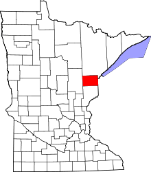 | |
| Townships | ||
| CDPs | ||
| Unorganized territories | ||
| Unincorporated communities | ||
| Indian reservations | ||
| Footnotes | ‡This populated place also has portions in an adjacent county or counties | |