Woodruff, Utah
| Woodruff, Utah | |
|---|---|
| Town | |
|
The Woodruff Stake House, a former Latter-day Saint office building, is listed on the National Register of Historic Places. | |
 Location in Rich County and the state of Utah | |
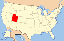 Location of Utah in the United States | |
| Coordinates: 41°31′22″N 111°9′41″W / 41.52278°N 111.16139°WCoordinates: 41°31′22″N 111°9′41″W / 41.52278°N 111.16139°W | |
| Country | United States |
| State | Utah |
| County | Rich |
| Settled | 1865 |
| Incorporated | 1933 |
| Named for | Wilford Woodruff |
| Area | |
| • Total | 0.5 sq mi (1.4 km2) |
| • Land | 0.5 sq mi (1.4 km2) |
| • Water | 0.0 sq mi (0.0 km2) |
| Elevation | 6,339 ft (1,932 m) |
| Population (2012) | |
| • Total | 179 |
| • Density | 360/sq mi (130/km2) |
| Time zone | Mountain (MST) (UTC-7) |
| • Summer (DST) | MDT (UTC-6) |
| ZIP code | 84086 |
| Area code(s) | 435 |
| FIPS code | 49-85260[1] |
| GNIS feature ID | 1434462[2] |

Woodruff is a town in Rich County, Utah, United States. The population was 180 at the 2010 census.
History
A post office called Woodruff has been in operation since 1872.[3] The town was named in honor of Wilford Woodruff, 4th President of The Church of Jesus Christ of Latter-day Saints.[4]
Geography
According to the United States Census Bureau, the town has a total area of 0.5 square miles (1.4 km²), all of it land.
Climate
This climatic region is typified by large seasonal temperature differences, with warm to hot (and often humid) summers and cold (sometimes severely cold) winters. According to the Köppen Climate Classification system, Woodruff has a humid continental climate, abbreviated "Dfb" on climate maps.[5]
Demographics
| Historical population | |||
|---|---|---|---|
| Census | Pop. | %± | |
| 1880 | 268 | — | |
| 1890 | 340 | 26.9% | |
| 1900 | 487 | 43.2% | |
| 1910 | 367 | −24.6% | |
| 1920 | 366 | −0.3% | |
| 1930 | 404 | 10.4% | |
| 1940 | 241 | −40.3% | |
| 1950 | 175 | −27.4% | |
| 1960 | 169 | −3.4% | |
| 1970 | 173 | 2.4% | |
| 1980 | 222 | 28.3% | |
| 1990 | 135 | −39.2% | |
| 2000 | 194 | 43.7% | |
| 2010 | 180 | −7.2% | |
| Est. 2015 | 187 | [6] | 3.9% |
As of the census[1] of 2000, there were 194 people, 60 households, and 49 families residing in the town. The population density was 361.4 people per square mile (138.7/km²). There were 75 housing units at an average density of 139.7 per square mile (53.6/km²). The racial makeup of the town was 100.00% White.
There were 60 households out of which 51.7% had children under the age of 18 living with them, 70.0% were married couples living together, 8.3% had a female householder with no husband present, and 16.7% were non-families. 13.3% of all households were made up of individuals and 1.7% had someone living alone who was 65 years of age or older. The average household size was 3.23 and the average family size was 3.62.
In the town the population was spread out with 42.8% under the age of 18, 5.2% from 18 to 24, 24.2% from 25 to 44, 15.5% from 45 to 64, and 12.4% who were 65 years of age or older. The median age was 26 years. For every 100 females there were 104.2 males. For every 100 females age 18 and over, there were 109.4 males.
The median income for a household in the town was $43,000, and the median income for a family was $42,750. Males had a median income of $38,333 versus $16,875 for females. The per capita income for the town was $13,976. About 10.5% of families and 18.7% of the population were below the poverty line, including 25.0% of those under the age of eighteen and 11.4% of those sixty five or over.
Notable residents
- Merlo J. Pusey, journalist and Pulitzer Prize-winning biographer
References
- 1 2 "American FactFinder". United States Census Bureau. Retrieved 2008-01-31.
- ↑ "US Board on Geographic Names". United States Geological Survey. 2007-10-25. Retrieved 2008-01-31.
- ↑ "Rich County". Jim Forte Postal History. Retrieved 18 October 2015.
- ↑ Van Atta, Dale (Jan 22, 1977). "You name it - there's a town for it". The Deseret News. pp. W6. Retrieved 18 October 2015.
- ↑ Climate Summary for Woodruff, Utah
- ↑ "Annual Estimates of the Resident Population for Incorporated Places: April 1, 2010 to July 1, 2015". Retrieved July 2, 2016.
- ↑ "Census of Population and Housing". Census.gov. Retrieved June 4, 2015.

Municipalities and communities of Rich County, Utah, United States | ||
|---|---|---|
| Towns | 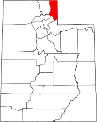 | |
| CDP | ||
| Ghost town | ||