Winona, Missouri
| Winona, Missouri | |
|---|---|
| City | |
 Location of Winona, Missouri | |
| Coordinates: 37°0′25″N 91°19′44″W / 37.00694°N 91.32889°WCoordinates: 37°0′25″N 91°19′44″W / 37.00694°N 91.32889°W | |
| Country | United States |
| State | Missouri |
| County | Shannon |
| Township | Winona |
| Government | |
| • Mayor | Brenda Barkman |
| Area[1] | |
| • Total | 3.81 sq mi (9.87 km2) |
| • Land | 3.81 sq mi (9.87 km2) |
| • Water | 0 sq mi (0 km2) |
| Elevation | 932 ft (284 m) |
| Population (2010)[2] | |
| • Total | 1,335 |
| • Estimate (2012[3]) | 1,317 |
| • Density | 350.4/sq mi (135.3/km2) |
| Time zone | Central (CST) (UTC-6) |
| • Summer (DST) | CDT (UTC-5) |
| ZIP code | 65588 |
| Area code(s) | 573 |
| FIPS code | 29-80512[4] |
| GNIS feature ID | 0752941[5] |
Winona is a city in Shannon County, Missouri, United States. The population was 1,335 at the 2010 census.
History
Winona was named by some lumbermen who hailed from Winona, Minnesota.[6]
Geography
Winona is located at 37°0′25″N 91°19′44″W / 37.00694°N 91.32889°W (37.006927, -91.328795).[7]
According to the United States Census Bureau, the city has a total area of 3.81 square miles (9.87 km2), all of it land.[1]
Demographics
| Historical population | |||
|---|---|---|---|
| Census | Pop. | %± | |
| 1890 | 602 | — | |
| 1900 | 495 | −17.8% | |
| 1910 | 444 | −10.3% | |
| 1920 | 359 | −19.1% | |
| 1930 | 442 | 23.1% | |
| 1940 | 480 | 8.6% | |
| 1950 | 473 | −1.5% | |
| 1960 | 562 | 18.8% | |
| 1970 | 973 | 73.1% | |
| 1980 | 1,050 | 7.9% | |
| 1990 | 1,081 | 3.0% | |
| 2000 | 1,290 | 19.3% | |
| 2010 | 1,335 | 3.5% | |
| Est. 2015 | 1,310 | [8] | −1.9% |
2010 census
As of the census[2] of 2010, there were 1,335 people, 529 households, and 358 families residing in the city. The population density was 350.4 inhabitants per square mile (135.3/km2). There were 595 housing units at an average density of 156.2 per square mile (60.3/km2). The racial makeup of the city was 96.93% White, 0.07% Black or African American, 0.82% Native American, 0.07% Asian, 0.15% from other races, and 1.95% from two or more races. Hispanic or Latino of any race were 1.50% of the population.
There were 529 households of which 38.2% had children under the age of 18 living with them, 46.7% were married couples living together, 14.0% had a female householder with no husband present, 7.0% had a male householder with no wife present, and 32.3% were non-families. 27.0% of all households were made up of individuals and 14.4% had someone living alone who was 65 years of age or older. The average household size was 2.52 and the average family size was 3.02.
The median age in the city was 34.1 years. 30% of residents were under the age of 18; 9.1% were between the ages of 18 and 24; 23.8% were from 25 to 44; 24.1% were from 45 to 64; and 13% were 65 years of age or older. The gender makeup of the city was 49.6% male and 50.4% female.
2000 census
As of the census[4] of 2000, there were 1,290 people, 525 households, and 343 families residing in the city. The population density was 342.4 people per square mile (132.1/km²). There were 587 housing units at an average density of 155.8 per square mile (60.1/km²). The racial makeup of the city was 94.96% White, 1.94% Native American, and 3.10% from two or more races. Hispanic or Latino of any race were 0.39% of the population.
There were 525 households out of which 35.0% had children under the age of 18 living with them, 49.3% were married couples living together, 13.0% had a female householder with no husband present, and 34.5% were non-families. 30.9% of all households were made up of individuals and 17.5% had someone living alone who was 65 years of age or older. The average household size was 2.46 and the average family size was 3.09.
In the city the population was spread out with 30.4% under the age of 18, 8.2% from 18 to 24, 26.1% from 25 to 44, 21.3% from 45 to 64, and 14.0% who were 65 years of age or older. The median age was 34 years. For every 100 females there were 87.2 males. For every 100 females age 18 and over, there were 81.4 males.
The median income for a household in the city was $18,640, and the median income for a family was $24,000. Males had a median income of $21,912 versus $15,865 for females. The per capita income for the city was $11,564. About 28.4% of families and 34.7% of the population were below the poverty line, including 47.3% of those under age 18 and 20.9% of those age 65 or over.
References
- 1 2 "US Gazetteer files 2010". United States Census Bureau. Retrieved 2012-07-08.
- 1 2 "American FactFinder". United States Census Bureau. Retrieved 2012-07-08.
- ↑ "Population Estimates". United States Census Bureau. Retrieved 2013-05-30.
- 1 2 "American FactFinder". United States Census Bureau. Retrieved 2008-01-31.
- ↑ "US Board on Geographic Names". United States Geological Survey. 2007-10-25. Retrieved 2008-01-31.
- ↑ Eaton, David Wolfe (1918). How Missouri Counties, Towns and Streams Were Named. The State Historical Society of Missouri. p. 364.
- ↑ "US Gazetteer files: 2010, 2000, and 1990". United States Census Bureau. 2011-02-12. Retrieved 2011-04-23.
- ↑ "Annual Estimates of the Resident Population for Incorporated Places: April 1, 2010 to July 1, 2015". Retrieved July 2, 2016.
- ↑ "Census of Population and Housing". Census.gov. Retrieved June 4, 2015.
External links
Municipalities and communities of Shannon County, Missouri, United States | ||
|---|---|---|
| Cities | 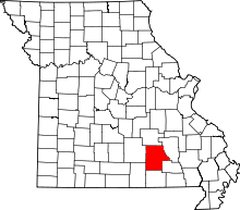 | |
| Villages | ||
| Townships |
| |
| Unincorporated communities | ||
| Ghost towns |
| |
| Footnotes | ‡This populated place also has portions in an adjacent county or counties | |