Whitewater, Wisconsin
| Whitewater, Wisconsin | |
|---|---|
| City | |
|
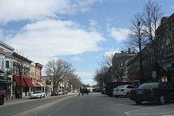
Main Street, downtown Whitewater | |
 Location of Whitewater, Wisconsin | |
| Coordinates: 42°50′6″N 88°44′10″W / 42.83500°N 88.73611°WCoordinates: 42°50′6″N 88°44′10″W / 42.83500°N 88.73611°W | |
| Country | United States |
| State | Wisconsin |
| Counties | Walworth, Jefferson |
| Government | |
| • Type | Common Council |
| Area[1] | |
| • Total | 9.06 sq mi (23.47 km2) |
| • Land | 8.76 sq mi (22.69 km2) |
| • Water | 0.30 sq mi (0.78 km2) |
| Elevation[2] | 823 ft (251 m) |
| Population (2010)[3] | |
| • Total | 14,390 |
| • Estimate (2012[4]) | 14,505 |
| • Density | 1,642.7/sq mi (634.3/km2) |
| Time zone | Central (CST) (UTC-6) |
| • Summer (DST) | CDT (UTC-5) |
| Zip Code | 53190 |
| Area code(s) | 262 |
| FIPS code | 55-86925[5] |
| GNIS feature ID | 1576690[2] |
| Website |
www |
Whitewater is a city in Walworth (mostly) and Jefferson counties in the U.S. state of Wisconsin. Located near the southern portion of the Kettle Moraine State Forest, Whitewater is the home of the University of Wisconsin–Whitewater. As of the 2010 census, the city's population was 14,390.[6] Of this, 11,150 were in Walworth County, and 3,240 were in Jefferson County.
History
Whitewater was founded at the confluence of Whitewater Creek and Spring Brook, and named for the white sand in their beds.[7] A gristmill was built on Whitewater creek, the resulting pond now called Lake Cravath. The town grew quickly when the first railroad line in Wisconsin passed through in 1853, but struggled when the two largest employers left town.[7]
Whitewater was a New England settlement. The original founders of Whitewater consisted entirely of settlers from New England. These people were "Yankees", that is to say they were descended from the English Puritans who settled New England in the 1600s. They were part of a wave of New England farmers who headed west into what was then the wilds of the Northwest Territory during the early 1800s. Most of them arrived as a result of the completion of the Erie Canal. When they arrived in what is now Whitewater there was nothing but dense virgin forest and wild prairie, the New Englanders laid out farms, constructed roads, erected government buildings and established post routes. They brought with them many of their Yankee New England values, such as a passion for education, establishing many schools as well as staunch support for abolitionism. They were mostly members of the Congregationalist Church though some were Episcopalian. Due to the second Great Awakening some of them had converted to Methodism before moving to what is now Whitewater. Whitewater, like much of Wisconsin, would be culturally very continuous with early New England culture for most of its early history.[8][9]
Geography
Whitewater is located at 42°50′6″N 88°44′10″W / 42.83500°N 88.73611°W (42.834950, -88.736119).[10]
According to the United States Census Bureau, the city has a total area of 9.06 square miles (23.47 km2), of which, 8.76 square miles (22.69 km2) is land and 0.30 square miles (0.78 km2) is water.[1] Most of the city lies in Walworth County.
Demographics
| Historical population | |||
|---|---|---|---|
| Census | Pop. | %± | |
| 1860 | 2,731 | — | |
| 1880 | 3,617 | — | |
| 1890 | 4,359 | 20.5% | |
| 1900 | 3,405 | −21.9% | |
| 1910 | 3,224 | −5.3% | |
| 1920 | 3,215 | −0.3% | |
| 1930 | 3,465 | 7.8% | |
| 1940 | 3,689 | 6.5% | |
| 1950 | 5,101 | 38.3% | |
| 1960 | 6,380 | 25.1% | |
| 1970 | 12,038 | 88.7% | |
| 1980 | 11,520 | −4.3% | |
| 1990 | 12,636 | 9.7% | |
| 2000 | 13,437 | 6.3% | |
| 2010 | 14,390 | 7.1% | |
| Est. 2015 | 14,692 | [11] | 2.1% |
2010 census

As of the census[3] of 2010, there were 14,390 people, 4,766 households, and 1,781 families residing in the city. The population density was 1,642.7 inhabitants per square mile (634.3/km2). There were 5,113 housing units at an average density of 583.7 per square mile (225.4/km2). The racial makeup of the city was 88.0% White, 3.5% African American, 0.3% Native American, 1.9% Asian, 0.1% Pacific Islander, 4.5% from other races, and 1.8% from two or more races. Hispanic or Latino of any race were 9.5% of the population.
There were 4,766 households of which 18.8% had children under the age of 18 living with them, 26.2% were married couples living together, 7.4% had a female householder with no husband present, 3.8% had a male householder with no wife present, and 62.6% were non-families. 34.6% of all households were made up of individuals and 9.7% had someone living alone who was 65 years of age or older. The average household size was 2.28 and the average family size was 3.01.
The median age in the city was 21.9 years. 11.9% of residents were under the age of 18; 53.5% were between the ages of 18 and 24; 14.7% were from 25 to 44; 11.8% were from 45 to 64; and 8.4% were 65 years of age or older. The gender makeup of the city was 50.7% male and 49.3% female.
2000 census
As of the census of 2000,[5] there were 13,437 people, 4,132 households, and 1,685 families residing in the city. The population density was 1,923.5 people per square mile (742.2/km²). There were 4,340 housing units at an average density of 621.3 per square mile (239.7/km²). The racial makeup of the city was 92.25% White, 2.34% African American, 0.27% Native American, 1.47% Asian, 0.01% Pacific Islander, 2.48% from other races, and 1.18% from two or more races. Hispanic or Latino of any race were 6.50% of the population.
There were 4,132 households out of which 19.3% had children under the age of 18 living with them, 30.5% were married couples living together, 7.1% had a female householder with no husband present, and 59.2% were non-families. 32.7% of all households were made up of individuals and 10.7% had someone living alone who was 65 years of age or older. The average household size was 2.38 and the average family size was 3.00.
In the city the population was spread out with 12.5% under the age of 18, 53.2% from 18 to 24, 15.7% from 25 to 44, 9.8% from 45 to 64, and 8.9% who were 65 years of age or older. The median age was 22 years. For every 100 females there were 95.6 males. For every 100 females age 18 and over, there were 94.1 males.
The median income for a household in the city was $31,600, and the median income for a family was $48,185. Males had a median income of $33,078 versus $22,431 for females. The per capita income for the city was $13,965. About 10.6% of families and 27.4% of the population were below the poverty line, including 17.3% of those under age 18 and 4.2% of those age 65 or over. (Note: information in this paragraph is still from the 2000 census.)
Local government


Whitewater has a council-manager form of government. The city manager is Cameron Clapper. The municipal judge is Richard Kelly. Whitewater's Common Council is made up of one member from each of the five districts in the city and two members-at-large. The Common Council meets on the first and third Tuesdays of the month at City Hall, with its meetings being broadcast live on Whitewater Public Television.
Culture
Annual events in Whitewater include "Freeze Fest" in January, the Bridal Fair, Farm Toy Show in February, Maxwell Street Day and the 4th of July Celebration in July. Adding to these annual events are the Minneica Water Ski Shows[13] Saturday evenings on Whitewater Lake. Departing from the Highway 12 crossing of the Ice Age Trail, group biking tours depart several times a week from the area. September through April, Young Auditorium at the university[14] features world-class entertainment.
Religion
Whitewater has several places of worship:
- Anchor Bible Church[15]
- Community of St. Patrick Catholic Church
- Congregational United Church of Christ[16]
- First English Lutheran Church
- First United Methodist Church[17]
- Kettle Moraine Baptist Church[18]
- Living Word Fellowship[19]
- St. Luke's Episcopal Church
- Whitewater Bible Church
- Whitewater Islamic center[20]
- Crosspoint Community Church
- Hope Ministries
Education
Whitewater is served by the Whitewater Unified School District (WWUSD), which has five schools in the city:
- Lakeview Elementary School
- Washington Elementary School
- Whitewater Middle School (WMS)
- Whitewater High School (WHS)
- LINCS Charter School
Kettle Moraine Baptist Academy, which serves students in grades kindergarten through 12, is also located in the city.[21]
The University of Wisconsin–Whitewater is in Whitewater.
Recreation
Notable people
- Stephen Ambrose, author, historian
- James C. Bartholf, Wisconsin politician and newspaper editor
- Zadoc P. Beach, Wisconsin politician
- Tom Bigelow, auto racer
- Marvin H. Bovee, Wisconsin politician
- Edwin Coe, newspaper editor and politician[22]
- Charles Coleman, Wisconsin politician
- Edward S. Curtis, photographer, director, actor, cinematographer
- Frank A. Dudley, New York state legislator and lawyer
- Ben Heller, Major League baseball player
- Tom Hulce, actor
- George W. Hull, Wisconsin politician
- Jeff Jagodzinski, NFL assistant coach, former head coach of the Boston College Eagles
- Dale Markham, NFL player
- Benjamin McCready, painter
- Stephen Nass, Wisconsin politician
- Leon Pescheret, fine artist, designer, printmaker
- Elaine Roe, U.S. Army officer, one of the first four women to be awarded the Silver Star
- Edward J. Roethe, Wisconsin legislator
- Henry Edgar Roethe, Wisconsin legislator
- Byron Storm, Wisconsin legislator
- Eric Studesville, NFL assistant coach
- Eleazer Wakeley, Justice of the Nebraska Territory Supreme Court
- Jerome Anthony Watrous, (September 6, 1840 – June 5, 1922) was an American author, newspaper writer, Republicanpolitician, and a Lt. Colonel as a US soldier
- Thompson Weeks, Wisconsin politician
- Samuel A. White, Wisconsin politician
References
- 1 2 "US Gazetteer files 2010". United States Census Bureau. Retrieved 2012-11-18.
- 1 2 "US Board on Geographic Names". United States Geological Survey. 2007-10-25. Retrieved 2008-01-31.
- 1 2 "American FactFinder". United States Census Bureau. Retrieved 2012-11-18.
- ↑ "Population Estimates". United States Census Bureau. Retrieved 2013-06-24.
- 1 2 "American FactFinder". United States Census Bureau. Retrieved 2008-01-31.
- ↑ "Profile of General Population and Housing Characteristics: 2010 Demographic Profile Data (DP-1): Whitewater city, Wisconsin". U.S. Census Bureau, American Factfinder. Retrieved October 5, 2012.
- 1 2 History of Whitewater
- ↑ History of Walworth County, Wisconsin by Albert Clayton Beckwith, 1912 page 779
- ↑ The History of Wisconsin by William Fletcher Thompson State Historical Society of Wisconsin, Dec 1, 1998 ISBN 0870203037, 9780870203039
- ↑ "US Gazetteer files: 2010, 2000, and 1990". United States Census Bureau. 2011-02-12. Retrieved 2011-04-23.
- ↑ "Annual Estimates of the Resident Population for Incorporated Places: April 1, 2010 to July 1, 2015". Retrieved July 2, 2016.
- ↑ "Census of Population and Housing". Census.gov. Retrieved June 4, 2015.
- ↑ Whitewaterskiteam.org
- ↑ UWW.edu
- ↑ Anchor Bible Church
- ↑ Congregational United Church of Christ
- ↑ "FUMC Home Page". Fumcwhitewater.org. Retrieved 2013-10-05.
- ↑ Kettle Moraine Baptist Church
- ↑ Living Word Fellowship
- ↑ whitewater Islamic center
- ↑ Kettle Moraine Baptist Academy
- ↑ 'Wisconsin Blue Book 1887,' Biographical Sketch of Edwin Coe, pg. 512
Further reading
- Kraege, Fred G. Whitewater. Charleston, SC: Arcadia Press, 2006.
External links
| Wikimedia Commons has media related to Whitewater, Wisconsin. |
Municipalities and communities of Jefferson County, Wisconsin, United States | ||
|---|---|---|
| Cities |  | |
| Villages | ||
| Towns | ||
| CDPs | ||
| Unincorporated communities |
| |
| Footnotes | ‡This populated place also has portions in an adjacent county or counties | |
Municipalities and communities of Walworth County, Wisconsin, United States | ||
|---|---|---|
| Cities | 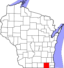 | |
| Villages | ||
| Towns | ||
| CDPs | ||
| Unincorporated communities |
| |
| Ghost towns | ||
| Footnotes | ‡This populated place also has portions in an adjacent county or counties | |
