West Easton, Pennsylvania
| Borough of West Easton | |
| Settlement | |
 Holy Ghost Ukrainian Catholic Church in West Easton. | |
| Country | United States |
|---|---|
| State | Pennsylvania |
| County | Northampton |
| Elevation | 230 ft (70.1 m) |
| Coordinates | 40°40′42″N 75°14′10″W / 40.67833°N 75.23611°WCoordinates: 40°40′42″N 75°14′10″W / 40.67833°N 75.23611°W |
| Area | 0.3 sq mi (0.8 km2) |
| - land | 0.3 sq mi (1 km2) |
| - water | 0.04 sq mi (0 km2), 13.33% |
| Population | 1,257 (2010) |
| Density | 3,678.9/sq mi (1,420.4/km2) |
| Incorporated | June 6, 1898 |
| Mayor | Gerald Gross |
| Timezone | EST (UTC-5) |
| - summer (DST) | EDT (UTC-4) |
| ZIP code | 18042 |
| Area code | 610 and 484 |
 Location of West Easton in Northampton County | |
 Location of West Easton in Pennsylvania | |
 Location of Pennsylvania in the United States | |
| Website: http://www.westeastonborough.org | |
West Easton is a borough in Northampton County, Pennsylvania, United States. West Easton is located in the Lehigh Valley region of the state, in the greater Easton area.
The population of West Easton was 1,257 at the 2010 census.
History
West Easton was incorporated as a borough on June 6, 1898.
Geography
West Easton is located at 40°40′42″N 75°14′10″W / 40.67833°N 75.23611°W (40.678298, -75.236144).[1]
According to the United States Census Bureau, the borough has a total area of 0.3 square miles (0.78 km2), of which, 0.3 square miles (0.78 km2) of it is land and 0.04 square miles (0.10 km2) of it (8.82%) is water.
Demographics
| Historical population | |||
|---|---|---|---|
| Census | Pop. | %± | |
| 1900 | 1,000 | — | |
| 1910 | 1,033 | 3.3% | |
| 1920 | 1,408 | 36.3% | |
| 1930 | 1,564 | 11.1% | |
| 1940 | 1,159 | −25.9% | |
| 1950 | 1,368 | 18.0% | |
| 1960 | 1,228 | −10.2% | |
| 1970 | 1,123 | −8.6% | |
| 1980 | 1,033 | −8.0% | |
| 1990 | 1,163 | 12.6% | |
| 2000 | 1,152 | −0.9% | |
| 2010 | 1,257 | 9.1% | |
| Est. 2015 | 1,251 | [2] | −0.5% |
| Sources:[3][4][5] | |||
As of the census[4] of 2010, there were 1,257 people, 488 households, and 175 families residing in the borough. The population density was 4,008 people per square mile (1,434.8/km2). There were 516 housing units at an average density of 1,539.3 per square mile (600.3/km2). The racial makeup of the borough was 85.0% White, 3.8% African American, 0.3% Native American, 0.7% Asian, 0.2% from other races, and 0.7% from two or more races. Hispanic or Latino of any race were 8.4% of the population.
There were 488 households, out of which 33.4% had children under the age of 18 living with them, 50.7% were married couples living together, 12.8% had a female householder with no husband present, and 30.8% were non-families. 25.4% of all households were made up of individuals, and 8.2% had someone living alone who was 65 years of age or older. The average household size was 2.55 and the average family size was 3.04.
In the borough the population was spread out, with 25.0% under the age of 18, 7.7% from 18 to 24, 32.1% from 25 to 44, 21.4% from 45 to 64, and 13.7% who were 65 years of age or older. The median age was 38 years. For every 100 females there were 95.6 males. For every 100 females age 18 and over, there were 95.9 males.
The median income for a household in the borough was $39,615, and the median income for a family was $48,393. Males had a median income of $35,288 versus $25,781 for females. The per capita income for the borough was $17,901. About 9.5% of families and 9.9% of the population were below the poverty line, including 11.2% of those under age 18 and 9.0% of those age 65 or over.
Public education
The Borough is served by the Wilson Area School District.
Gallery
 Main Street.
 Borough Hall.
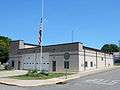 West Easton Fire Co.
 House on Spring Street.
References
- ↑ "US Gazetteer files: 2010, 2000, and 1990". United States Census Bureau. 2011-02-12. Retrieved 2011-04-23.
- ↑ "Annual Estimates of the Resident Population for Incorporated Places: April 1, 2010 to July 1, 2015". Retrieved July 2, 2016.
- ↑ "Census of Population and Housing". U.S. Census Bureau. Retrieved 11 December 2013.
- 1 2 "American FactFinder". United States Census Bureau. Retrieved 2008-01-31.
- ↑ "Incorporated Places and Minor Civil Divisions Datasets: Subcounty Resident Population Estimates: April 1, 2010 to July 1, 2012". Population Estimates. U.S. Census Bureau. Retrieved 11 December 2013.
- ↑ 2010 Census Interactive Population http://www.census.gov/2010census/popmap/ipmtext.php?fl=42
External links
| Wikimedia Commons has media related to West Easton, Pennsylvania. |
Municipalities and communities of Northampton County, Pennsylvania, United States | ||
|---|---|---|
| Cities |  | |
| Boroughs | ||
| Townships | ||
| CDPs | ||
| Unincorporated communities | ||
| Footnotes | ‡This populated place also has portions in an adjacent county or counties | |