Werder Zone
| Dollo Zone Gobolka Doollo | |
|---|---|
|
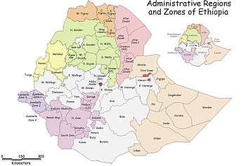
Map of Dollo Zone | |
 Dollo Zone Location within Ethiopia | |
| Coordinates: 7°15′N 46°00′E / 7.250°N 46.000°E | |
| Country | Ethiopia |
| Region | Somali |
| Zone | Werder |
| Population (2007) | |
| • Total | 306,488 |
| Time zone | EAT (UTC+3) |

Dollo (Somali: Doollo) is one of the nine zones in the Somali Region of Ethiopia. It was previously known as Warder/Werder, so named after its largest city, Warder.[1] Dollo is bordered on the southwest by Korahe, on the northwest by Jarar, and on the northeast and southeast by Somalia. The Provisional Administrative Line defines the southeast border with Somalia.
Demographics
Based on the 2007 Census conducted by the Central Statistical Agency of Ethiopia (CSA), this Zone has a total population of 306,488, of whom 175,624 are men and 130,864 women. While 28,784 or 9.39% are urban inhabitants, a further 113,408 or 37% were pastoralists. The largest ethnic group reported in Dollo were the Somalis (99.57%); all other ethnic groups made up 0.43% of the population. Somali language is spoken as a first language by 99.58%; the remaining 0.42% spoke all other primary languages reported. 99.36% of the population said they were Muslim.[2]
The 1997 national census reported a total population for this Zone of 324,308 in 42,564 households, of whom 181,566 were males and 142,742 were females; 24,681 or 7.61% of its population were urban dwellers. The largest ethnic group reported in the Dollo Zone was the Somali 323,928 (99.9%), and Somali was spoken by 323,881 (99.9%). The literacy rate in this Zone is 4.2%. The CSA categorized 160,057 (49.3%) of the people in the Zone as being part of the labor pool of whom 10,722 (6.7%) were unemployed).[3]
According to a May 24, 2004 World Bank memorandum, 1% of the inhabitants of Dollo have access to electricity, this zone has a road density of 0.0 kilometers per 1000 square kilometers. 28.2% of the population is in non-farm related jobs, compared to the national average of 25% and an average of 28% for pastoral Regions.[4] 13% of all eligible children are enrolled in primary school, and 1% in secondary schools. 100% of the zone is exposed to malaria, and none to Tsetse fly. The memorandum gave this zone a drought risk rating of 788.[5]
Agriculture
On 5–23 November 2003, the CSA conducted the first ever national agricultural census, of which the livestock census was an important component.[6] For the Somali Region, the CSA generated estimated figures for the livestock population (cattle, sheep, goats, camels, and equids) and their distribution by commissioning an aerial survey. For the Dollo Zone, their results included:
| Animal | Estimated total | number per sqk. |
|---|---|---|
| cattle | 36,146 | 0.7 |
| sheep | 2,253,550 | 69.9 (including goats) |
| goats | 1,413,143 | 69.9 (including sheep) |
| camels | 376,183 | 7.2 |
| asses | 460 | 0.01 (all equids) |
| mules | 7 | 0.01 (all equids) |
| horses | 1 | 0.01 (all equids) |
Notes
- ↑ "Ethiopia" (PDF). USAID. Retrieved 20 August 2014.
- ↑ Census 2007 Tables: Somali Region, Tables 2.1, 2.4, 3.1, 3.2 and 3.4.
- ↑ 1994 Population and Housing Census of Ethiopia: Results for Somali Region, Vol. 1 Tables 2.1, 2.7, 2.12, 2.15 (accessed 10 January 2009). The results of the 1994 census in the Somali Region were not satisfactory, so the census was repeated in 1997.
- ↑ Comparative national and regional figures comes from the World Bank publication, Klaus Deininger et al. "Tenure Security and Land Related Investment", WP-2991 (accessed 23 March 2006). This publication defines Benishangul-Gumaz, Afar and Somali as "pastoral Regions".
- ↑ World Bank, Four Ethiopias: A Regional Characterization (accessed 23 March 2006)
- ↑ "Livestock aerial survey in the Somali Region", CSA (November 2003), Tables 4, 6 (accessed 17 May 2009)
Coordinates: 7°15′N 46°00′E / 7.250°N 46.000°E
Zones of the Somali Region | ||
|---|---|---|