Somali Region
| Somali Region Deegaanka Soomaalida ሶማሊ ክልል | ||
|---|---|---|
| kilil | ||
| Ethiopian Somali Regional State | ||
| ||
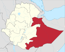 Map of Ethiopia showing Somali Region | ||
| Country | Ethiopia | |
| Capital | Jijiga | |
| Government | ||
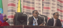
| • President | Abdi Mohamoud Omar | |
| • Vice-President | Mawlid Hayir | |
| Area | ||
| • Total | 279,252 km2 (107,820 sq mi) | |
| Population (2013) | ||
| • Total | 5,318,000 | |
| • Density | 19/km2 (49/sq mi) | |
| Demonym(s) | Somali | |
| Time zone | EAT (UTC+3) | |
| ISO 3166 code | ET-SO | |

The Ethiopian Somali Regional State (Somali: Dawlada Deegaanka Soomaalida Itoobiya) is the easternmost of the nine ethnic divisions (kililoch) of Ethiopia. It is often called Soomaali Galbeed ("Western Somalia") on account of its geographical position within the Greater Somalia matrix.[1] The state borders the Ethiopian regions of Oromia, Afar and Dire Dawa (Diridhawa) to the west, as well as Djibouti to the north, Somalia to the north, east and south, and Kenya to the south-west.
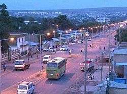
Jijiga has been the capital of the Somali Regional State since 1994. The capital had been Kebri Dahar (Qabridahare) until 1992, when it was moved to Gode. On April 1994, the capital was moved to Jijiga on account of political considerations.[2] Other major towns and cities include: Degehabur, Kebri Beyah, Kebri Dahar, Godey, Shilavo, Geladin, Feer-feer, Kelafo, and Werder.
Overview
The Somali Region covers much of the traditional territory of Ogaden and it formed a large part of the pre-1995 province of Hararghe. The population is predominantly Somali, and there is internal pressure to remove Ethiopian rule. There have been attempts to incorporate the area into a Greater Somalia. In the 1970s, Somalia invaded Ethiopia in support of a local guerrilla movement, igniting the Ogaden War, which Somalia lost due to timely military intervention from the Soviet Union and its ally Cuba. Despite this defeat, local groups still seek either to become part of Somalia or independent, frequently resorting to violence; one such action, the 2007 Abole oil field raid, has led to a series of military reprisals against civilians accused of supporting the Ogaden National Liberation Front.
Until its first-ever district elections in February 2004, Zonal and woreda administrators, and village chairmen were appointed by the Regional government. Senior politicians at the Regional level nominated their clients to the local government positions. In the 2004 local elections, each woreda elected a council including a spokesman, vice-spokesman, administrator, and vice-administrator. These councils have the responsibility of managing budgets and development activities within their respective districts.[3]
Demographics

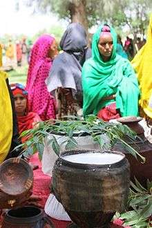
Based on the 2007 Census conducted by the Central Statistical Agency of Ethiopia (CSA), the Somali Region has a total population of 4,445,219, consisting of 2,472,490 men and 1,972,729 women; urban inhabitants number 623,004 or 14.02% of the population, a further 1,687,858 or 37.97% were pastoralists. With an estimated area of 279,252 square kilometers, this region has an estimated density of 15.9 people per square kilometer. For the entire region 685,986 households were counted, which results in an average for the Region of 6.8 persons to a household, with urban households having on average 6 and rural households 6.5 people. Ethnic groups include Somalis (97.2%), Amhara (0.66%), Oromo (0.46%), foreign-born Somalis (0.20%) and Gurages (0.12%). Somali was spoken by 96.82% of the inhabitants. Other major languages included Amharic (0.67%), and Oromifa (0.51%). 98.4% of the population is Muslim, 0.6% Orthodox Christian, and 1.0% are followers of all other religions.[4]
There are 8 refugee camps and 1 transit center, housing 212,967 refugees from Somalia, located in Somali Region.[5]
In the previous census, conducted in 1994, the region's population was reported to be 3,439,860, of which 1,875,996 were males and 1,563,864 were females. The urban residents of the Somali Region numbered 492,710 households, with an average of 6.6 persons per household; a high sex ratio of 120 males to 100 females was reported.[6] The ethnic groups included Somalis (96.23%), Oromo (2.25%), Amhara (0.69%), and Gurages (0.14%). Somali was the working language and is predominantly spoken within the Region, spoken by 95.9% of the inhabitants. Other major languages included Oromifa (2.24%), Amharic (0.92%), and Gurage (0.033%). 98.7% of the population were Muslim, 0.9% Orthodox Christian, and 0.3% are followers of other religions.[7]
According to the CSA, as of 2004, 38.98% of the total population had access to safe drinking water, of whom 21.32% were rural inhabitants and 77.21% were urban.[8] Values for other reported common indicators of the standard of living for Somali as of 2005 include the following: 71.8% of the inhabitants fall into the lowest wealth quintile; adult literacy for men is 22% and for women 9.8%; and the Regional infant mortality rate is 57 infant deaths per 1,000 live births, which is less than the nationwide average of 77; at least half of these deaths occurred in the infants’ first month of life.[9]
| Year | Ethiopia population | Somali Region population | % of Ethiopia | Source |
|---|---|---|---|---|
| 2007 | 73,918,505 | 4,439,147 | 6.01% | |
| 2012 | 84,320,987 | 5,148,989 | 6.11% | |
| 2013 | 86,613,986 | 5,318,000 | 6.14% | |
Agriculture
The CSA of Ethiopia estimated in 2005 that farmers in the Somali Region had a total of 459,720 cattle (representing 1.19%% of Ethiopia's total cattle), 463,000 sheep (2.66%), 650,970 goats (5.02%), 91,550 donkey (3.66%), 165,260 camels (36.2%), 154,670 poultry of all species (0.5%), and 5,330 beehives (0.12%). For nomadic inhabitants, the CSA provided two sets of estimates, one based on aerial surveys and the other on more conventional methodology:[10]
| Livestock | Aerial survey (conducted 5-23 Nov. 2003) | Conventional survey (conducted 11 Dec. 2003) |
|---|---|---|
| Cattle | 670,280 | 130,610 |
| Sheep | 6,410,800 | 250,110 |
| Goats | 5,525,460 | 177,580 |
| Camels | 1,041,870 | 64,510 |
| Donkeys | 42,640 | 14,290 |
| Mules | 430 | 160 |
| Horses | 50 | - |
Administrative zones
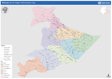
The Somali Region is subdivided into administrative zones:[11]
- Afder
- Werder (Doolo)
- Fafan (Jigjiga)
- Jarar (Degehabur)
- Korahe
- Liben
- Nogob (Fiq)
- Shabelle (Gode)
- Sitti (Shinile)
See also
References
- ↑ Lamberti, Marcello (1986). Map of Somali dialects in the Somali Democratic Republic. H. Buske. p. 15. ISBN 3871186902.
- ↑ "April 1994 Monthly Situation Report" United Nations Emergencies Unit for Ethiopia (accessed 29 May 2008)
- ↑ Tobias Hagmann, Mohamud H. Khalif: "State and Politics in Ethiopia's Somali region since 1991", Bildhaan: the International Journal of Somali Studies, 6 (2006), p. 33
- ↑ " Census 2007 Tables: Somali Region", Tables 2.1, 2.5, 3.1, 3.2, 3.4
- ↑ "Registered Somali Refugee Population". The UN Refugee Agency. July 31, 2014.
- ↑ The 1994 National Census was delayed in the Somali Region until 1997. The Census did not cover all parts of the Region, namely rural kebeles in the following Zones: Shinile, Fiq, Gode, and Afder. The 1994 Population and Housing Census of Ethiopia: Results for Somali Region, vol.1, Chapter 2 "Population size and characteristics"
- ↑ FDRE States: Basic Information - Somalia, Population (accessed 12 March 2006)
- ↑ "Households by sources of drinking water, safe water sources" CSA Selected Basic Welfare Indicators (accessed 28 January 2009)
- ↑ Macro International Inc. "2008. Ethiopia Atlas of Key Demographic and Health Indicators, 2005." (Calverton: Macro International, 2008), pp. 2, 3, 10 (accessed 28 January 2009)
- ↑ "CSA 2005 National Statistics", Tables D.4 - D.7.
- ↑ http://reliefweb.int/map/ethiopia/ethiopia-somali-region-administrative-map-05-jan-2015
Further reading
- Tobias Hagmann, "Beyond clannishness and colonialism: understanding political disorder in Ethiopia's Somali Region, 1991- 2004", Journal of Modern African Studies, 43 (2005), 509-536.
External links
- Map of Somali Region at UN-OCHA
- Map of Somali Region at DPPA of Ethiopia (PDF file)
- List of Ogaden-Somali Members of Ethiopian Parliament
- Official Website of Ogaden-Somali region of Ethiopia
- "Ethiopia: Rains pound Somali region as death toll rises" - UN IRIN
- "Floods plague Horn of Africa, wash away refugee shelters" - UN News
Zones of the Somali Region | ||
|---|---|---|
Woredas of the Somali Region | ||
|---|---|---|
| Afder Zone | ||
| Degehabur Zone | ||
| Fiq Zone | ||
| Gode Zone | ||
| Jijiga Zone | ||
| Korahe Zone | ||
| Liben Zone | ||
| Shinile Zone | ||
| Werder Zone | ||
Coordinates: 7°26′19″N 44°17′49″E / 7.4387305°N 44.2968750°E