Watsontown, Pennsylvania
| Watsontown, Pennsylvania | |
|---|---|
| Borough | |
|
Panorama of part of Watsontown from the Watsontown Cemetery (view full size) | |
| Nickname(s): Town of The Brothers Kramer | |
 Watsontown, Pennsylvania Location within the state of Pennsylvania | |
| Coordinates: 41°05′07″N 76°51′48″W / 41.08528°N 76.86333°WCoordinates: 41°05′07″N 76°51′48″W / 41.08528°N 76.86333°W | |
| Country | United States |
| State | Pennsylvania |
| County | Northumberland |
| Settled | 1794 |
| Incorporated (borough) | 1858 |
| Area | |
| • Total | 0.9 sq mi (2.4 km2) |
| • Land | 0.7 sq mi (1.8 km2) |
| • Water | 0.2 sq mi (0.6 km2) |
| Elevation[1] | 481 ft (146 m) |
| Population (2000) | |
| • Total | 2,254 |
| • Density | 3,161.9/sq mi (1,226.3/km2) |
| Time zone | Eastern (EST) |
| • Summer (DST) | EDT (UTC) |
| Zip code | 17777 |
| Area code(s) | 570 |
| Website | Watsontown |

Watsontown is a borough in Northumberland County, Pennsylvania, United States. The population was 2,254 at the 2000 census. It was named for John Watson, an early settler.
History
Land in the Watsontown area was first purchased by John Watson in 1792. The borough's post office was opened in 1828. There was a racetrack in Watsontown from 1830 to 1840. Railroad tracks first reached the borough in 1854. A sawmill was built in the area in 1856. Watsontown was a part of Turbot Township until its incorporation in 1867.[2]
Geography

Watsontown is located at 41°5′7″N 76°51′48″W / 41.08528°N 76.86333°W (41.085319, -76.863325).[3] According to the United States Census Bureau, the borough has a total area of 0.9 square miles (2.3 km2), of which, 0.7 square miles (1.8 km2) of it is land and 0.2 square miles (0.52 km2) of it (24.47%) is water.
Watsontown's terrain is almost entirely flat except for a hill in the eastern part of the borough. The borough's land is mostly residential, with some forest and industrial areas. The West Branch Susquehanna River borders the western part of Watsontown. The borough is served by Pennsylvania Route 44 and Pennsylvania Route 405.[4]
History
Watsontown has a rich history dating back to the late 18th century. Watsontown was an important part of a transportation network that included roads, railroads, and canals along the Susquehanna River. Additionally, Watsontown served as a stop along the Underground Railroad for slaves escaping to Canada. Many businesses were located here because of this. Part of the old canal and the tow path used by mules at the time is still visible along the river.
The Watsontown River Bridge was listed on the National Register of Historic Places in 1988.[5]
Demographics
| Historical population | |||
|---|---|---|---|
| Census | Pop. | %± | |
| 1870 | 1,181 | — | |
| 1880 | 1,481 | 25.4% | |
| 1890 | 2,157 | 45.6% | |
| 1900 | 1,898 | −12.0% | |
| 1910 | 1,950 | 2.7% | |
| 1920 | 2,153 | 10.4% | |
| 1930 | 2,248 | 4.4% | |
| 1940 | 2,282 | 1.5% | |
| 1950 | 2,327 | 2.0% | |
| 1960 | 2,431 | 4.5% | |
| 1970 | 2,514 | 3.4% | |
| 1980 | 2,366 | −5.9% | |
| 1990 | 2,310 | −2.4% | |
| 2000 | 2,255 | −2.4% | |
| 2010 | 2,351 | 4.3% | |
| Est. 2015 | 2,320 | [6] | −1.3% |
| Sources:[7][8][9] | |||
As of the census[8] of 2000, there were 2,254 people, 967 households, and 591 families residing in the borough. The population density was 3,161.9 people per square mile (1,226.3/km2). There were 1,017 housing units at an average density of 1,426.0 per square mile (553.1/km2). The racial makeup of the borough was 98.66% White, 0.40% African American, 0.18% Native American, 0.13% Asian, 0.13% Pacific Islander, 0.09% from other races, and 0.40% from two or more races. Hispanic or Latino of any race were 0.35% of the population. There are currently 8 registered sex offenders residing within the borough.
There were 967 households, out of which 25.1% had children under the age of 18 living with them, 48.5% were married couples living together, 10.1% had a female householder with no husband present, and 38.8% were non-families. 33.2% of all households were made up of individuals, and 15.9% had someone living alone who was 65 years of age or older. The average household size was 2.21 and the average family size was 2.81.
In the borough the population was spread out, with 21.1% under the age of 18, 7.2% from 18 to 24, 27.3% from 25 to 44, 23.1% from 45 to 64, and 21.3% who were 65 years of age or older. The median age was 41 years. For every 100 females there were 79.3 males. For every 100 females age 18 and over, there were 79.6 males.
The median income for a household in the borough was $31,094, and the median income for a family was $37,065. Males had a median income of $30,648 versus $20,972 for females. The per capita income for the borough was $16,110. About 8.4% of families and 11.2% of the population were below the poverty line, including 15.7% of those under age 18 and 10.6% of those age 65 or over.
References
- ↑ "Watsontown, Pennsylvania (PA 17777) profile: population, maps, real estate, averages, homes, statistics, relocation, travel, jobs, hospitals, schools, crime, moving, houses, news, sex offenders". Retrieved 18 October 2016.
- ↑ "Watsontown Borough, Northumberland County 17777". Retrieved 18 October 2016.
- ↑ "US Gazetteer files: 2010, 2000, and 1990". United States Census Bureau. 2011-02-12. Retrieved 2011-04-23.
- ↑ "Google Maps". Retrieved 18 October 2016.
- ↑ National Park Service (2010-07-09). "National Register Information System". National Register of Historic Places. National Park Service.
- ↑ "Annual Estimates of the Resident Population for Incorporated Places: April 1, 2010 to July 1, 2015". Retrieved July 2, 2016.
- ↑ "Census of Population and Housing". U.S. Census Bureau. Retrieved 11 December 2013.
- 1 2 "American FactFinder". United States Census Bureau. Retrieved 2008-01-31.
- ↑ "Incorporated Places and Minor Civil Divisions Datasets: Subcounty Resident Population Estimates: April 1, 2010 to July 1, 2012". Population Estimates. U.S. Census Bureau. Retrieved 11 December 2013.
External links
The Dr. Van Fleet Climbing Rose was created in Watsontown by Dr. Walter Van Fleet, a resident botanist.
A growing online book of Watsontown history MyWatsontown.com invites contributors.
Municipalities and communities of Northumberland County, Pennsylvania, United States | ||
|---|---|---|
| Cities | 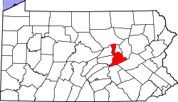 | |
| Boroughs | ||
| Townships | ||
| CDPs | ||
| Unincorporated communities |
| |