Washington Township, Preble County, Ohio
| Washington Township, Preble County, Ohio | |
|---|---|
| Township | |
|
The Daniel Christman Farmhouse, a historic site in the township | |
 Location of Washington Township in Preble County | |
| Coordinates: 39°46′48″N 84°38′53″W / 39.78000°N 84.64806°WCoordinates: 39°46′48″N 84°38′53″W / 39.78000°N 84.64806°W | |
| Country | United States |
| State | Ohio |
| County | Preble |
| Area | |
| • Total | 40.0 sq mi (103.7 km2) |
| • Land | 40.0 sq mi (103.7 km2) |
| • Water | 0.0 sq mi (0.0 km2) |
| Elevation[1] | 1,076 ft (328 m) |
| Population (2000) | |
| • Total | 2,104 |
| • Density | 52.6/sq mi (20.3/km2) |
| Time zone | Eastern (EST) (UTC-5) |
| • Summer (DST) | EDT (UTC-4) |
| FIPS code | 39-81564[2] |
| GNIS feature ID | 1086856[1] |

Washington Township is one of the twelve townships of Preble County, Ohio, United States. The 2000 census found 2,104 people in the township.[3]
Geography
Located in the north central part of the county, it borders the following townships:
- Monroe Township - north
- Harrison Township - northeast corner
- Twin Township - east
- Lanier Township - southeast
- Gasper Township - south
- Dixon Township - southwest
- Jackson Township - west
- Jefferson Township - northwest corner
The city of Eaton, the county seat of Preble County, is located in central Washington Township.
Name and history
Washington Township was organized in 1809,[4] and named for President George Washington.[5] It is one of forty-three Washington Townships statewide.[6]
Government
The township is governed by a three-member board of trustees, who are elected in November of odd-numbered years to a four-year term beginning on the following January 1. Two are elected in the year after the presidential election and one is elected in the year before it. There is also an elected township fiscal officer,[7] who serves a four-year term beginning on April 1 of the year after the election, which is held in November of the year before the presidential election. Vacancies in the fiscal officership or on the board of trustees are filled by the remaining trustees.
References
- 1 2 "US Board on Geographic Names". United States Geological Survey. 2007-10-25. Retrieved 2008-01-31.
- ↑ "American FactFinder". United States Census Bureau. Retrieved 2008-01-31.
- ↑ Preble County, Ohio — Population by Places Estimates Ohio State University, 2007. Accessed 15 May 2007.
- ↑ Kilbourn, John (1833). "The Ohio Gazetteer, or, a Topographical Dictionary". Scott and Wright. p. 476. Retrieved 12 December 2013.
- ↑ History of Preble County, Ohio, with illustrations and biographical sketches. H. Z. Williams & Bro. 1881. p. 37.
- ↑ "Detailed map of Ohio" (PDF). United States Census Bureau. 2000. Retrieved 2007-02-16.
- ↑ §503.24, §505.01, and §507.01 of the Ohio Revised Code. Accessed 4/30/2009.
External links
Municipalities and communities of Preble County, Ohio, United States | ||
|---|---|---|
| City | 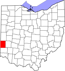 | |
| Villages | ||
| Townships | ||
| CDP | ||
| Unincorporated communities | ||
| Ghost towns | ||
| Footnotes | ‡This populated place also has portions in an adjacent county or counties | |