Wamsutter, Wyoming
| Wamsutter, Wyoming | |
|---|---|
| Town | |
 Location of Wamsutter, Wyoming | |
 Wamsutter, Wyoming Location in the United States | |
| Coordinates: 41°40′15″N 107°58′39″W / 41.67083°N 107.97750°WCoordinates: 41°40′15″N 107°58′39″W / 41.67083°N 107.97750°W | |
| Country | United States |
| State | Wyoming |
| County | Sweetwater |
| Area[1] | |
| • Total | 1.45 sq mi (3.76 km2) |
| • Land | 1.45 sq mi (3.76 km2) |
| • Water | 0 sq mi (0 km2) |
| Elevation | 6,772 ft (2,064 m) |
| Population (2010)[2] | |
| • Total | 451 |
| • Estimate (2012[3]) | 464 |
| • Density | 311.0/sq mi (120.1/km2) |
| Time zone | Mountain (MST) (UTC-7) |
| • Summer (DST) | MDT (UTC-6) |
| ZIP code | 82336 |
| Area code(s) | 307 |
| FIPS code | 56-81300[4] |
| GNIS feature ID | 1609172[5] |
Wamsutter is a town in Sweetwater County, Wyoming, United States. The population was 451 at the 2010 census.
The original inhabitants of the area were the Shoshone and Ute tribes. Westerners did not really settle in the county until the coming of the railroad in the 1860s.[6] Originally, the town was known as Washakie. Confusion with nearby Fort Washakie prompted an 1884 name change to Wamsutter, after a Union Pacific bridge engineer.[7]
The town, which bills itself as "The Gateway to the Red Desert" is located along Interstate 80 between Rawlins and Rock Springs, on the easternmost border of Sweetwater County. The natural gas industry has had a lot of influence on Wamsutter in recent years. Both in employment opportunities in the area, and by contributing to the community directly.[8]
Wamsutter is the largest settlement, and the only incorporated town in the Great Divide Basin.
Geography
Wamsutter is located at 41°40′15″N 107°58′39″W / 41.67083°N 107.97750°W (41.670839, -107.977457).[9]
According to the United States Census Bureau, the town has a total area of 1.45 square miles (3.76 km2), all of it land.[1]
Demographics
| Historical population | |||
|---|---|---|---|
| Census | Pop. | %± | |
| 1940 | 169 | — | |
| 1950 | 103 | −39.1% | |
| 1960 | 110 | 6.8% | |
| 1970 | 139 | 26.4% | |
| 1980 | 681 | 389.9% | |
| 1990 | 240 | −64.8% | |
| 2000 | 261 | 8.8% | |
| 2010 | 451 | 72.8% | |
| Est. 2015 | 493 | [10] | 9.3% |
BP has an office in Wamsutter, and the small town's population reportedly has increased to over 1200 over the past several years. Some estimates place the town's population over 6000 within the next ten years, and the town is struggling with this rapid growth, particularly due to the lack of available housing.[12]
2010 census
As of the census[2] of 2010, there were 451 people, 189 households, and 112 families residing in the town. The population density was 311.0 inhabitants per square mile (120.1/km2). There were 286 housing units at an average density of 197.2 per square mile (76.1/km2). The racial makeup of the town was 82.7% White, 0.7% African American, 2.9% Native American, 11.1% from other races, and 2.7% from two or more races. Hispanic or Latino of any race were 19.7% of the population.
There were 189 households of which 32.3% had children under the age of 18 living with them, 45.5% were married couples living together, 8.5% had a female householder with no husband present, 5.3% had a male householder with no wife present, and 40.7% were non-families. 29.6% of all households were made up of individuals and 3.2% had someone living alone who was 65 years of age or older. The average household size was 2.39 and the average family size was 2.96.
The median age in the town was 38.3 years. 25.7% of residents were under the age of 18; 6.7% were between the ages of 18 and 24; 27.9% were from 25 to 44; 33.6% were from 45 to 64; and 6% were 65 years of age or older. The gender makeup of the town was 58.1% male and 41.9% female.
2000 census
As of the census[4] of 2000, there were 261 people, 100 households, and 65 families residing in the town. The population density was 198.7 people per square mile (76.9/km²). There were 148 housing units at an average density of 112.6 per square mile (43.6/km²). The racial makeup of the town was 93.87% White, 0.77% Native American, 3.07% from other races, and 2.30% from two or more races. Hispanic or Latino of any race were 13.03% of the population.
There were 100 households out of which 38.0% had children under the age of 18 living with them, 54.0% were married couples living together, 8.0% had a female householder with no husband present, and 35.0% were non-families. 29.0% of all households were made up of individuals and 5.0% had someone living alone who was 65 years of age or older. The average household size was 2.54 and the average family size was 3.25.
In the town the population was spread out with 31.4% under the age of 18, 6.9% from 18 to 24, 34.9% from 25 to 44, 23.8% from 45 to 64, and 3.1% who were 65 years of age or older. The median age was 33 years. For every 100 females there were 119.3 males. For every 100 females age 18 and over, there were 126.6 males.
The median income for a household in the town was $35,625, and the median income for a family was $46,250. Males had a median income of $34,643 versus $20,000 for females. The per capita income for the town was $18,943. About 11.4% of families and 10.6% of the population were below the poverty line, including 20.6% of those under the age of eighteen and none of those sixty five or over.
Education
Public education in the town of Wamsutter is provided by Sweetwater County School District #1. Students in grades K-8 attend Desert School in Wamsutter, which is divided into elementary (grades K-6) and middle school (grades 7-8) campuses. Upon the completion of 8th grade, students attend Rawlins High School (grades 9-12; part of Carbon County School District #1) by agreement of the respective boards of trustees Today's Wamsutter is a quiet reflection of the town it once was during the early days of western expansion. During the mid-1800s, Wamsutter was a vibrant cattle town.
References
- 1 2 "US Gazetteer files 2010". United States Census Bureau. Retrieved 2012-12-14.
- 1 2 "American FactFinder". United States Census Bureau. Retrieved 2012-12-14.
- ↑ "Population Estimates". United States Census Bureau. Retrieved 2013-06-01.
- 1 2 "American FactFinder". United States Census Bureau. Retrieved 2008-01-31.
- ↑ "US Board on Geographic Names". United States Geological Survey. 2007-10-25. Retrieved 2008-01-31.
- ↑ http://www.sweetwatermuseum.org/
- ↑ http://www.ultimatewyoming.com/sectionpages/sec5/wamsutter.html
- ↑ http://casperstartribune.net/articles/2008/09/17/news/wyoming/567cba04cbcc32f9872574c70006245c.prt
- ↑ "US Gazetteer files: 2010, 2000, and 1990". United States Census Bureau. 2011-02-12. Retrieved 2011-04-23.
- ↑ "Annual Estimates of the Resident Population for Incorporated Places: April 1, 2010 to July 1, 2015". Retrieved July 2, 2016.
- ↑ "Census of Population and Housing". Census.gov. Retrieved June 4, 2015.
- ↑ University of Wyoming
Municipalities and communities of Sweetwater County, Wyoming, United States | ||
|---|---|---|
| Cities | 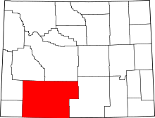 | |
| Towns | ||
| CDPs | ||
| Unincorporated communities | ||
| Ghost towns | ||