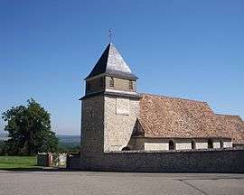
Villers-sur-le-Roule
| Villers-sur-le-Roule | ||
|---|---|---|
 | ||
| ||
 Villers-sur-le-Roule | ||
|
Location within Normandy region  Villers-sur-le-Roule | ||
| Coordinates: 49°11′44″N 1°19′36″E / 49.1956°N 1.3267°ECoordinates: 49°11′44″N 1°19′36″E / 49.1956°N 1.3267°E | ||
| Country | France | |
| Region | Normandy | |
| Department | Eure | |
| Arrondissement | Les Andelys | |
| Canton | Gaillon-Campagne | |
| Intercommunality | Eure-Madrie-Seine | |
| Government | ||
| • Mayor (2008–2014) | Denise Brockaert | |
| Area1 | 4.32 km2 (1.67 sq mi) | |
| Population (2008)2 | 683 | |
| • Density | 160/km2 (410/sq mi) | |
| Time zone | CET (UTC+1) | |
| • Summer (DST) | CEST (UTC+2) | |
| INSEE/Postal code | 27691 / 27940 | |
| Elevation |
7–127 m (23–417 ft) (avg. 123 m or 404 ft) | |
|
1 French Land Register data, which excludes lakes, ponds, glaciers > 1 km² (0.386 sq mi or 247 acres) and river estuaries. 2 Population without double counting: residents of multiple communes (e.g., students and military personnel) only counted once. | ||
.svg.png)
Villers-sur-le-Roule is a commune in the Eure department in Haute-Normandie in northern France.
Population
| Historical population | ||
|---|---|---|
| Year | Pop. | ±% |
| 1793 | 285 | — |
| 1800 | 273 | −4.2% |
| 1806 | 273 | +0.0% |
| 1821 | 293 | +7.3% |
| 1831 | 322 | +9.9% |
| 1836 | 337 | +4.7% |
| 1841 | 340 | +0.9% |
| 1846 | 358 | +5.3% |
| 1851 | 309 | −13.7% |
| 1856 | 312 | +1.0% |
| 1861 | 295 | −5.4% |
| 1866 | 305 | +3.4% |
| 1872 | 287 | −5.9% |
| 1876 | 286 | −0.3% |
| 1881 | 234 | −18.2% |
| 1886 | 227 | −3.0% |
| 1891 | 229 | +0.9% |
| 1896 | 202 | −11.8% |
| 1901 | 204 | +1.0% |
| 1906 | 217 | +6.4% |
| 1911 | 215 | −0.9% |
| 1921 | 208 | −3.3% |
| 1926 | 225 | +8.2% |
| 1931 | 207 | −8.0% |
| 1936 | 204 | −1.4% |
| 1946 | 197 | −3.4% |
| 1954 | 185 | −6.1% |
| 1962 | 204 | +10.3% |
| 1968 | 208 | +2.0% |
| 1975 | 331 | +59.1% |
| 1982 | 470 | +42.0% |
| 1990 | 540 | +14.9% |
| 1999 | 607 | +12.4% |
| 2008 | 683 | +12.5% |
See also
References
| Wikimedia Commons has media related to Villers-sur-le-Roule. |
This article is issued from Wikipedia - version of the 2/11/2016. The text is available under the Creative Commons Attribution/Share Alike but additional terms may apply for the media files.
