Uvalda, Georgia
| Uvalda, Georgia | |
|---|---|
| City | |
|
Uvalda City Hall | |
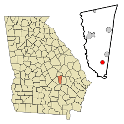 Location in Montgomery County and the state of Georgia | |
| Coordinates: 32°2′16″N 82°30′32″W / 32.03778°N 82.50889°WCoordinates: 32°2′16″N 82°30′32″W / 32.03778°N 82.50889°W | |
| Country | United States |
| State | Georgia |
| County | Montgomery |
| Government | |
| • Mayor | Paul Bridges |
| Area | |
| • Total | 1.9 sq mi (5 km2) |
| • Land | 1.9 sq mi (5 km2) |
| • Water | 0 sq mi (0 km2) |
| Elevation | 177 ft (54 m) |
| Population (2000) | |
| • Total | 530 |
| • Density | 278.9/sq mi (106/km2) |
| Time zone | Eastern (EST) (UTC-5) |
| • Summer (DST) | EDT (UTC-4) |
| ZIP code | 30473 |
| Area code(s) | 912 |
| FIPS code | 13-78744[1] |
| GNIS feature ID | 0324646[2] |

Uvalda is a city in Montgomery County, Georgia, United States. The population was 530 at the 2000 census. It is part of the Vidalia Micropolitan Statistical Area.
Geography
Uvalda is located at 32°2′16″N 82°30′32″W / 32.03778°N 82.50889°W (32.037903, -82.508789).[3]
According to the United States Census Bureau, the city has a total area of 1.9 square miles (4.9 km2), all land.
Demographics
| Historical population | |||
|---|---|---|---|
| Census | Pop. | %± | |
| 1920 | 240 | — | |
| 1930 | 513 | 113.8% | |
| 1940 | 592 | 15.4% | |
| 1950 | 511 | −13.7% | |
| 1960 | 589 | 15.3% | |
| 1970 | 663 | 12.6% | |
| 1980 | 646 | −2.6% | |
| 1990 | 561 | −13.2% | |
| 2000 | 530 | −5.5% | |
| 2010 | 598 | 12.8% | |
| Est. 2015 | 585 | [4] | −2.2% |
As of the census[1] of 2000, there were 530 people, 201 households, and 147 families residing in the city. The population density was 277.0 people per square mile (107.1/km²). There were 252 housing units at an average density of 131.7 per square mile (50.9/km²). The racial makeup of the city was 60.19% White, 38.49% African American, and 1.32% from two or more races. Hispanic or Latino of any race were 1.51% of the population.
There were 201 households out of which 36.8% had children under the age of 18 living with them, 51.7% were married couples living together, 17.4% had a female householder with no husband present, and 26.4% were non-families. 23.9% of all households were made up of individuals and 10.9% had someone living alone who was 65 years of age or older. The average household size was 2.64 and the average family size was 3.11.
In the city the population was spread out with 28.9% under the age of 18, 7.2% from 18 to 24, 27.5% from 25 to 44, 23.2% from 45 to 64, and 13.2% who were 65 years of age or older. The median age was 35 years. For every 100 females there were 89.3 males. For every 100 females age 18 and over, there were 83.0 males.
The median income for a household in the city was $31,513, and the median income for a family was $36,806. Males had a median income of $23,750 versus $19,250 for females. The per capita income for the city was $15,217. About 12.9% of families and 19.3% of the population were below the poverty line, including 24.6% of those under age 18 and 23.2% of those age 65 or over.
Notable people
- Wally Moses, Major League Baseball outfielder
References
- 1 2 "American FactFinder". United States Census Bureau. Retrieved 2008-01-31.
- ↑ "US Board on Geographic Names". United States Geological Survey. 2007-10-25. Retrieved 2008-01-31.
- ↑ "US Gazetteer files: 2010, 2000, and 1990". United States Census Bureau. 2011-02-12. Retrieved 2011-04-23.
- ↑ "Annual Estimates of the Resident Population for Incorporated Places: April 1, 2010 to July 1, 2015". Retrieved July 2, 2016.
- ↑ "Census of Population and Housing". Census.gov. Retrieved June 4, 2015.
External links
Municipalities and communities of Montgomery County, Georgia, United States | ||
|---|---|---|
| Cities | 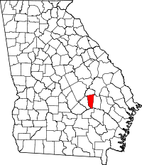 | |
| Towns | ||
| Footnotes | ‡This populated place also has portions in an adjacent county or counties | |