Utica, Pennsylvania
| Utica, Pennsylvania | |
|---|---|
| Borough | |
 Utica, Pennsylvania | |
| Coordinates: 41°26′11″N 79°57′23″W / 41.43639°N 79.95639°WCoordinates: 41°26′11″N 79°57′23″W / 41.43639°N 79.95639°W | |
| Country | United States |
| State | Pennsylvania |
| County | Venango |
| Settled | 1830 |
| Incorporated | 1863 |
| Government | |
| • Type | Borough Council |
| Area | |
| • Total | 1.4 sq mi (3.6 km2) |
| Population (2000) | |
| • Total | 211 |
| • Density | 157.2/sq mi (60.8/km2) |
| Time zone | Eastern (EST) (UTC-5) |
| • Summer (DST) | EDT (UTC-4) |
| Zip code | 16362 |
| Area code(s) | 814 |
Utica is a borough in Venango County, Pennsylvania, United States. The population was 211 at the 2000 census.
Geography
Utica is located at 41°26′11″N 79°57′23″W / 41.43639°N 79.95639°W (41.436319, -79.956341).[1]
According to the United States Census Bureau, the borough has a total area of 1.4 square miles (3.6 km2), of which, 1.3 square miles (3.4 km2) of it is land and 0.04 square miles (0.10 km2) of it (2.90%) is water.
Demographics
| Historical population | |||
|---|---|---|---|
| Census | Pop. | %± | |
| 1870 | 225 | — | |
| 1880 | 301 | 33.8% | |
| 1890 | 321 | 6.6% | |
| 1900 | 268 | −16.5% | |
| 1910 | 265 | −1.1% | |
| 1920 | 251 | −5.3% | |
| 1930 | 206 | −17.9% | |
| 1940 | 216 | 4.9% | |
| 1950 | 264 | 22.2% | |
| 1960 | 274 | 3.8% | |
| 1970 | 281 | 2.6% | |
| 1980 | 255 | −9.3% | |
| 1990 | 242 | −5.1% | |
| 2000 | 211 | −12.8% | |
| 2010 | 189 | −10.4% | |
| Est. 2015 | 184 | [2] | −2.6% |
| Sources:[3][4][5] | |||
As of the census[4] of 2000, there were 211 people, 79 households, and 57 families residing in the borough. The population density was 157.2 people per square mile (60.8/km²). There were 122 housing units at an average density of 90.9 per square mile (35.2/km²). The racial makeup of the borough was 100.00% White.
There were 79 households out of which 43.0% had children under the age of 18 living with them, 48.1% were married couples living together, 16.5% had a female householder with no husband present, and 27.8% were non-families. 26.6% of all households were made up of individuals and 8.9% had someone living alone who was 65 years of age or older. The average household size was 2.67 and the average family size was 3.26.
In the borough the population was spread out with 36.5% under the age of 18, 3.3% from 18 to 24, 25.1% from 25 to 44, 23.2% from 45 to 64, and 11.8% who were 65 years of age or older. The median age was 34 years. For every 100 females there were 83.5 males. For every 100 females age 18 and over, there were 88.7 males.
The median income for a household in the borough was $22,875, and the median income for a family was $23,929. Males had a median income of $29,063 versus $19,250 for females. The per capita income for the borough was $11,435. About 30.4% of families and 29.2% of the population were below the poverty line, including 48.1% of those under the age of eighteen and none of those sixty five or over.
References
- ↑ "US Gazetteer files: 2010, 2000, and 1990". United States Census Bureau. 2011-02-12. Retrieved 2011-04-23.
- ↑ "Annual Estimates of the Resident Population for Incorporated Places: April 1, 2010 to July 1, 2015". Retrieved July 2, 2016.
- ↑ "Census of Population and Housing". U.S. Census Bureau. Retrieved 11 December 2013.
- 1 2 "American FactFinder". United States Census Bureau. Retrieved 2008-01-31.
- ↑ "Incorporated Places and Minor Civil Divisions Datasets: Subcounty Resident Population Estimates: April 1, 2010 to July 1, 2012". Population Estimates. U.S. Census Bureau. Retrieved 11 December 2013.
Municipalities and communities of Venango County, Pennsylvania, United States | ||
|---|---|---|
| Cities | 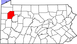 | |
| Boroughs | ||
| Townships | ||
| CDPs | ||
| Unincorporated communities | ||
| Ghost town | ||
| Footnotes | ‡This populated place also has portions in an adjacent county or counties | |