Ullahpara Upazila
| Ullahpara উল্লাপাড়া | |
|---|---|
| Upazila | |
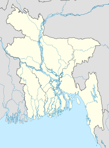 Ullahpara Location in Bangladesh | |
| Coordinates: 24°19.2′N 89°34′E / 24.3200°N 89.567°ECoordinates: 24°19.2′N 89°34′E / 24.3200°N 89.567°E | |
| Country |
|
| Division | Rajshahi Division |
| District | Sirajganj District |
| Area | |
| • Total | 414.43 km2 (160.01 sq mi) |
| Population (1991) | |
| • Total | 399,074 |
| • Density | 960/km2 (2,500/sq mi) |
| Time zone | BST (UTC+6) |
| Postal code | [6760] |
| Website | Official Map of Ullahpara |
Ullahpara (Bengali: উল্লাপাড়া) is an Upazila of Sirajganj District in the Division of Rajshahi, Bangladesh.[1] Ullahpara is known as the gateway to North Bengal as the intersection of Dhaka-Rangpur and Dhaka-Rajshahi highways at Hatikumrul falls within it.
History
The exact history of the development of the Ullapara region is not known, but according to most geologists, in 4500 B.C., the land of Varendra was built with parts of Dinajpur, Joypurhat, Bogra and Rajshahi and the west parts of Pabna. Pabna and Mymensingh were built for centuries by deposition of alluvial soil by these two rivers. At that time, there was no Jamuna River, and Sirajganj and Tangail were part of Mymensingh. According to the Chinese travelerHiuen Tsang, the people survived in Sirajgonj for seven centuries before the river Jamuna began to separate this area from greater Mymensingh. During those times the newly formed land of this region was under water for around eight or nine months of the year. According to Hiuen Sang, the western bank of the Karotoa river was in the Pundrabardhan Kingdom. Thus we can assume that, Ullapara was also in this kingdom at the time. A connection was established with Ullahpara by the flow of water into the land in the era of Muslim Administration (1204-1757) and the time of British (1757-1947), and finally a business center was established. Later, in 1875 a thana (police station) was established here and finally on July 2, 1983 it was recognized as an Upazilla.
Geography
Ullahpara is located at 24°19′10″N 89°34′00″E / 24.3194°N 89.5667°E, on the western bank of the river Norway. It has 69,479 household units and a total area of 414.43 km². Ullapara was built on alluvial soil deposited by Padma, Jamuna, and a few other rivers like Brahmaputra, Karotoa, Fulzor, etc.. Raiganj and Tarash upazila are to the north, Tarash and Bhangura are to the west, Faridpur and Shahjadpur are to the south, and Belkuchi and Kamarkhanda are to the east of the Upazila. It's estimated to be 10–12 feet above sea-level. The rivers that flow through it are Karotoa, Fulzor, Jopjopia, and Kamla Dargadoh, to name a few. The highest temperature is 35° Celsius and the lowest is 21° Celsius. The annual average rainfall in this area ranges from 170–190 cm.
Demographics
As of the 1991 Bangladesh census, Ullapara has a population of 399,074. Males constitute 51.13% of the population, and females 48.87%. Its 18+ population is 192,188. Ullapara has an average literacy rate of 39.61% (7+ years), male 44.81%, and female 34.09%, compared to the national average of 82.4%. Marks of war of liberation Matrys' memorial monument at Ghatina. [2]
Points of interest
Ria Rupon park is a spectacular place to make a visit with friends and family. Ghatina railway bridge area is also a place to make a fresh visit. The sontola bridge over the Karotoa river is also a beautiful place.
Administration
Upazila Nirbahi Officer is the administrative head of the Upazila posted by the government, while Upazila Chairman is the elected representative of the people, who is supposed to work for the development and welfare of the Upazila. Advocate Maruf bin habib is the Upazila's Chairman. Mr. S.M Nazrul Islam is Municipal Mayor of Ullapara. Ullapara has 13 Unions/Wards, 264 Mauzas/Mahallas, and 425 villages. Each Union in turn has its elected Chairman.
Transport
The Riverine route was the only effective route of communication in the earlier days. Communication over the whole upazila is quite good nowadays. The Dhaka-Rangpur highway and Dhaka-Rajshahi railway connect the upazila (Village:Newargacha) with the other parts of the country. There is a good network of road communication throughout. After the commissioning of the rail-road bridge (the largest and longest in Bangladesh) over the river Jamuna at the end of last century, it takes around 3 hours now to reach Dhaka (the capital of the country) by road. Any train over Bangabandhu bridge has stpoage in Ullapara railway station. Shyamolipara bus stand is main bus stopage for Ullapara.
Education
People were deprived of modern education until the beginning of the Twentieth Century. The oldest institution for secondary education, Ullapara Merchant's Pilot High English School, was established in 1906 (by the jute merchants of the then small river port). Salop High School was established in 1905 (by landlord ). Subsequently other educational institutions were set up, such as: -Kaliakoir Adarsha High School, Ullapara Adarsha High School, Ullapara Degree College, Govt. Akbar Ali College, Ullapara Science College, Momena Ali Science School, Hamida Pilot High School & College, Barahar School and College, Ghona Kuchia Mara College, Solonga College, Rajman High School, Baropangashi High School K.A.M High School, Ideal High School, Scholastica Institute(Learning & Skill Development), Dharoil High School, Chengtia Technical and Business Management College, Sholi Banani High School, Headmaster Name Dhab, Newargacha Girls school, Lahiri Mohanpur K.M. Institute etc. Akbar Ali College was the first College in the Upazila, established in 1970 by enthusiastic scholars and students of the region. The College was nationalised afterwards. There are 15 private universities, 43 high schools, 146 govt. primary schools, 105 private(Reg.) primary schools and 106 Brac schools in Ullapara. The people (the majority being Muslims) are also interested in the traditional Islamic system of education 'Education of Madrasha'. So, there are- 1 Kamil, 6 Fajil, 4 Alim, 42 Dakhil and 75 Eftadaye madrasha here. Md. Pear Mahmud, Md. Abul Kashem Mia, Md. Fazlul Karim Chowdhury is the 1st Graduate(1962) of Ullapara Thana. Md. Pear Mahmud is a retired district account's officer(DAO), Abul Kashem Mia is a retired headmaster & Md. Fazlul Karim Chowdhury is a retired general manager of habib bank, [Dhaka].
Notable residents
Abdur Rashid Tarkabagish (Politician in British regime), Abdul Latif Mirza (Freedom fighter and MP), H T Imam (First cabinet secretary of the country and current political advisor of the Prime Minister), Akbar Ali (Educationist and MP), Fazle Lohani (Media Personnel), Sufian Khondker (Vice President and National Technology Director for Water Management at ARCADIS), Kader Khan.
Rajendra Lahiri was a prominent Indian independence movement activist.
See also
References
| Wikimedia Commons has media related to Ullahpara Upazila. |
- ↑ Md. Ruhul Amin (2012), "Ullahpara Upazila", in Sirajul Islam and Ahmed A. Jamal, Banglapedia: National Encyclopedia of Bangladesh (Second ed.), Asiatic Society of Bangladesh
- ↑ "Population Census Wing, BBS.". Archived from the original on 2005-03-27. Retrieved November 10, 2006.
| Upazila/Thana: | ||
|---|---|---|
Headquarters: Rajshahi | ||
| Bogra District |  | |
| Joypurhat District | ||
| Naogaon District | ||
| Natore District | ||
| Nawabganj District | ||
| Pabna District | ||
| Rajshahi District | ||
| Sirajganj District | ||