Tanore Upazila
| Tanore তানোর | |
|---|---|
| Upazila | |
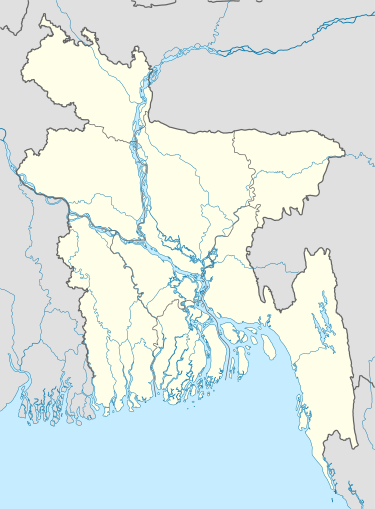 Tanore Location in Bangladesh | |
| Coordinates: 24°36′10″N 88°34′50″E / 24.6028°N 88.5806°ECoordinates: 24°36′10″N 88°34′50″E / 24.6028°N 88.5806°E | |
| Country |
|
| Division | Rajshahi Division |
| District | Rajshahi District |
| Area | |
| • Total | 295.40 km2 (114.05 sq mi) |
| Population (2011) | |
| • Total | 191,330 |
| • Density | 648/km2 (1,680/sq mi) |
| Time zone | BST (UTC+6) |
| Website | Official Map of Tanore |
Tanore (Bengali: তানোর) is an Upazila of Rajshahi District in the Division of Rajshahi, Bangladesh.Tanore police station was established in February 1869 and it was declared sub-district or upazila in 1983.[1]
Geography
Tanore is located at 24°36′10″N 88°34′50″E / 24.6028°N 88.5806°E.It is 30 kilometer away from Rajshahi city.It is surrounded by Niamatpur Upazila and Manda Upazila of Naogaon District to the north, Mohanpur Upazila of Rajshahi district to the east, Paba Upazila and Godagari Upazila of Rajshahi district to the south, Chapai Nawabganj Sadar Upazila and Nachol Upazila of Chapai Nawabganj District to the west.There is a river at Tanore Upazila called Shiba River. It has 47425 households and total area 295.40 km². The main river is the Shiba.[2]


Demographics
At the 2011 Bangladesh census, Tanore has a population of 191,330 (males 94041 and females 97289). Males constitute 49.15% of the population, and females 50.85%.Population density is 648/km2. Tanore has an average literacy rate of 48.8%(males 51.1% and Females 46.7%) (7+ years). According to religion Muslims are 162018 (84.68%), Hindus 15152 (7.92%), Christians 9329 (4.87%), Buddhists 17 (0.01%), Others 4814 (2.52%). Indeginous tribe Santhal people live in this sub-district. There are 510 mosques, 200 Eid-gahs, 22 temples, 16 Churches, 1 Pagoda.[3]
Economy
The total agricultural area is around 22,665 hectare of which cultivable land area is 21,295 hectare & forest land area is 100 kilometer. The main crops of this sub-district are paddy, potato, wheat, maize, tomato, brinjal, onion, garlic etc. Rice is the staple food of the people of this area. Mango and Jack fruits are produced in this area very well.
Administration
Tanore has 2 Municipalities, 7 Unions/Wards, 211 Mauzas/Mahallas,169 villages and 47,425 households.
Unions are
- Kalma Union
- Badhair Union
- Pachandar Union
- Saranjai Union
- Talanda Union
- Kamargaon Union
- Chanduria Union
Two municipalities are:
- Tanore
- Mundumala
Education
The Literacy Rate of Tanore upazila is 48.8%. There are 127 primary schools(49 government and 78 non-government), 62 high/junior-high schools, 18 colleges(including 2 technical and vocational colleges) and 28 madrasas.
Transport
Tanore sub-district can be reached by road but there is no railway connection with this sub-district.Tanore Upazila Parisad is approximately 30 kilometer away from Rajshahi Bus stand.In rainy season Shiba river is used to transport goods to this upazila. There is 216 km metallic road, 51 km semi-metallic road and 427 km unmetalled road.
See also
References
- ↑ "Tanore Upazila". Banglapedia. Retrieved 22 July 2016.
- ↑ Asadullah Mamun Hasan (2012). "Tanore Upazila". In Sirajul Islam and Ahmed A. Jamal. Banglapedia: National Encyclopedia of Bangladesh (Second ed.). Asiatic Society of Bangladesh.
- ↑ এক নজরে তানোর উপজেলা [Tanore Upazila at a Glance]. Tanore Upazila (in Bangla). Retrieved 15 December 2014.
External links
| Upazila/Thana: | ||
|---|---|---|
Headquarters: Rajshahi | ||
| Bogra District |  | |
| Joypurhat District | ||
| Naogaon District | ||
| Natore District | ||
| Nawabganj District | ||
| Pabna District | ||
| Rajshahi District | ||
| Sirajganj District | ||