Tropic of Capricorn
Coordinates: 23°26′14″S 0°0′0″W / 23.43722°S -0.00000°E


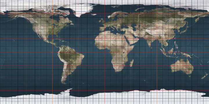
.jpg)


The Tropic of Capricorn (or the Southern Tropic) is the circle of latitude that contains the subsolar point on the December (or southern) solstice. It is thus the southernmost latitude where the Sun can be directly overhead. Its northern equivalent is the Tropic of Cancer.
The Tropic of Capricorn is one of the five major circles of latitude that mark maps of the Earth. As of 22 December 2016, its latitude is 23°26′13.5″ (or 23.43708°) [1] south of the equator, but it is very gradually moving northward, currently at the rate of 0.47 arcseconds, or 15 metres, per year.[2]
Geography and environment
The Tropic of Capricorn is the dividing line between the Southern Temperate Zone to the south and the tropics to the north. The northern hemisphere equivalent of the Tropic of Capricorn is the Tropic of Cancer.
The position of the Tropic of Capricorn is not fixed, but rather it varies in a complex manner over time; see under circles of latitude for information.
In Australia, areas on the Tropic have some of the most variable rainfall in the world[3] and thus even the wetter areas cannot be generally farmed, since irrigation sources invariably dry up in drought years. In southern Africa, where rainfall is more reliable, farming is possible, though yields are low even with fertilisers.
In South America, whilst in the continental cratons soils are almost as old as in Australia and Southern Africa, the presence of the geologically young and evolving Andes means that this region is on the western side of the subtropical anticyclones and thus receives warm and humid air from the Atlantic Ocean. As a result, areas in Brazil adjacent to the Tropic are extremely important agricultural regions, producing large quantities of crops such as sugarcane, and the natural rainforest vegetation has been almost entirely cleared, except for a few remaining patches of Atlantic Forest. In and west of the Andes, however, the Humboldt Current makes conditions extremely arid, creating the Atacama Desert, one of the driest in the world, so that no glaciers exist between Volcán Sajama at 18˚30'S and Cerro Tres Cruces at 27˚S.[4] Vegetation here is almost non-existent, though on the eastern slopes of the Andes rainfall is adequate for rainfed agriculture.
Around the world
Starting at the Prime Meridian and heading eastwards, the Tropic of Capricorn passes through 10 countries:
Places located along the Tropic of Capricorn
The following cities and landmarks are either located near the Tropic of Capricorn, or the tropic passes through them.
|
|
|
 Atsimo-Andrefana Region, Madagascar
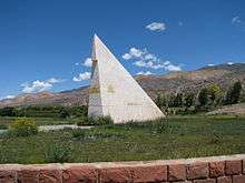
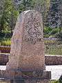 The Tropic of Capricorn marked in Jujuy Province in northern Argentina
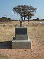 Monument marking the Tropic of Capricorn as it passes through Botswana
.jpg) A sign marking the Tropic of Capricorn as it passes through Namibia
A sign marking the Tropic of Capricorn as it passes through Namibia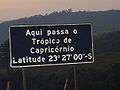 Roadway plaque marking the Tropic of Capricorn in the city of Santana do Parnaíba, Brazil, at the correct latitude for year 1917.
 Roadside monument marking Tropic of Capricorn in Rockhampton, Queensland, Australia, 28 January 2005
 Monument marking Tropic of Capricorn in Rockhampton, Queensland, Australia, 1970
 Road sign marking Tropic of Capricorn in Western Australia, Australia, 26 August 2008
 Monument marking the Tropic of Capricorn just north of Alice Springs, Northern Territory, Australia

List of countries entirely south of the Tropic of Capricorn
As the major portion of earth's land is located in the Northern Hemisphere there are only four countries entirely south of the Tropic of Capricorn (there are 74 countries entirely north of the Tropic of Cancer):
Name
The Tropic of Capricorn is so named because, when it was named about 2,000 years ago, the sun was also in the direction of the constellation Capricornus (capricorn is Latin for goat horn) at the December solstice. In modern times the sun appears in the constellation Sagittarius during this time. The change is due to precession of the equinoxes. The word "tropic" itself comes from the Greek trope (τροπή), meaning turn, change in direction or circumstances, referring to the fact that the sun appears to "turn back" at the solstices.
See also
- 23rd parallel south
- 24th parallel south
- Tropic of Cancer
- Arctic Circle
- Antarctic Circle
- Axial tilt
- Equator
- Milankovitch cycles
- Capricornus
External links
| Wikimedia Commons has media related to Tropic of Capricorn. |
| Look up tropic of capricorn in Wiktionary, the free dictionary. |
- Temporal Epoch Calculations
- Useful constants" See: Obliquity of the ecliptic
Notes
- ↑ obliquity of the ecliptic (Eps Mean)
- ↑ Montana State University: Milankovitch Cycles & Glaciation
- ↑ Geographical Patterning of Interannual Rainfall Variability in the Tropics and Near Tropics
- ↑ Exposure dating of Late Glacial and pre-LGM moraines in the Cordon de Doña Rosa, Northern/Central Chile (~31°S)
- ↑ The Cook islands, Tokelau and Niue, which are part of the Realm of New Zealand lie above the Tropic of Capricorn.
|