Tres Piedras, New Mexico

Tres Piedras (Spanish: three rocks)[1] is an unincorporated community in northern New Mexico adjacent to Carson National Forest.
Geography
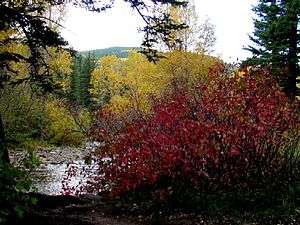
Tres Piedras is located about 30 miles northwest of Taos, New Mexico and west of the Rio Grande on U.S. Route 64. At about 8,000 feet (2,400 m) in altitude, it is located within the southern portion of the San Juan Range of the Rocky Mountains. It is on the western edge of a sagebrush plain, with ponderosa pines growing throughout the village.[2] The village is adjacent to the Carson National Forest.[3]
History
The village, named for three outcroppings of granite, was settled in 1879 and became a small ranching and timber village.[2]
Between 1880 and 1941 Tres Piedras was a railroad stop on the narrow gauge Chili Line railroad that operated between Antonito, Colorado and Santa Fe, New Mexico. The village still has the old railroad water tower.[3]
Recreation
It is a granite climbing area, one of two west of the Rio Grande in New Mexico.[1]
References
- 1 2 Dennis R. Jackson (1 January 2006). New Mexico. Globe Pequot Press. p. 52. ISBN 978-0-7627-3132-9.
- 1 2 Laurence Parent (11 January 2011). Scenic Driving New Mexico, 3rd. Globe Pequot. p. 18. ISBN 978-0-7627-6762-5.
- 1 2 Laurence Parent (11 January 2011). Scenic Driving New Mexico, 3rd. Globe Pequot. p. 19. ISBN 978-0-7627-6762-5.
Further reading
- Adelaide K. Bullen; Ripley P. Bullen (1942). A Pueblo Cave Site at Tres Piedras, New Mexico.
Coordinates: 36°38′56.04″N 105°58′2.91″W / 36.6489000°N 105.9674750°W
Municipalities and communities of Taos County, New Mexico, United States | ||
|---|---|---|
| Towns |  | |
| Villages | ||
| CDPs | ||
| Other unincorporated communities | ||
| Indian reservation | ||