Alaska Route 7
| ||||
|---|---|---|---|---|
|
South / North Tongass Highway Mitkof Highway / Nordic Drive Egan Drive / Glacier Highway Haines Highway | ||||
| Route information | ||||
| Maintained by Alaska DOT&PF | ||||
| Tongass Highway segment | ||||
| Length: | 37.1 mi (59.7 km) | |||
| South end: | Dead end near Ketchikan | |||
| Major junctions: |
| |||
| North end: | Dead end near Ward Cove | |||
| Mitkof Highway segment | ||||
| Length: | 34.21 mi (55.06 km) | |||
| South end: | Dead end on Mitkof Island | |||
| Major junctions: |
| |||
| North end: | Sandy Beach Road in Petersburg | |||
| Egan Drive / Glacier Highway segment | ||||
| Length: | 39.01 mi (62.78 km) | |||
| South end: | Franklin Street in Juneau | |||
| Major junctions: |
Juneau-Douglas Bridge in Juneau | |||
| North end: | Dead end in Juneau | |||
| Haines Highway segment | ||||
| Length: | 39.7 mi (63.9 km) | |||
| South end: | Front Street in Haines | |||
| North end: | Haines Highway on the Alaska—British Columbia border | |||
| Location | ||||
| Boroughs: | Ketchikan Gateway, Unorganized, Juneau, Haines | |||
| Highway system | ||||
| ||||

Alaska Route 7 (abbreviated as AK-7) is a state highway in the Alaska Panhandle of the U.S. state of Alaska. It consists of four unconnected pieces, serving some of the Panhandle communities at which the Alaska Marine Highway ferries stop, and connecting to the Alaska Highway in Yukon via the Haines Highway.
Route description
According to Alaska's supplement to the Federal Manual on Uniform Traffic Control Devices, AK-7 follows (from south to north):[1]
- South Tongass Highway, North Tongass Highway (Ketchikan)
- Nordic Drive, Mitkoff Highway (Petersburg)
- Glacier Highway, Egan Drive (Juneau)
- Haines Highway, Haines to Border
No other segments are shown on maps.[2][3][4][5][6]
The Alaska Marine Highway ferry service connect the segments, but the ferry ports are for most parts not located at the endpoint of each segment, so many of the endpoints are dead ends.
Tongass Highway
The southernmost piece of AK-7 is known as the Tongass Highway, and heads both ways from Ketchikan on Revillagigedo Island. The ferry service calls at Ketchikan.
Mitkoff Highway / Nordic Drive
Another section of AK-7 is the Mitkoff Highway, traveling south from Petersburg to the southeast point of Mitkof Island. AK-7 also includes the short Nordic Drive, connecting the Mitkoff Highway to the north point of the island. The ferry service calls at Petersburg.
Egan Drive / Glacier Highway
Egan Drive, part of AK-7, is the main road through Juneau, replacing the Glacier Highway from downtown Juneau to near the Juneau International Airport. Beyond the airport, AK-7 continues along the Glacier Highway past Auke Bay to its northernmost point near Berners Bay. The extreme southern end of Egan Drive is known as Marine Way. The ferry service calls at Auke Bay. There are plans to extend the road north of Berners Bay, a project called Lynn Canal Highway.
Haines Highway
The final piece of AK-7 begins in downtown Haines, where the ferry service calls, and follows the Haines Highway northwest to the border with British Columbia, Canada. In British Columbia, it continues north as the Haines Highway with no designation, eventually connecting with Yukon Highway 3 (whichs ends at the Alaska Highway at Haines Junction in the Yukon Territory).
Major intersections
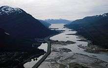
.jpg)
| County | Location | mi[7] | km | Destinations | Notes | ||
|---|---|---|---|---|---|---|---|
| Ketchikan Gateway | Ketchikan | 0.00 | 0.00 | Dead end | Beaver Falls access | ||
| 15.5 | 24.9 | Alaska Marine Highway | |||||
| Ward Cove | 31.7 | 51.0 | Dead end | ||||
| Gap in route | |||||||
| Unorganized | Mitkof Island | 0.00 | 0.00 | Dead end | |||
| Petersburg | 32.21 | 51.84 | Alaska Marine Highway | ||||
| 34.21 | 55.06 | Sandy Beach Road east | Nordic Drive turns east and becomes Sandy Beach Road | ||||
| Gap in route | |||||||
| City and Borough of Juneau | 0.00 | 0.00 | Franklin Street — Downtown, Thane | ||||
| 0.68 | 1.09 | Juneau-Douglas Bridge — Douglas | |||||
| Vanderbilt Hill Road | |||||||
| Glacier Highway Access Road | Interchange | ||||||
| Mendenhall Loop Road | Southern terminus of Mendenhall Loop Road | ||||||
| Glacier Highway south | AK-7 takes on the Glacier Highway | ||||||
| Mendenhall Loop Road | Northern terminus of Mendenhall Loop Road; To University of Alaska Southeast | ||||||
| 13.15 | 21.16 | Alaska Marine Highway | |||||
| 39.01 | 62.78 | Dead end | Beyond Echo Cove access | ||||
| Gap in route | |||||||
| Haines | Haines | 0.00 | 0.00 | ||||
| | 39.7 | 63.9 | Haines Highway north — Haines Junction | Continuation into British Columbia and eventually the Yukon Territory | |||
| 1.000 mi = 1.609 km; 1.000 km = 0.621 mi | |||||||
References
- ↑ Alaska Department of Transportation and Public Facilities, Alaska Traffic Manual Supplement, January 17, 2003
- ↑ Google Maps street maps, accessed August 2007
- ↑ American Automobile Association Road Atlas: United States, Canada, Mexico, 1995
- ↑ Gousha Road Atlas: United States, Canada, Mexico, 1996
- ↑ Rand McNally Road Atlas: United States, Canada, Mexico, 1998
- ↑ MapQuest.com, Inc., National Geographic Road Atlas: United States, Canada, Mexico, 2001
- ↑ Alaska Department of Transportation and Public Facilities, Southern Region General Log, April 25, 2006 (Routes 291400 (South Tongass Highway), 291500 (North Tongass Highway), 294000 (Mitkof Highway), 294020 (Nordic Drive), 296000 (Glacier Highway/Egan Drive), and 298000 (Haines Highway))