Tofte, Minnesota
| Tofte, Minnesota | |
|---|---|
| Unincorporated community | |
|
Sunrise over Lake Superior in Tofte | |
 Tofte, Minnesota  Tofte, Minnesota Location of the community of Tofte | |
| Coordinates: 47°34′26″N 90°50′11″W / 47.57389°N 90.83639°WCoordinates: 47°34′26″N 90°50′11″W / 47.57389°N 90.83639°W | |
| Country | United States |
| State | Minnesota |
| County | Cook |
| Elevation | 627 ft (191 m) |
| Time zone | Central (CST) (UTC-6) |
| • Summer (DST) | CDT (UTC-5) |
| ZIP codes | 55615 |
| Area code(s) | 218 |
| GNIS feature ID | 658702[1] |

Tofte is an unincorporated community in Tofte Township, Cook County, Minnesota, United States.
The community is located on the North Shore of Lake Superior.
Tofte is located 27 miles southwest of the city of Grand Marais; and 56 miles northeast of the city of Two Harbors.
Minnesota Highway 61 and Cook County Road 2 (Sawbill Trail) are two of the main routes in the community. Tofte is located within the Superior National Forest.
Temperance River State Park, the Gitchi-Gami State Trail, the Superior Hiking Trail, and the Carlton Peak Lookout are all nearby.
The communities of Schroeder and Taconite Harbor are immediately southwest of Tofte.
A post office called Tofte has been in operation since 1897.[2] The community was named for natives of Tofte, Norway.[3]
References
- ↑ "US Board on Geographic Names". United States Geological Survey. 2007-10-25. Retrieved 2008-01-31.
- ↑ "Cook County". Jim Forte Postal History. Retrieved 9 May 2015.
- ↑ Warren Upham (1920). Minnesota Geographic Names: Their Origin and Historic Significance. Minnesota Historical Society. p. 137.
Municipalities and communities of Cook County, Minnesota, United States | ||
|---|---|---|
| City | 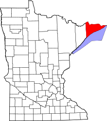 | |
| Townships | ||
| Unorganized territories | ||
| CDP | ||
| Unincorporated communities | ||
| Indian reservation | ||
| Ghost towns | ||