Time, Illinois
| Time | |
| Village | |
| Country | United States |
|---|---|
| State | Illinois |
| County | Pike |
| Coordinates | 39°33′40″N 90°43′23″W / 39.56111°N 90.72306°WCoordinates: 39°33′40″N 90°43′23″W / 39.56111°N 90.72306°W |
| Area | 0.44 sq mi (1 km2) |
| - land | 0.44 sq mi (1 km2) |
| - water | 0.00 sq mi (0 km2) |
| Population | 29 (2000) |
| Density | 66.5/sq mi (26/km2) |
| Timezone | CST (UTC-6) |
| - summer (DST) | CDT (UTC-5) |
| Postal code | 62363 |
| Area code | 217 |
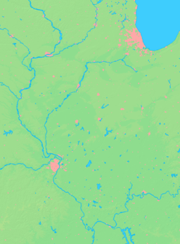  Location of Time within Illinois | |
| Wikimedia Commons: Time, Illinois | |
Time is a village in Pike County, Illinois, United States. The population was 29 at the 2000 census.
Culture

In the past, Time was a popular tourist location in IL during the annual "Fall Color Tour" and "Ice Cream Social" celebrations, centered on the historic Band Stand in Time Square. Time had a thriving local tourist economy during these events under the supervision of former mayor Richard Perry.
Public architecture
The Time band stand is (2012) a classic example of a public park gazebo.
Geography
Time is located at 39°33′40″N 90°43′23″W / 39.56111°N 90.72306°W (39.561160, -90.722947).[1]
According to the 2010 census, Time has a total area of 0.44 square miles (1.14 km2), all land.[2]
Demographics
| Historical population | |||
|---|---|---|---|
| Census | Pop. | %± | |
| 1880 | 182 | — | |
| 1890 | 146 | −19.8% | |
| 1900 | 125 | −14.4% | |
| 1910 | 158 | 26.4% | |
| 1920 | 95 | −39.9% | |
| 1930 | 74 | −22.1% | |
| 1940 | 52 | −29.7% | |
| 1950 | 57 | 9.6% | |
| 1960 | 45 | −21.1% | |
| 1970 | 39 | −13.3% | |
| 1980 | 27 | −30.8% | |
| 1990 | 36 | 33.3% | |
| 2000 | 29 | −19.4% | |
| 2010 | 23 | −20.7% | |
| Est. 2015 | 22 | [3] | −4.3% |
As of the census[5] of 2000, there were 29 people, 13 households, and 7 families residing in the village. The population density was 66.5 people per square mile (25.4/km²). There were 14 housing units at an average density of 32.1 per square mile (12.3/km²). The racial makeup of the village was 100.00% White.
There were 13 households out of which 23.1% had children under the age of 18 living with them, 46.2% were married couples living together, 15.4% had a female householder with no husband present, and 38.5% were non-families. 30.8% of all households were made up of individuals and 23.1% had someone living alone who was 65 years of age or older. The average household size was 2.23 and the average family size was 2.75.
In the village the population was spread out with 10.3% under the age of 18, 10.3% from 18 to 24, 24.1% from 25 to 44, 34.5% from 45 to 64, and 20.7% who were 65 years of age or older. The median age was 46 years. For every 100 females there were 93.3 males. For every 100 females age 18 and over, there were 85.7 males.
The median income for a household in the village was $14,375, and the median income for a family was $33,750. Males had a median income of $38,750 versus $13,750 for females. The per capita income for the village was $12,253. There were no families and 5.3% of the population living below the poverty line, including no under eighteens and none of those over 64.
References
- ↑ "US Gazetteer files: 2010, 2000, and 1990". United States Census Bureau. 2011-02-12. Retrieved 2011-04-23.
- ↑ "G001 - Geographic Identifiers - 2010 Census Summary File 1". United States Census Bureau. Retrieved 2015-12-25.
- ↑ "Annual Estimates of the Resident Population for Incorporated Places: April 1, 2010 to July 1, 2015". Retrieved July 2, 2016.
- ↑ "Census of Population and Housing". Census.gov. Archived from the original on May 11, 2015. Retrieved June 4, 2015.
- ↑ "American FactFinder". United States Census Bureau. Retrieved 2008-01-31.
Municipalities and communities of Pike County, Illinois, United States | ||
|---|---|---|
| Cities | ||
| Town | ||
| Villages | ||
| Townships | ||
| Unincorporated communities |
| |
| Ghost towns | ||