Thwing, East Riding of Yorkshire
Mar2006.jpg)
Coordinates: 54°06′58″N 0°23′44″W / 54.116067°N 0.395623°W
Thwing /ˈðwɪŋ/ is a village in the Yorkshire Wolds, in the East Riding of Yorkshire, England. It forms part of the civil parish of Thwing and Octon.
Description
.jpg)
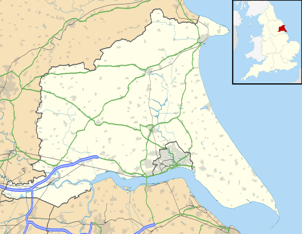
Thwing is located in the Yorkshire Wolds in the civil parish of Thwing and Octon about 8 miles (13 km) west of the North Sea coast at Bridlington.[1]
The village has a 12th-century Norman Church (All Saints),[2] and a pub known as The Falling Stone,[3] previously The Rampant Horse, before 1976 the Raincliffe Arms.[4][5]
The Falling Stone pub name is a reference to the Wold Cottage Meteorite, which fell nearby on 13 December 1795. A monument to its fall can be visited.
The church, as well as the post office (1830s) and 'Pear Tree farmhouse' (late 18th century) are listed buildings.[2][6][7]
History
Thwing is thought to mean 'narrow strip of land', deriving from thvengr (Old Scandinavian) or thweng (Old English).[8] The village is recorded in Domesday Book (1086) as Tuennc, in the hundred of Burton.[8][9]
The church of All Saints dates from the 12th century.[2] A market and fair began in Thwing in 1257.[10]
A Wesleyan chapel was established in Thwing in the early 1800s. It was built around 1810, and rebuilt and enlarged around 1839.[11][12]
From the 1850s to the start of the 21st century the extent of building development in the village was practically unchanged.[1][13]
See also
- John Twenge (Saint John of Bridlington) was born in Thwing in 1320 or 1324.[14]
- Marmaduke Thweng, 1st Baron Thweng
References
- 1 2 Ordnance Survey. 1:25000. 2009
- 1 2 3 Historic England. "Church of All Saints (1083406)". National Heritage List for England. Retrieved 2 December 2012.
- ↑ "The Falling Stone – Thwing". www.themobilefoodguide.com. Retrieved 28 April 2013.
- ↑ "The Villages of the Yorkshire Wolds – Thwing". Driffield Online. 1999. Retrieved 20 August 2006.
- ↑ Coates, J (2006). "Thwing, East Yorkshire". Two Mile Ash Site. Archived from the original on 23 July 2008. Retrieved 28 April 2013.
- ↑ Historic England. "Pear Tree Farmhouse (1162663)". National Heritage List for England. Retrieved 2 December 2012.
- ↑ Historic England. "The Post Office (1083363)". National Heritage List for England. Retrieved 2 December 2012.
- 1 2 Mills, A.D. (1998). Dictionary of English Place-Names (2 ed.). Oxford University Press. Thwing, p.347a.
- ↑ Thwing in the Domesday Book. Retrieved 14 November 2012.
- ↑ Letters, Samantha (2005). "39. Yorkshire". Gazetteer of Markets and Fairs in England and Wales to 1516. British History Online. Thwing.
- ↑ Allen 1831, p. 92.
- ↑ Wolffe, John (2006). Yorkshire Returns of the 1851 Census of Religious Worship: Introduction, City of York and East Riding. Borthwick Publications. p. 106.
- ↑ Ordnance survey. 1:10506 & 1:10000. 1854, 1912, 1956–8, 1972–83
- ↑ "26. The Roll of Honour". The East Riding of Yorkshire. Cambridge County Geographies. p. 149.
Sources
- Gazetteer – A–Z of Towns Villages and Hamlets. East Riding of Yorkshire Council. 2006. p. 11.
- Allen, Thomas (1831). "XII. Survey of Dickering Wapentake – Thwing". A new and complete history of the county of York. 4. I.T. Hinton. pp. 91–95.
External links
| Wikimedia Commons has media related to Thwing. |