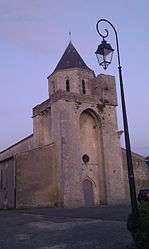
Thairé
| Thairé | ||
|---|---|---|
 | ||
| ||
 Thairé | ||
|
Location within Nouvelle-Aquitaine region  Thairé | ||
| Coordinates: 46°04′29″N 1°00′07″W / 46.0747°N 1.0019°WCoordinates: 46°04′29″N 1°00′07″W / 46.0747°N 1.0019°W | ||
| Country | France | |
| Region | Nouvelle-Aquitaine | |
| Department | Charente-Maritime | |
| Arrondissement | Rochefort | |
| Canton | Aigrefeuille-d'Aunis | |
| Government | ||
| • Mayor (2008–2014) | Françoise Arel | |
| Area1 | 18.74 km2 (7.24 sq mi) | |
| Population (2008)2 | 1,440 | |
| • Density | 77/km2 (200/sq mi) | |
| Time zone | CET (UTC+1) | |
| • Summer (DST) | CEST (UTC+2) | |
| INSEE/Postal code | 17443 / 17290 | |
| Elevation |
1–47 m (3.3–154.2 ft) (avg. 11 m or 36 ft) | |
|
1 French Land Register data, which excludes lakes, ponds, glaciers > 1 km² (0.386 sq mi or 247 acres) and river estuaries. 2 Population without double counting: residents of multiple communes (e.g., students and military personnel) only counted once. | ||

Thairé is a commune in the Charente-Maritime department in the Nouvelle-Aquitaine region in southwestern France on the Atlantic Ocean.
Population
| Historical population | ||
|---|---|---|
| Year | Pop. | ±% |
| 1962 | 769 | — |
| 1968 | 774 | +0.7% |
| 1975 | 724 | −6.5% |
| 1982 | 886 | +22.4% |
| 1990 | 951 | +7.3% |
| 1999 | 1,053 | +10.7% |
| 2008 | 1,440 | +36.8% |
See also
References
External links
| Wikimedia Commons has media related to Thairé. |
This article is issued from Wikipedia - version of the 11/11/2016. The text is available under the Creative Commons Attribution/Share Alike but additional terms may apply for the media files.
